
Road and Access Law:
Researching and Resolving Common Disputes
All rights reserved. These materials may not be reproduced without written permission
from NBI, Inc. To order additional copies or for general information please contact our
Customer Service Department at (800) 930-6182 or online at www.NBI-sems.com.
For information on how to become a faculty member for one of our seminars, contact the
Planning Department at the address below, by calling (800) 777-8707, or emailing us at
This publication is designed to provide general information prepared by professionals in
regard to subject matter covered. It is sold with the understanding that the publisher is not
engaged in rendering legal, accounting, or other professional service. Although prepared
by professionals, this publication should not be utilized as a substitute for professional
service in specific situations. If legal advice or other expert assistance is required, the
services of a professional should be sought.
Copyright 2007
NBI, Inc.
PO Box 3067
Eau Claire, WI 54702
38512
National Business Institute is a division of NBI, Inc. and is not in any way affiliated with the
National Business Institute, Inc. of Atlanta, Georgia.
Any West copyrighted materials that are included in this manual are reprinted with
permission.

Are you
maximizing
the visibility of your
company?
SPONSORSHIPS
Let us help you.
Savvy businesses know they need to take every opportunity to get their company
and products in front of the right audience. NBI
is
that opportunity.
By sponsoring break times at NBI seminars, you’re taking advantage of yet another
way to establish relationships with new customers – and solidify your contact with
those you already have.
Why pass up this opportunity when reaching our shared audience is so easy?
Call us today to find out more about how you can become a sponsor for an
NBI seminar.
Legal Product Specialist
Laurie Johnston
800.777.8707

IN-HOUSE TRAINING
Can training your staff be
easy and individualized?
It can be with NBI.
Your company is unique, and so are your training needs. Let NBI tailor the content
of a training program to address the topics and challenges that are relevant to you.
With customized in-house training we will work with you to create a program that
helps you meet your particular training objectives. For maximum convenience, we’ll
bring the training session right where you need it…to your office. Whether you
need to train 5 or 500 employees, we’ll help you get everyone up to speed on the
topics that impact your organization most!
Spend your valuable time and money on the information and skills you really need!
Call us today and we will begin putting our training solutions to work for you.
Legal Product Specialists
Jim Lau Laurie Johnston
800.777.8707
Road and Access Law:
Researching and Resolving Common Disputes
Authors
A. McCampbell Gibson
Alston & Bird LLP
One Atlantic Center
1201 West Peachtree Street
Atlanta, GA
James A. Langlais
Alston & Bird LLP
One Atlantic Center
1201 West Peachtree Street
Atlanta, GA
Dale R. Samuels
Jarrard & Davis, LLP
105 Pilgrim Village Drive, Suite 200
Cummings, GA
PRESENTERS
A. McCAMPBELL GIBSON is a partner in with Alston & Bird LLP's litigation and trial
practice group. He co-chairs the group's Real Estate Litigation Team. Mr. Gibson has been
named a Georgia Super Lawyer in Real Estate Litigation in 2006 and 2007. He concentrates on
complex commercial litigation with an emphasis on real estate disputes. He represents and
counsels national retailers, developers, mall, hotel and office owners, property management
companies, petroleum companies, restaurants, and convenience stores in and contract
enforcement, restrictive covenant and brokerage disputes. Mr. Gibson is a member of the
International Council of Shopping Centers and Leadership Georgia. Mr. Gibson also devotes a
significant amount of time to defending companies from toxic tort and project liability claims,
involving alleged personal injuries (e.g., exposure to chlorine, welding fumes and pesticides) and
property damage (e.g., alleged adhesive failure and printing press damage). Mr. Gibson received
his B.A. degree, magna cum laude, from Washington & Lee University. He received his J.D.
degree, cum laude, from the University of Georgia, where he was an editor for the Georgia Law
Review. Mr. Gibson wrote Gibson and Pearson, "Enough is Enough! - the Scope of the
'Perpetual' Right to Cure," and Gibson and Stroud, "Do I Have Manganism or Parkinson's
Disease?: Causation Hurdles in Proving an Association Between Welding Fumes and Disparate
Neurological Disorders," Mealey's Welding Rod Litigation Reporter.
JAMES A. LANGLAIS is a partner in the Environmental and Land Use Group and the Toxic
Tort Group at Alston & Bird LLP in the firm's Atlanta office. His practice focuses on complex
toxic torts, mass torts and environmental litigation. He also represents clients in land use and
business litigation matters. Mr. Langlais routinely represents clients in toxic tort and mass tort
cases and cost recovery/contribution cases in federal and state courts. He drafted the Ethics
Ordinance for the newly-formed city of Sandy Springs, Georgia and was recently appointed the
Chair of the Sandy Springs Ethics Board. He also counsels the newly-formed city of Milton,
Georgia with respect to the promulgation of its own ethics ordinance and Ethics Board
procedural rules. Mr. Langlais has published about environmental and toxic tort matters in such
publications as Mealey's Emerging Toxic Torts and The State Bar of Georgia Environmental
Newsletter, and speaks before professional organizations such as the State Bar of Georgia. Mr.
Langlais was selected to be included in the 2007 edition of The Best Lawyers in America in the
specialty of Mass Tort Litigation. He received his B.S. degree and his M.B.A. degree, summa
cum laude with a concentration in environmental management, from the University of
Massachusetts and his J.D. degree from South Texas College of Law. Mr. Langlais is a member
of the State Bar of Texas and the State Bar of Georgia. He is admitted to practice in Georgia and
Texas.
DALE (BUBBA) R. SAMUELS is a partner in the law firm of Jarrard & Davis, LLP, where he
practices in the areas of government, real estate and land use law, particularly in the
representation of local governmental entities. Prior to joining the firm, he practiced law in South
Carolina where he served as county attorney for Florence County, South Carolina, and during his
tenure there, he served as the president of the South Carolina Association of County Attorneys.
In addition, Mr. Samuels served as an officer of the Government Law Section of the South
Carolina Bar, as a member of the Employment Law, Tax Law and Professional Responsibility
sections and as a voting member of the House of Delegates of the South Carolina Bar. He also
served as a judicial law clerk to the Honorable William T. Howell, Chief Judge of the South
Carolina Court of Appeals. Mr. Samuels earned his B.A. degree from the Florida State
University in Tallahassee, Florida, and J.D. degree from the University of South Carolina School
of Law.

Table Of Contents
C
reation And Use Of Public Roads
1
3
P
rivate Roads In Georgia: Creation And Use
3
1
A
bandonment And Vacation Considerations
4
3
C
ontrol, Supervision And Management Of Roads And
H
ighways
5
5
R
oad And Access Pitfalls When Handling Real Estate
T
ransactions
14
3
C
ommon Road And Access Problems And Solutions
14
9

Creation And Use Of Public Roads
Submitted by Dale (Bubba) R. Samuels
• Special Circumstances Surrounding Public Roads
On Record
• Off Record: Is It Legitimately A Public Road?
• What Influences The Scope Of The Road Right Of
Way?
13

I. CREATION AND USE OF PUBLIC ROADS
The importance and affect of public roads on the ownership of land and the operation of
local government cannot be overstated. Public roads may fix one or more boundaries of a tract
of land, determine the legal right of access to a tract, and may constitute an easement in the title
across the interior of the tract. See generally
PINDAR'S GEORGIA REAL ESTATE LAW AND
PROCEDURE WITH FORMS § 5-1 (hereinafter “PINDAR’S”); see also 64 C.J.S. Municipal
Corporations § 1422. Further, public roads are also a major function of local governments which
are generally obligated to maintain, repair, record, and enforce right of ways on public roads.
See, e.g.
, O.C.G.A. §§ 9-6-21; 32-3-1 et seq.; Cherokee County v. McBride, 262 Ga. 460 (1992).
The following article explores the legal means and special circumstances surrounding public
road creation and the scope of a public road’s operation and affect on land ownership and the
authority of local government.
A. Special Circumstances Surrounding Public Roads on Record
Generally, “public road” as defined in State law is “a highway, road, street, avenue, toll
road, tollway, drive, detour, or other way open to the public and intended or used for its
enjoyment and for the passage of vehicles in any county or municipality of Georgia” including
those “public rights, structures, sidewalks, facilities, and appurtenances incidental to the
construction, maintenance, and enjoyment of such rights of way.” O.C.G.A. § 32-1-3 (24); see
also Chatham County v. Allen, 261 Ga. 177 (1991) (same); State Highway Board v. Baxter, 167
Ga. 124 (1928) (finding that the word “road’ in its popular sense includes overland ways of
every character, but has no fixed meaning in the law, depending on the context in which it
appears). Public roads may be constructed by private developers, counties, municipalities, the
state highway department, or by the federal government. P
INDAR'S § 5-3. Public roads in
14

Georgia are “legally” created by dedication, by prescription, by the express grant of an easement,
by deed, by special statutory proceeding, or by condemnation. See
O.C.G.A. §§ 32-3-3;
P
INDAR’S § 5-3; see also 64 C.J.S. Municipal Corporations § 1422.
For each of these types of methods of creation, special circumstances arise which may
influence whether a road has in fact become a public road and the legal affect of a created public
road. These factors can be categorized as “on-record” and “off-record” public roads. On-record
public roads are those roads that have been established by express grant, express dedication, or
by a government’s special statutory authority such as through its condemnation or purchasing
powers. See
O.C.G.A. § 33-3-3. Off-record public roads can be characterized as those roads
which have not been expressly granted to the public, but may be designated as public roads
through a sequence of provable facts and events which mandate that the road enter the public
domain. See, e.g.
, Jordan v. Way, 235 Ga. 496 (1975) (“Road may be public road
notwithstanding fact that it is not recorded with Department of Transportation.”); Baker v. State
,
92 Ga. App. 60 (1955) (“A highway may have its origin in a legislative act, or in order of court
of competent jurisdiction, or may come into existence by dedication or by prescription.”).
Importantly, if a road is considered a dedicated public road or an otherwise valid public
road on record, then a county may be compelled by mandamus to maintain the road “so that
ordinary loads, with ordinary ease and facility, can be continuously hauled over [it].” O.C.G.A.
§ 9-6-21; see also O.C.G.A. § 32-4-41 (1) (“A county shall plan, designate, improve, manage,
control, construct, and maintain an adequate county road system and shall have control of and
responsibility for all construction, maintenance, or other work related to the county road
system.”); Cherokee County v. McBride
, 262 Ga. 460 (1992); 40 C.J.S. Highways § 179 (noting
that construction, maintenance, and repair of public highways is a governmental function, and
15

insofar as repair and maintenance are concerned, a duty).
First, regarding public roads on record, local government authorities may expressly create
public roads by statute by acquiring roads via purchase, dedication, condemnation, donations,
and exchange of property. O.C.G.A. §§ 22-1-2; 32-3-3; 32-4-41; 32-4-90; 32-4-92; 36-34-3.
For example, Code Section 32-3-3 provides local governments broad powers to: (1) “accept
donations, transfers, or devises of land” from private and public entities “in fee or any lesser
interest”; (2) enter into agreements with private persons “for the exchange of real property or
interests therein for public road purposes”; (3) acquire roads by prescription; and (4) acquire
roads by dedication. However, although a local government may acquire public roads through
several means, a local government has an obligation to work with property owners to allow them
the highest and best use of their property. Tilley Props., Inc. v. Bartow County
, 261 Ga. 153
(1991). Further, a local government may not acquire property for future public purposes unless
it brings a substantial monetary saving, enhances the integration of highways, or forestalls the
physical or functional obsolescence of highways; but an entire lot, block, or tract may be
acquired although only part is needed if it is in the public interest. See, e.g.
, Fulton County v.
Davidson, 253 Ga. 734 (1985).
Second, a public road may come into existence through a dedication of a strip of land for
road purposes by an owner, evidenced by some action on the owner’s part, showing consent to
the abandonment of the owner’s dominion and dominion and control by the public. See
O.C.G.A. § 32-1-3(8) (defining “dedication” as “the donation by the owner, either expressly or
impliedly, and acceptance by the public of property for public road purposes, in accordance
with statutory or common-law purposes”); P
INDAR’S § 5-4. Generally, “[t]o prove a dedication
of land to public use, there must be an offer, either express or implied, by the owner of the land,
16

and an acceptance, either express or implied, by the appropriate public authorities or the
general public.” Smith v. State of Georgia
, 248 Ga. 154, 158 (1981); Ross v. Hall County
Commissioners, 235 Ga. 309 (1975); Carroll v. DeKalb County, 216 Ga. 663 (1961); Brown v.
City of East Point, 148 Ga. 85 (1918); see also O.C.G.A. § 44-5-230. To prove an offer of
dedication, “it must be shown that a property owner's acts clearly manifested an intention to
dedicate the property for public use.” Chandler v. Robinson
, 269 Ga. 881 (1998). Further,
“acceptance of an express offer to dedicate property may be shown by public use of the
property for a period of time sufficient to indicate that the public is acting on the basis of a
claimed right resulting from the dedicatory acts by the owner." Smith
, 248 Ga. at 160.
A typical example of express dedication is by express contract and deed. Generally,
where a dedication is made by deed, the grantor, the grantee, and the public are all parties to the
transaction. See PINDAR'S § 5-6; see also 26 C.J.S. Dedication § 15 (“The intent to dedicate
may be manifested by a deed. Such a deed may be from the dedicator to an individual, in
which the dedicator declares that a part of the land is subject to a public use, or it may except
some part of the land conveyed for a public use.”). Creation by contract includes deeds in
which the fee-simple title is conveyed to the strip in question, or other instruments granting an
easement for road purposes. P
INDAR'S § 5-6. Further, although a road deed may be valid
without a delineation of the area, it must contain language sufficient to designate with
reasonable certainty the land over which the road extends and a reference to a plat will not
suffice unless it can be determined from the plat exactly where the lines of the proposed road
will run. See
Ketchum v. Whitfield County, 270 Ga. 180 (1998) (finding that a deed dedicating
a road does not need to contain a perfect legal description, and the deed and dedication will be
valid so long as the description provides sufficient keys to determine the boundaries by
17

extrinsic evidence); DOT v. Howard, 245 Ga. 96 (1980) (finding that highway deed to DOT
was invalid where true legal title was in the grantor's wife, and could not be color of title
because of indefinite description); State Highway Dep’t v. Blalock
, 214 Ga. 29 (1958);
P
INDAR’S § 5-7.
Another common example of an offer of express dedication is the recordation of a
subdivision plat by a developer showing designated streets. See
Smith, 248 Ga. at 158
(“Where the owner of a tract of land subdivides it into lots and records a map or plat showing
such lots, with designated streets, and sells lots with reference to such map or plat, the owner
will be presumed to have expressly dedicated the streets designated on the map to the public.”);
26 C.J.S. Dedication § 17 (“[A] survey and plat alone are sufficient to establish an offer to
dedicate if it is evident from the face of the plat that it was the intention of the proprietor to set
apart certain ground for public use.”). Further, even where a proposed dedication plat is
ambiguous, parol evidence, the surrounding circumstances and the subsequent conduct of the
public can be used to show the boundaries and extent of a dedication. See
Cobb County v.
Crew, 267 Ga. 525 (1997). However, even though an owner may have expressly offered to
dedicate a road via a recorded plat, dedication will not be complete until the public accepts the
express offer. See
Watson v. Clayton County, 214 Ga. App. 225 (1994) (finding that the
recordation of a plat of subdivision containing offers to dedicate streets does not in itself
constitute acceptance by the public authorities of the street because the street must be both
dedicated by a private property owner and accepted by a public authority before it becomes a
public street.); 26 C.J.S. Dedication § 17 (“The mere filing of plat or map . . . does not of itself
work a dedication of the land indicated as reserved for the public use.”). Finally, acceptance of
an offer of dedication will not be inferred if a local government fails to assess property taxes on
18

the road. See Hale v. City of Statham, 269 Ga. 817 (1998) (“Although exemption from
taxation is one factor to consider in determining whether a government has exercised control
over property, a tax map is insufficient as a matter of law to manifest acceptance.”).
In sum, a road may be dedicated by express grant or presumed by the recordation of a
subdivision plat. However, although these facts may raise a presumption of dedication on the
part of an owner, a local government must still evidence acceptance of the express offer of
dedication. Accordingly, general contract law principles apply to determinations of offers and
acceptances of dedications, with the preferred construction that which renders all the provisions
of the instrument operative and effective, thus carrying out the intention of the parties. See
26
C.J.S. Dedication § 15.
B. Off Record: Is it Legitimately a Public Road?
If a public road has not been legally created by express grant, express dedication, or by
statute, then a road may still be considered a public road if certain facts and circumstances
arise. These include the manifestation of an implied easement, implied dedication, or a
prescription.
First, it is well established that where title to a public road or highway is not shown to be
in the public by express grant, there is a presumption that it exists merely as an easement, under
which the base fee in the underlying ground remains in the adjacent owners. R.G. Foster & Co.
v. Fountain, 216 Ga. 113 (1960); Thomas v. Douglas, 165 Ga. App. 128 (1983); PINDAR’S § 5-
14; 26 C.J.S. Dedication § 68 (noting that where the owner of property makes a common law
dedication, the ultimate fee remains unaffected, neither the government, the municipality, nor
the public acquiring any interest other than that of a mere easement). If a public road exists by
mere easement, then the public is not entitled to rights in timber, minerals, or other rights in the
19

roadway. Smith v. City of Rome, 19 Ga. 89 (1855). In the great majority of cases, however,
an express grant or express dedication is by fee simple due to the substantial cost in
constructing and maintaining public streets and highways. See
PINDAR’S § 5-16.
Second, as noted above, a road may considered a public road via implied dedication if
two criteria are established: (1) the owner intended to dedicate the land for public use; and (2)
the public accepted the dedicated property. Chandler
, 269 Ga. at 881. However, “[w]hen an
implied dedication is claimed, the facts relied on must be such as to clearly indicate a purpose
on the part of the owner to abandon his personal dominion over the property and to divert it to a
definite public use.” Id.
; Dunaway v. Windsor, 197 Ga. 705 (1944) (finding that to infer an
intention to dedicate property to public use from owner's “acquiescence” in use of his property
by the public “acquiescence” means a tacit consent to acts or conditions, and implies a
knowledge of those things which are acquiesced). Thus, whether an implied dedication or
acceptance has taken place is a question for the trier of fact. Jackson v. Stone
, 210 Ga. App.
465, 466 (1993).
Generally, actions that have been found to constitute an implied dedication include the
owner’s allowance of public use of the road and the acquiescence of the owner to local
governing authorities to repair and maintain roads. Jergens v. Stanley
, 247 Ga. 543 (1981)
(finding seven-year use by the public as a road and working by county is sufficient to establish
a dedication); Hood v. Spruill
, 242 Ga. App. 44 (2000) (finding that whether roadway easement
over private land is private or public is determined by use of roadway). Importantly, however,
these facts are not conclusive to show that a road has been dedicated to public use. See, e.g.
,
Forehand v. Carter
, 270 Ga. 534 (1999) (finding that an owner who permits the county to
occasionally grade a part of an alley does not manifest an intention to dedicate the alley to
20

public use); Chatham County v. Allen, 261 Ga. 177 (1991) (finding that unopened,
undeveloped, proposed roads in subdivision do not become “public roads” which county is
obligated to maintain, solely by virtue of process of implied dedication and acceptance, and
county could not be required to develop such roads); Irwin County v. Owens
, 256 Ga. App. 359
(2002) (“The mere use of one's property by a small portion of the public, even for an extended
period of time, is not sufficient to authorize an inference that the property has been dedicated to
a public use.”); see also
Central of Georgia R.R. Co. v. DEC Associates, Inc., 231 Ga. App.
787 (1998) (finding that where 15 to 20 years have elapsed since the dedication of an easement
without the government exercising any control, the presumption of law arises that the donation
of the easement was declined by the governmental entity).
Moreover, simply because the disputed road is depicted on a Department of
Transportation map, or a local government has a policy of delivering gravel and grading private
roads upon request, does not by themselves establish dedication of a road as a public roadway.
See
Chandler, 269 Ga. at 881 (“[A] road's placement on an official highway map is
‘administrative . . . as between the state, counties and municipalities. Its purpose [is] not to
ascertain and fix the status of the public right of use of every road in Georgia.’ Hence, this
evidence also fails to support a claim of implied dedication.”); Jackson v. Stone
, 210 Ga. App.
465 (1993) (finding that owner retained control over who used road by specifically granting or
refusing easements to use road, that road was built at his own expense, and that county's policy
of delivering gravel and grading private roads upon request was not indication of road's
dedication to public); P
INDAR’S 5-4; 26 C.J.S. Dedication § 40; 32 A.L.R.2d 953. Therefore, in
sum, implied dedication will generally be found to have occurred if an owner allows
continuous public use for an extended period of time and permits local authorities to
21

continuously maintain the road for many years. See, e.g., Chandler, 269 Ga. at 881-82 (finding
no implied dedication because no maintenance performed on road in twenty-five years and only
on an occasional basis before then); Childs v. Sammons
, 272 Ga. 737, 738 (2000) (plaintiff did
not prove that occasional grading of 40 foot strip of road traversing defendant’s land dedicated
road to public use).
Finally, similar to implied dedication, a roadway may also be transformed into a public
road if acquired by prescription through continuous public use after seven years. See
O.C.G.A.
§§ 32-3-3(c) (“[A]ny state agency, county, or municipality is authorized to acquire by
prescription and to incorporate into its system of public roads any road on private land which
has come to be a public road by the exercise of unlimited public use for the preceding seven
years or more.”); 44-5-164; Chandler
, 269 Ga. at 882; A.C.L.R. Co. v. Sweatman, 81 Ga. App.
269 (1950). Thus, while a dedication implies a conveyance and an acceptance, a prescription
requires an unbroken possession or user under a claim of right. Dunaway v. Windsor
, 197 Ga.
705 (1944).
Generally,
[i]n order to obtain prescriptive rights over a roadway, the possession must
not originate in fraud, must be public, continuous, exclusive,
uninterrupted, peaceable, and accompanied by a claim of right. The use
must also be adverse rather than permissive, and in the case of public
roads acquired by prescription, public authorities must have either
accepted the road or exercised dominion over it. Lastly, there must have
been unlimited public use of the roadway for at least the seven years
preceding the claim of prescriptive acquisition.
Harbor Co. v. Copelan
, 256 Ga. App. 79 (2002) (quoting Chandler, 269 Ga. at 883). Similar to
implied dedication, courts have accordingly held that only continuous public use and
maintenance, as opposed to tenuous public use and infrequent public maintenance, is sufficient
to put an owner on notice of adverse use for a prescription. See
Chandler, 269 Ga. at 883
22

(finding that county did not acquire roadway by prescription where roadway was blocked and
impassable for approximately ten years prior to the property owners’ acquisition of property
and clearance of the roadway and use of road by neighboring property owner was permissive);
Jordan v. Way
, 235 Ga. 496 (1975) (finding that evidence showing road across owner's
property had been in existence for 74 years prior to its closing, that public used road in manner
adverse to owner continuously throughout such period, and that county authorities had repaired
road, was sufficient to support finding that public road had been established across owner's
property by prescription); Dunaway
, 197 Ga. at 705 (finding that evidence indicating that
trucks passing over land owner’s property from time to time and that the public authorities had
performed some work on the roadway, was insufficient to establish a continuous, uninterrupted,
and adverse use of the property by the public as a highway, as would be sufficient to establish a
highway by prescription); Harbor Co.
, 256 Ga. App. at 79 (finding that county did not acquire
title through prescription to a six-inch privately owned strip of land abutting county road and
covered by portion of privately constructed curbs and gutters, even if county accepted or
exercised dominion over curbs and gutters, where curbs and gutters were constructed with
express permission from owner of strip, and there was no evidence that county ever gave owner
of strip notice that it was asserting any claims adverse to his right of ownership ); Bass v.
Pearson, 219 Ga. App. 487 (1995) (“While there is evidence that numerous individuals used
that road and that the county had at some point graded and graveled the road, there is nothing
indicating when or for how long the county performed that work.”). Accordingly,
prescriptions, like implied dedications, require continuous adverse use by the public with a
coterminous claim of dominion and control over the road by local government.
23

C. What Influences the Scope of the Road Right of Way?
Another crucial area involving the creation, use, and operation of public roads is the
scope of a public road’s right of way. Generally, “right of way” is defined by statute as
“property or any interest therein, whether or not in the form of a strip, which is acquired for or
devoted to a public road.” O.C.G.A. § 32-1-3(25). The scope a public road right of way may be
influenced by several statutory provisions and common law factors which include (1) whether
the road is owned in fee simple by local government or the road is a mere easement for public
use; (2) the established width and parameters of public roadways; (3) the existence and rights of
abutting property owners; (4) utility line easements and urban servitudes; and (5) encroachments.
See
PINDAR’S §§ 5-13 through 5-25; 64 C.J.S. Municipal Corporations § 1462.
First, as noted above, a public road not dedicated to the public by express grant is
presumed to exist only as an easement, under which the base fee remains in the adjacent land
owners and the easement continues only as long as the public need for the road continues. See
Thomas v. Douglas, 165 Ga. App. 128 (1983); City of Atlanta v. Jones, 135 Ga. 376 (1910)
(holding that even a deed to a county or city may be subject to interpretation as to whether it
conveys a fee or a mere easement). As noted above, because of the costs of road maintenance,
most state and local governments acquire a fee simple title to the roadway, either by warranty
deed or by indefeasible fee authorized by statute. O.C.G.A. §§ 32-3-3; 32-4-41; 32-4-90; 32-4-
92; 36-34-3.
Second, the width of public roadways is generally determined by examination of the
deeds and records under which title to the road was acquired. Waller v. State Highway Dep’t
,
218 Ga. 605 (1963). Therefore, where a parcel of land of definite width is expressly dedicated as
a roadway, whether by deed, easement, subdivision plat, or otherwise, the width shown becomes
24

the official margin even though the actual part used and occupied for road purposes may be less.
Dover v. Pritchett
, 251 Ga. 842 (1984) (iron pins placed at corners of property said to prevail
over measurements to determine width of county road); Thurston v. City of Forest Park
, 211 Ga.
910 (1955). However, in cases where a public road has been established by implied dedication
or prescription, there is no presumption that the owner of the land on which the road traverses
intended to dedicate more than the public use requires. See, e.g.
, R.G. Foster & Co. v. Fountain,
216 Ga. 113 (1960) (finding that when dedication of a highway results from mere use and
acquiescence, it shall not to be inferred that the donor parted with more than the use necessitates,
therefore the evidence sustained verdict for landowner); Thrash v. Wood
, 215 Ga. 609 (1960)
(finding that parking area not included in dedication). Sidewalks are also considered part of a
public road, but dedication of an area solely for sidewalk purposes does not permit a government
from converting it into vehicular traffic without compensation to abutting property owners. R.G.
Foster, 216 Ga.113; see also Atlanta Muffler Shop v. McSwain, 98 Ga. App. 722 (1958)
(“Sidewalks are intended as public throughfares, and any person or corporation placing
obstructions on or over them in such manner as to render them dangerous to persons using them
in a normal manner is guilty of negligence.”). Finally, as noted in the statutory definition of
“public road,” a public roadway includes all “structures, sidewalks, facilities, and appurtenances
incidental to the construction, maintenance, and enjoyment of such rights of way.” O.C.G.A. §
32-1-3 (24). Accordingly, the width of a public right of way is determined by deed or the prior
public use of the right of way by the public in the absence of an express deed.
Third, the owners of land abutting a public road may influence a right of way and occupy
a special status as compared with members of the public generally. Generally, title to the
underlying fee of a street or road is prima facie vested in the abutting owners, unless conveyed or
25

transmitted to the public authorities. Fambro v. Davis, 256 Ga. 326 (1986) (noting that the fee in
all roads should be vested either exclusively in the owner of the adjacent land on one side of the
road, or in him as to one half of the road, and as to the other half, in the proprietor of the land on
the opposite side of the road). Further, subject to certain exceptions, and depending upon
whether the road is owned in fee simple or by easement, abutting owners may have special rights
of access, underground and overhead rights, and reversionary rights upon abandonment.
P
INDAR’S § 5-17; 64 C.J.S. Municipal Corporations § 1462 (“The owner of property abutting on
a public street has an easement over the street of light, air, and view, and an interference with his
right of privacy has been considered as an element going to make up his right to relief against an
encroachment on the highway.”). An abutting owner may also be subject to special obligations
not to obstruct passage, and may be liable for improvements on the roadway in some cases.
O.C.G.A. §§ 36-39-16; 36-39-20; P
INDAR’S § 5-17.
Importantly, abutting owners may have a special easement of access to their land over the
public right of way. See Barham v. Grant, 185 Ga. 601 (1937). The easement of access includes
the to reach the traveled part of the public road, but an owner is not entitled to enter at all points
along his boundary, provided the abutting owner is offered a convenient access to the premises.
See, e.g.
, State Highway Board v. Baxter, 167 Ga. 124 (1928) (finding that an abutting owner “is
not entitled, as against the public, to access to his land at all points in the boundary between it
and the highway, if the entire access has not been cut off, and if he is offered a convenient access
to his property and to improvements thereon, and his means of ingress and egress are not
substantially interfered with by the public”). Therefore, courts have concluded that curbing and
medians in the public right of way and regulation of traffic flow generally do not impair access
to an abutting owner’s property rights. See, e.g.
, Clark v. Clayton County, 133 Ga. App. 171
26

(1974) (finding that median change by closing front cross-over of owner’s hotel and opening
another 370 feet away did not interfere with owner’s ingress and egress); Dougherty County v.
Snelling, 132 Ga. App. 540 (1974) (finding that abutting owner has no rights to control traffic
flow, which is regulated for public safety); Johnson v. Burke County
, 101 Ga. App. 747 (1960)
(“[I]t conclusively appears . . . that the curb in question is so constructed and situated as to not
interfere with the right of the plaintiffs, their customers or others, in the matter of ingress and
egress.”). Finally, the right of access of abutting owners can be taken away from the abutting
owner by the exercise of the power of eminent domain and the establishment of limited-access
highways. See
O.C.G.A. §§ 22-1-2; 32-1-3(14) (defining limited access highway as “a public
highway, road, or street for through traffic, over, from, or to which owners or occupants of
abutting land or other persons have no right or easement or only a limited right or easement of
access, light, view, or air by reason of the fact that their property abuts upon such limited-access
highway, road, or street or for any other reason”).
Fourth, a public right of way may also be affected by the duty of local governments and
abutting property owners to keep the right of way free of encroachments. See
O.C.G.A. §§ 32-6-
1(a) (“It shall be unlawful for any person to obstruct, encroach upon, solicit the sale of any
merchandise on, or injure materially any part of any public road.”); 32-6-2 (authority to regulate
parking and unattended vehicles on public roads); Crider v. Kelly
, 232 Ga. 616 (1974) (finding
that DOT can require removal of any obstruction placed without express permission on road
within state's system and governing body of municipality can require removal of any such an
obstruction placed on city street not on state’s system).
Generally, encroachments on a right of way without the express permission of State or
local government is considered a “purpresture” and may constitute an abatable nuisance subject
27

to an injunction. See S.E. Pipeline Co. v. Garrett, 192 Ga. 817 (1941) (“The rule both in reason
and by authority is that, unless the public sustain or may sustain some degree of inconvenience
or annoyance in the use of a public highway or street or other public property, there is no public
nuisance.”); see also
Stephens v. State Highway Dep’t, 223 Ga. 713 (1967) (finding that an
inadvertent encroachment of less than one foot on the right of way would not require an
injunction which would in effect force demolition of the building). Courts have accordingly
found unauthorized encroachments as constituting an unlawful nuisance, including fuel tanks,
Williamson v. Souter
, 172 Ga. 364 (1931), pay telephones, City of Dalton v. Staten, 201 Ga. 754
(1947), newsstands, Magrill v. City of Atlanta
, 32 Ga. App. 5 (1924), and piles of debris.
Harbuck v. Richland Box Co.
, 204 Ga. 352 (1948). Thus, any unauthorized immobile structure
on a public road may constitute a public nuisance. See, e.g.
, Smith v. Hiawassee Hardware Co.,
167 Ga. App. 70 (1983) (“Structures on private property adjoining road rights-of-way only
become unlawful . . . if they obstruct a clear view of roads in such a manner as to constitute a
traffic hazard, and they are unauthorized.”) Williams v. Scruggs Co.
, 213 Ga. App. 470 (1994)
(finding plaintiff was unable to show that the allegedly vision-obstructing debris and heavy
equipment located on defendant’s property was “unauthorized”).
Finally, the right of way is also influenced by a local government’s power to regulate and
maintain utility lines. Generally, local governments are authorized by statute to license the use
of city and county streets for the transmission of utilities and for street railways so long as the
use of the public generally is not unreasonably interfered with. See, e.g.
, O.C.G.A. §§ 32-4-42
(“A county may grant permits and establish reasonable regulations for the installation,
construction, maintenance, renewal, removal, and relocation of pipes, mains, conduits, cables,
wires, poles, towers, traffic and other signals, and other equipment, facilities, or appliances of
28

any utility in, on, along, over, or under the public roads of the county . . . .”); 36-34-2 (regulation
of utilities by municipalities). Thus, although “the owner of the soil retains the exclusive right in
mines, quarries, springs of water, timber, and earth, . . . these rules must be taken with some
limitation as to the streets of a city. Certain uses . . . which are called ‘urban servitudes’ are the
necessary incidents of streets in large cities, and are paramount to the rights of the owner of the
fee.” City of Albany v. Lippitt
, 191 Ga. 756 (1941); PINDAR’S § 5-22.
Further, regulation of utilities and additional uses of the right of way for utilities may be
expanded over time. Faulker v. Georgia Power Co.
, 243 Ga. 649 (1979) (“A definition of land
to the public use as a street not only embraces all of the customary uses to which streets are
devoted at the time of the dedication, but will expand to take in all new uses that become
customary as civilization advances.”). Therefore, courts have found that the installation of
additional telephone wires, Kerlin v. Southern Bell Tel. Co.
, 191 Ga. 663 (1941), and facilities to
accommodate higher voltage electric lines, Humphries v. Georgia Power Co.
, 224 Ga. 128
(1968), amounted to a change in the degree of use rather than in the kind of use, so as not to
violate the existing right of way. However, while a local government may mandate that a utility
move utility lines to accommodate future road widening, it may not deny current permits based
on future potential use. DeKalb County v. Georgia Power Co.
, 249 Ga. 704 (1982) (electric
lines) (“The county may require the power company to move the power line to accommodate
future widening of [roads], but may not deny the power company a permit to locate the power
line within the right-of-way of that road because of speculation that [the road] may be widened at
some unspecified and unknown time in the future.”); City of Atlanta v. DeKalb County
, 196 Ga.
252 (1943) (water lines); P
INDAR’S § 5-22. In sum, State and local government may reasonably
regulate and license utility lines in the right of way subject to certain restrictions. See
O.C.G.A.
29
§§ 32-4-42; 36-34-2; 32-6-173.
30

Private Roads In Georgia: Creation And Use
Submitted by James A. Langlais
• Introduction
• Creating Private Roads Through Easements
• Difference Between Easements And Fee Estates,
Restrictive Covenants And Licenses
• Scope Of Easements
• Abandonment Or Forfeiture, Extinguishment
And Estoppel Of Easements
• Maintenance And Repair Of Easements
• Creation Of Private Roads Through
Condemnation
31

NATIONAL BUSINESS INSTITUTE
ROAD AND ACCESS LAW: RESEARCHING AND RESOLVING
COMMON DISPUTES
Atlanta, Georgia
July 17, 2007
PRIVATE ROADS IN GEORGIA: CREATION AND USE
James A. “Jim” Langlais
Alston & Bird, LLP
One Atlantic Station
1201 West Peachtree Street
Atlanta, Georgia 30309
(404) 8881-7490
A. Introduction
In Georgia, private roads may be created in a number of ways: by express grants, by
prescription, by necessity, and by private condemnation.
1
Procedures for creating private roads
such as these are intended to provide for an economically affordable and efficient method to gain
access to property.
2
In addition to providing landlocked property owners with mechanisms to
gain access to property, these procedures also seek to protect the interests of the servient estate
owner, i.e., the one burdened with the private road or easement.
3
This paper examines the
various types of mechanisms to create private roads in Georgia, as well as the legal issues related
to their creation, scope, maintenance and extinguishment.
B. Creating Private Roads through Easements
An easement is “a right in the owner of one parcel of land (i.e., the dominant estate
owner), by reason of such ownership, to use the land of another for a special purpose not
inconsistent with the general property in the servient estate owner”.
4
It is not a fee estate in land
or merely a contract right, but rather it is an interest in land owned or possessed by another; a
1
O.C.G.A. § 44-9-1; Jones v. Mauldin, 208 Ga. 14, 64 S.E.2d 452 (Ga., 1951) overruled on
other grounds.
2
Elk Horn Ranch, Inc. v. Board of County Com’rs, Crook County, 2002 W.Y. 167, 57 P.3d 1218
(Wyo. 2002).
3
Barge v. Sadler, 70 S.W.3d 683 (Tenn. 2002); Elk Horn Ranch, Inc. v. Board of County
Com’rs, Crook County, 2002 W.Y. 167, 57 P.3d 1218 (Wyo. 2002).
4
Brown v. Tomlinson, 246 Ga. 513, 272 S.E.2d 258 (1980); 25 Am. Jur. 2d, Easements and
Licenses § 1.
Hollomon v. Board of Education
, 168 Ga. 359, 147 S.E. 882 (1929).
32

privilege to enjoy and use the land of another.
5
Moreover, it may be created only by a person
with title to or an estate in the servient estate.
6
Easements can be created in a number of ways
including easement by express grant, easement by prescription, and easement by implication of
law or necessity.
7
1. Easements by Express Grant
Express easements can be created by contract, deed or other written instrument.
8
To
create an express easement, the written instrument must describe with reasonable particularity
the land to which the easement extends.
9
It is not, however, necessary to delineate the exact path
and boundaries of the easement, i.e., provide a legal description of the easement.
10
The
description of an easement is sufficient if it provides a key so that the land where the easement is
located can be identified.
11
An easement description has been found sufficient in the following
situations:
• easement was described as being situated “between Lot #77, Lake George and
Pine Avenue, including causeway to the creek, near the railroad bridge, known
as the headwaters of the Gress River” was held to be sufficient.
12
5
5 Rest. of Law, §§ 450, p. 2901, 540b, p. 2903; Sinnett v. Werelus, 83 Idaho 514, 365 P.2d 952
(1961); Young v. Thendara, Inc.
, 328 Mich. 42, 43 N.W.2d 58 (1950); Kazi v. State Farm Fire
and Cas. Co., 24 Cal. 4
th
871, 15 P.3d 223 (2001); Preseault v. U.S., 100 F.3d 1525 (Fed. Cir.
1996); Sun Valley Land and Minerals, Inc. v. Hawkes
, 138 Idaho 543, 66 P.3d 798 (2003).
6
25 Am. Jur. 2d, Easements and Licenses § 15.
7
O.C.G.A. § 44-9-1; Jones v. Mauldin, 208 Ga. 14, 64 S.E.2d 452 (Ga., 1951) overruled on
other grounds.
8
Latham Homes Sanitation, Inc. v. CSX Transportation, Inc., 245 Ga.App. 573, 538 S.E.2d 107
(2000); Bibb County v. Georgia Power Co.
, 241 Ga.App. 131, 525 S.E.2d 136 (1999); Khamis
Enterprises, Inc. v. Boone, 480 S.E.2d 364 (1997); Irvin v. Laxmi, 266 Ga. 204, 467 S.E.2d 510
(1996); City of Columbia, Mo. v. Baurichter
, 729 S.W.2d 475 (Mo. Ct. App. 1987); Lewis v.
DeKalb County, 251 Ga. 100, 303 S.E.2d 112 (1983); Georgia Power Co. v. Leonard, 187 Ga.
608, 1 S.E.2d 579 (1939); Seaboard Air Line Ry. Co. v. Greenfield
, 128 S.E. 430 (1925);
Chapman v. Gordon
, 29 Ga. 250 (1859).
9
Lovell v. Anderson, 242 Ga.App. 537, 530 S.E.2d 233 (2000); Concerned Citizens v. State Ex.
rel. Rhodes, 329 N.C. 37, 404 S.E.2d 677 (1991); Champion v. Neason, 220 Ga. 15, 136 S.E.2d
718 (1964); Lewis v. Bowen
, 209 Ga. 717 (1), 75 S.E.2d 422 (1953); Rest. of Law, § 471(d), p.
2964.
10
Wynns v. White, 273 Ga.App. 209, 614 S.E.2d 830 (2005); Murdock v. Ward, 267 Ga. 303,
477 S.E.2d 835 (1996).
11
O.C.G.A. § 44-9-1; Howard v. Rivers, 266 Ga. 185, 465 S.E.2d 666 (1996); Glass v. Carnes,
260 Ga. 627(4), 398 S.E.2d 7 (1990); Champion v. Neason
, 220 Ga. 15, 136 S.E.2d 718 (1964).
12
Wynns v. White, 273 Ga.App. 209, 614 S.E.2d 830 (2005); Adams v. City of Ila, 221 Ga.App.
372, 471 S.E.2d 310 (1996)(property description was sufficient in deed granting right-of-way;
deed contained sufficient “keys” to clarify any indefiniteness in property description, making
reference to militia district in which right-of-way was located, and defining right-of-way
specifically by referring to and incorporating street’s preexisting roadway).
33

• easement was described by a specific reference to a diagram or plat showing
the easement has been held sufficient.
13
• easement represented by parallel lines on plat of subdivision.
14
However, the grant of an easement with an indefinite description will be upheld where its
location has been established by parties’ consent.
15
Moreover, in instances where the written
instrument is ambiguous, parol evidence may be used to explain the extent of the description of
an easement and identify its location.
16
For example, in a situation where a plat is referenced in
a written instrument purporting to grant an easement, but where no plat is actually attached to the
written instrument, parol evidence identifying the plat may be introduced.
17
2. Easements by Prescription
In Georgia, the elements of a prescriptive easement are essentially the same as adverse
possession.
18
Prescription, however, differs from adverse possession;
19
adverse possession
confers title to the property while prescription only confers the right to use the property.
20
The person seeking to establish prescriptive easement must prove that the use or the road
or way was public, continuous, exclusive, uninterrupted (7 years for improved lands or 20 years
through wild lands), peaceable, and accompanied by a claim of right.
21
Moreover, the use must
be adverse (i.e., without the consent of the owner) rather than permissive, the private way must
not exceed 20 feet in width and be the same 20 feet as originally appropriated, and must be kept
in repair during the period of use.
22
13
Howard v. Rivers, 266 Ga. 185, 465 S.E.2d 666 (1996); Chicago Title Insurance Co. v.
Investguard, Ltd., 215 Ga.App. 121, 449 S.E.2d 681 (1994)(access easement may be described
by reference to a plat showing a road lineated on the plat, which plat is attached to a deed and
incorporated by reference into the deed); Turner v. City of Nashville
, 177 Ga.App. 649, 340
S.E.2d 619 (1986); Norton Realty & Loan Co. v. Board of Education.
, 129 Ga.App. 668(4), 200
S.E.2d 461 (1973).
14
Chicago Title Insurance Co. v. Investguard, Ltd., 215 Ga.App. 121, 449 S.E.2d 681 (1994);
Hardigree v. Hardigree
, 244 Ga. 830, 262 S.E.2d 127 (1979).
15
Barton v. Gammell, 143 Ga.App. 291, 238 S.E.2d 445 (Ga.App. 1977)(The grant of an
easement containing an indefinite description will be upheld where its location has been
established by consent of the parties).
16
Irvin v. Laxmi, 266 Ga. 204, 467 S.E.2d 510 (1996).
17
Mayor & Council of Athens v. Gregory, 231 Ga. 710, 203 S.E.2d 507 (1974).
18
Moody v. Degges, 258 Ga.App. 135, 137, 573 S.E.2d 93, 95 (2002).
19
Thomson v. Dypvik 174 Cal App 3d 329, 220 Cal.Rptr. 46 (6
th
Dist., 1986); Wheeler v.
Newman, 394 NW2d 620 (Minn App., 1986); Glenville v Strahl, 516 SW2d 781(Mo App.,
1974).
20
Id.
21
Moody v. Degges, 258 Ga.App. 135, 137, 573 S.E.2d 93 (2002); Jackson v. Norfolk Southern
R.R., 2002, 255 Ga.App. 695, 566 S.E.2d 415 (2002); Childs v. Sammons, 272 Ga.App. 737,
739(2), 534 S.E.2d 409 (2000); O.C.G.A. § 44-9-1.
22
Id.
34

Merely using a roadway, however, is insufficient to acquire a prescriptive easement.
23
Moreover, since the imposition of prescriptive rights is a rather harsh remedy, Georgia courts
will strictly construe the elements of OCGA § 44-9-1 against the party asserting the right to the
easement.
24
If the party seeking the prescriptive easement fails to strictly comply with OCGA §
44-9-1 or fails to prove any of the necessary elements to establish prescriptive rights, he will not
be entitled to acquire the easement.
25
Further, where a road has been used prescriptively as a private way for as much as one
year, the owner of land over which it passes (i.e., the servient estate) may not close it up without
first giving the users thereof thirty days’ written notice so that they may have the way made
permanent.
26
3. Easements by Necessity
Under O.C.G.A. § 44-9-40(b), “[w]hen any person or corporation of this state owns real
estate or any interest therein to which the person or corporation has no means of access, ingress,
and egress and when a means of ingress, egress, and access may be had over and across the lands
of any private person or corporation, such person or corporation may file his or its petition in the
superior court of the county having jurisdiction…”
27
Even where other means of access exist,
condemnation of a private way or easement by necessity is warranted if the easement seeker can
establish that the existing access options are not economically feasible.
28
To be entitled to condemn an easement or private road over the lands of another by
necessity, the easement seeker must show that the way sought by him is absolutely indispensable
as a means for reaching his property.
29
The way of necessity must be more than one of
convenience.
30
A landowner seeking to establish an easement by necessity will not be entitled to a
private way of necessity to obtain access if he voluntarily landlocked himself; i.e, he created the
problem he now seeks redress for.
31
The reasoning behind the rule is that a private way would
only reward the property owner for his own negligence in failing to reserve an easement for
23
BMH Real Estate Partnership v. Montgomery, 246 Ga.App. 301, 304(3), 540 S.E.2d 256
(2000).
24
O.C.G.A. § 44-9-54; In re Popescu, 172 B.R. 691 (1994)(under Georgia law, establishment of
private way by prescription is to be strictly construed); Farris Construction Co. v. 3032 Briarcliff
Road Associates, 247 Ga. 578, 277 S.E. 2d 673 (1981).
25
Id.
26
Hall v. Browning, 195 Ga. 423, 24 S.E.2d 392 (1943); Kirkland v. Pitman, 122 Ga. 256, 50
S.E. 117 (1905).
27
O.C.G.A. § 44-9-40(b); Hensley v. Henry, 246 Ga.App. 417, 541 S.E.2d 398 (2000).
28
O.C.G.A. § 44-9-40; Atlanta-East, Inc. v. Tate Mountain Associates, Inc., 265 Ga. 742, 462
S.E.2d 613 (1995).
29
Wyatt v. Hendrix, 146 Ga. 143, 90 S.E. 957 (1916).
30
Moore v. Dooley, 240 Ga. 472, 241 S.E.2d 232 (1978); Hasty v. Wilson, 223 Ga. 739, 158
S.E.2d 915 (1967); Burton v. Atlanta & W.P.R. Co.
, 206 Ga. 698, 58 S.E.2d 424 (1950).
31
Bruno v. Evans, 200 Ga.App. 437, 408 S.E.2d 458 (1991), certiorari denied.
35

property he had previously sold.
32
However, even where a party has voluntarily landlocked
himself, under some circumstances, he may still be entitled to obtain access by condemnation
under O.C.G.A. § 44–9–40(b) if he can show that construction of a road over the property sold
would cost more than the value of the remaining property.
33
C. Difference between Easements and Fee Estates, Restrictive Covenants and Licenses
The difference between a fee simple estate and an easement is that the easement describes
the right to the use of the land, while title to the fee simple estate is the grant of title to the land
itself. This difference is not insignificant because a fee simple estate owner receives substantive
and procedural rights that are not to easement holders. For example, the owner of a fee simple
estate, unlike an easement, has the right to sell his land.
34
In determining whether the interest
conveyed is easement or fee simple title to land, each case depends upon its own particular facts
and circumstances.
35
As with many determinations involving real property, this determination
turns on the intent of the parties.
36
Easements also differ from restrictive covenants. Unlike restrictive covenants, easements
require only that the servient estate owner not to interfere with the dominant estate owner’s
rights.
37
Easements “run with the land”, which means that subsequent owners or successors may
either be able to enforce the easement or be burdened by it.
38
A restrictive covenant, on the
other hand, may or may not run with the land and it generally sets limits upon the use of the
subject property. A restrictive covenant relates to the burden or servitude upon land, an
easement relates to the benefit conferred upon the dominant tenement.
39
Whether an instrument
grants an easement or a restrictive covenant depends on the intent of the parties and an
evaluation of the whole instrument in light of the facts and circumstances at the time of its
execution.
40
For example, where a deed specifically states that the land was sold and conveyed
subject to specified restrictions, a restrictive covenant rather than an easement will be found; the
presence of the word “restrictions” was indicative of the intent of the grantor to restrict the use of
the property rather than grant an easement.
41
Easement are also distinguishable from licenses in that a licenses are mere permissive
uses which confer a personal privilege to do some act on the land without possessing an actual
estate in that land and they are generally revocable.
42
An easement, on the other hand, implies
32
Mersac v. National Hills Condominium Association, 267 Ga. 493, 480 S.E.2d 16 (1997).
33
Kellett v. Salter, 244 Ga. 601, 261 S.E.2d 597 (1979).
34
Lanier v. Burnette, 245 Ga.App. 566, 538 S.E.2d 476 (2000).
35
Barber v. Southern Ry. Co., 247 Ga. 84, 274 S.E.2d 336 (1981); Jackson v. Rogers, 205 Ga.
581, 54 S.E.2d 132 (1949); Georgia & F. Ry. v. Swain
, 145 Ga. 817, 90 S.E. 44 (1916).
36
City of Buford v. Gwinnett County, 262 Ga. 248, 585 S.E.2d 122 (Ga.App. , 2003).
37
Brown v DOT, 195 Ga.App. 262, 393 S.E.2d 36 (1990).
38
Barton v. Gammell, 143 Ga.App. 291, 238 S.E.2d 445 (Ga.App. 1977).
39
Id.
40
O.C.G.A. § 44-5-34.
41
Moreland v Henson, 256 Ga 685, 353 S.E.2d 181 (1987).
42
Barton v Gammell, 143 Ga.App. 291, 238 S.E.2d 445 (1977).
36

an interest in the land in and over which it is to be enjoyed, and are generally not revocable.
43
D. Scope of Easements
Where an easement is granted without limitations on its use, an easement owner is
entitled to use an easement for all reasonable purposes that develop over time if such uses
significantly relate to the purpose the easement was granted.
44
The first rule of construction in
examining the scope and purpose of an easement is to look at the intent of the parties.
45
In Savannah Jaycees Foundation, Inc. v. Gottlieb, subdivision lot owners were authorized
to park their automobiles on property designated as a park in the subdivision plat, as incident to
their easement to use the park property for recreational purposes;
46
implicit in the easement grant
was the authority to do things reasonably necessary for enjoyment of the easement, recreational
users of property.
47
Notwithstanding, the owners of the servient estate did have the power to
restrict which portions of property could be used for parking since unlimited parking rights were
unnecessary for enjoyment of the easement.
48
In Reece v. Smith, owners of landlocked property who acquired an implied easement
were authorized to install within path of easement, underground utilities since utilities were
necessary to reasonable enjoyment of the landlocked land in question as place of residence, and
there was no evidence that installation would unreasonably burden the servient landowners’
rights.
49
However, in Lanier v. Burnette, where landowners had acquired an easement for the
sole purpose of ingress to and egress from the property, they were not entitled to a utility
easement because, under the particular circumstances, it was not a reasonable use that
significantly related or was essential to the deed-granted easement.
50
E. Abandonment or Forfeiture, Extinguishment and Estoppel of Easements
An easement may be lost or extinguished in a number of ways including abandonment or
forfeited by nonuse, and estopppel.
51
An easement of necessity may also be extinguished where
43
Barton v Gammell, 143 Ga.App. 291, 238 S.E.2d 445 (1977).
44
Kiser v. Warner Robins Air Park Estates, Inc., 237 Ga. 385, 228 S.E.2d 795 (1976); Savannah
Jaycees Foundation, Inc. v. Gottlieb, 615 S.E.2d 226 (2005).
45
Kiser v. Warner Robins Air Park Estates, Inc., 237 Ga. 385, 228 S.E.2d 795 (1976).
46
Savannah Jaycees Foundation, Inc. v. Gottlieb, 273 Ga.App. 374, 615 S.E.2d 226 (2005).
47
Id.
48
Id.
49
Reece v. Smith, 265 Ga.App. 497, 594 S.E.2d 654 (2004).
50
Lanier v. Burnette, 245 Ga.App. 566, 538 S.E.2d 476 (2000).
51
O.C.G.A. § 44-9-6; Owens Hardware Co. v. Walters, 210 Ga. 321, 80 S.E.2d 285 (1954);
Tietjen v. Meldrim
, 169 Ga. 678, 151 S.E. 349 (1930); Rolleston v. Sea Island Properties, Inc.,
1985, 254 Ga. 183, 327 S.E.2d 489, certiorari denied 106 S.Ct. 77, 474 U.S. 823, 88 L.Ed.2d 63
(an easement can also be extinguished by estoppel if the easement owner shows an intent not to
make use of the easement in the future, and the servient estate owner reasonable relies upon the
conduct of the dominant owner).
37

the purpose for the easement ceases to exist.
52
The owner of an easement may abandon or forfeit an easement if he abandons or fails to
use it for “a term sufficient to raise the presumption of release or abandonment”. There is,
however, no presumption of abandonment from nonuse for a period of time less than 20 years.
53
Moreover, the mere non-use of an easement acquired by grant, even for a time period greater
than 20 years, without further evidence of an intent to abandon it, will not be considered
abandoned.
54
Intent to abandon an easement can only be established with clear, unequivocal and
decisive evidence.
55
Intent can also, however, be inferred from acts of the parties.
56
For
example, sufficient evidence existed to extinguish an easement where an easement was not used
for approximately 30 years and a fence had been built barring access to the easement, and it had
been shown that the easement owner had been present at the property and therefore could have
used the easement or objected to the presence of the fence.
57
An easement can also be extinguished by estoppel if the easement owner shows an intent
not to make use of the easement in the future, and the servient estate owner reasonable relies
upon the dominant owner’s conduct.
58
To determine whether an easement is properly
extinguished by estoppel, one must ascertain whether it was reasonably foreseeable that the
servient owner would rely upon the easement owner’s actions, and whether reinstatement of the
easement would unreasonably harm the servient owner.
59
It is, also, well-settled that an easement of necessity may be extinguished where the
purpose for the easement ceases to exist.
60
For example, where credible evidence is presented
that other access to the property is available, a way of necessity will cease to exist.
61
F. Maintenance and Repair of Easements
The easement owner ordinarily has a duty to maintain or repair an easement, where the
52
O.C.G.A. § 44-9-5; Reece v. Smith, 265 Ga.App. 497, 594 S.E.2d 654 (2004), reconsideration
denied, certiorari denied.
53
Boling v. Golden Arch Realty Corp., 242 Ga. 3, 4, 247, S.E.2d 744 (1978).
54
Smith v. Gwinnett County, 248 Ga. 882(2), 286 S.E.2d 739 (1982); Church of the Nativity,
Inc. v. Whitener, 249 Ga.App. 45, 547 S.E.2d 587 (2001), reconsideration denied. (non-use of
express easement over church’s property for 24 years did not constitute abandonment of
easement, where current easement holders’ predecessors in title had no intent to abandon
easement).
55
Hardigree v. Hardigree, 244 Ga. 830(2), 262 S.E.2d 127 (1979).
56
Tietjen v. Meldrim, 172 Ga. 814, 159 S.E. 231 (1931).
57
O.C.G.A. § 44-9-6; Duffy Street S.R.O., Inc. v. Mobley, 266 Ga. 849, 471 S.E.2d 507 (1996).
58
Rolleston v. Sea Island Properties, Inc., 254 Ga. 183, 327 S.E.2d 489 (1985), certiorari denied
106 S.Ct. 77, 474 U.S. 823, 88 L.Ed.2d 63
59
Id.
60
Reece v. Smith, 265 Ga.App. 497, 594 S.E.2d 654 (2004), reconsideration denied, certiorari
denied.
61
Russell v. Napier, 82 Ga. 770, 9 S.E. 746 (1889).
38

easement is used for his benefit alone.
62
This duty arises both statutorily
63
and by caselaw.
64
It
is implicit with the grant of an easement that the easement holder will undertake those things
reasonably necessary for and ancillary to the continued use and enjoyment of the easement.
65
With the requirement for the easement owner to maintain and keep the easement in repair also
comes the power to restrict the unauthorized use of that easement;
66
this despite the fact that the
easement owner does not actually own the property in fee.
67
An easement owner is responsible for repairs when use of easement is impaired due to
lack of maintenance.
68
An easement may be forfeited if the easement owner fails to properly
maintain or repair the easement.
69
It is, however, more likely that the easement owner would be
assessed damages, as opposed to forfeiture, since equity seeks to avoid the drastic measure of
forfeiture.
70
Moreover, one seeking a prescriptive easement must show that he made repairs and
maintenance for the prescriptive period.
71
The purpose of requiring a showing of repairs is to
give notice to the landowner that the prescriber’s use of the road is adverse rather than
permissive.
72
G. Creation of Private Roads through Condemnation
In Georgia, private condemnation is authorized by statute, specifically O.C.G.A. § 44-9-
40 et seq.
73
Under section 44-9-40, the county superior courts are vested with the authority and
jurisdiction to grant private ways or easements to individuals to enter and exit their property or
62
Kiser v Warner Robins Air Park Estates, Inc., 237 Ga 385, 228 S.E.2d 795 (1976).
63
O.C.G.A. § 44-9-40 (easements shall be kept “…in repair by the person on whose application
they are established or his successor in title”); O.C.G.A. § 44-9-43 (“the condemnor or his
successors in title have a duty to maintain the private way…and in a state of good repair”).
64
Lanier v. Burnette, 245 Ga.App. 566, 538 S.E.2d 476 (2000). The servient estate owner, on
the other hand, is not legally obligated to maintain or repair an easement for the benefit of an
easement owner. Harvey v. Lindsey
, 251 Ga.App. 387 (2001).
65
Lanier v. Burnette, 245 Ga.App. 566, 538 S.E.2d 476 (2000). The servient estate owner, on
the other hand, is not legally obligated to maintain or repair an easement for the benefit of an
easement owner. Harvey v. Lindsey
, 251 Ga.App. 387 (2001).
66
Sams v Young, 217 Ga 685, 124 S.E.2d 386 (1962).
67
Id.
68
Equitable Life Assur. Soc. of U. S. v. Tinsley Mill Village, 249 Ga. 769, 294 S.E.2d 495
(1982).
69
Kiser v Warner Robins Air Park Estates, Inc., 237 Ga 385, 228 S.E.2d 795 (1976).
70
Id.
71
Mersac, Inc. v. National Hills Condominium Ass’n, Inc., 267 Ga. 493, 480 S.E.2d 16 (1997),
reconsideration denied, (Feb. 14, 1997).
72
O.C.G.A. § 44-9-54 Lopez v. Walker, 250 Ga.App. 706, 551 S.E.2d 745 (2001),
reconsideration denied, (July 2, 2001) and cert. denied, (Jan. 9, 2002); Simmons v. Bearden
, 234
Ga.App. 81, 506 S.E.2d 220 (1998)(the requirement that the plaintiff has kept the way in repair
is not so much the repairs as the notice which is given by the repairs).
73
O.C.G.A. § 44-9-40.
39

places of business under certain circumstances.
74
Such easements, however, must be 20 feet or
less in width depending on the particular needs of the applicant.
75
Any person or corporation with landlocked property may file in the superior court in the
county where the property sits a petition for ingress, egress, and access over and across the lands
of any private person or corporation in order to access there property.
76
Each such petition is
deemed a declaration of necessity by the applicant and must allege such facts and pray for a
judgment condemning an easement of access, ingress, and egress not to exceed 20 feet in width
over and across the property of the private person or corporation.
77
Additionally, each petition
must describe the property over which the easement is sought with particularity and must include
the following:
• the distance and direction of the easement;
78
• the nature of any improvements through which the private way will go;
79
• a plat showing the measurements and location of the easement;
80
• the names and addresses of all persons owning an interest in the property.
81
The applicant must also ensure that a copy of the petition and any attachments is served upon all
known persons with an ownership interest in the property and who reside in the county where the
property is situated.
82
Additionally, the petition must also name an assessor to act on behalf of
the person or corporation seeking to condemn the easement.
83
After taking into consideration the requirements of service, the superior court judge will
make and enter up a “show cause” order requiring the owner or owners of the property show
cause as to why the easement for private way should not be condemned and requiring the said
owner or owners to name an assessor to act on his or their behalf.
84
The owner of the property
that has been condemned, however, may challenge necessity, location, and width of private way,
and can, also, extinguish all claims to private way if party seeking way fails to timely pay
adequate compensation.
85
74
Id.
75
Id.
76
O.C.G.A. § 44-9-40(b).
77
Id.
78
O.C.G.A. § 44-9-41(1).
79
Id.
80
Id.
81
Id.
82
O.C.G.A. § 44-9-41.
83
O.C.G.A. § 44-9-42.
84
O.C.G.A. § 44-9-43.
85
O.C.G.A. § 44-9-47; Cline v. McMullan, 263 Ga. 321, 431 S.E.2d 368 (1993).
40

Once the private easement is established, “it shall be entered on and fully described on the
official minutes of the county commission and the road deed file”.
86
Moreover, once the
condemnation of the private easement becomes final, the condemnor has a duty to maintain the
private way and to keep it open and in a state of good repair.
87
Failure to maintain the private
way and to keep it open and in a state of good repair for a period of one year will constitute an
abandonment of the private way, and the title shall revert back to the owner of the property over
which the private easement was condemned or his successors in title.
88
Those individuals whose
property has been condemned for the creation of a private easement are entitled to fair and just
compensation by the condemnor for the taking of their property, the amount of which is to be
determined by a jury.
89
To prevail on summary judgment in a private way condemnation action, the landowner
opposing the condemnation must present evidence that the one seeking condemnation has a
reasonable means of access to its property other than over landowner’s property.
90
86
O.C.G.A. § 44-9-50.
87
O.C.G.A. § 44-9-41.
88
O.C.G.A. § 44-9-41.
89
O.C.G.A. § 44-9-46.
90
O.C.G.A. §§ 9-11-56(c), 44-9-40; Atlanta-East, Inc. v. Tate Mountain Associates, Inc., 265
Ga. 742, 462 S.E.2d 613 (1995).
41
42

Abandonment And Vacation Considerations
Submitted by Dale (Bubba) R. Samuels
• Abandonment Of Public Roads
• Termination Of Private Easements
43

III. ABANDONMENT AND VACATION CONSIDERATIONS
A. Abandonment of Public Roads
Once duly created and made a part of a public road system pursuant to O.C.G.A. § 32-4-1
et
seq., a public road may be abandoned pursuant to the procedures set forth in O.C.G.A. § 32-7-
1 et
seq. The road abandonment statute essentially provides a two-step process for removing a
public road from the public entity’s road system as follows: first, the public road must be
declared abandoned,
1
and once abandoned, the statute sets forth the methods of disposition of the
abandoned roadway.
2
1. When should statutory vacation be initiated?
O.C.G.A. § 32-7-1 provides the authority for the State, counties, and municipalities to
substitute for, relocate, or abandon public roads, pursuant to the procedure for abandonment set
forth in O.C.G.A. § 32-7-2. Thus, whenever the road to be abandoned constitutes a “public
road,” the statutory abandonment procedure must be utilized. See
, Forsyth County v.
Martin, 279 Ga. 215, 610 S.E.2d 512 (2005).
a. Authority to vacate public roads
The road abandonment statute specifically provides as follows:
Whenever deemed in the public interest, the department or a county or a
municipality may substitute for, relocate, or abandon any public road that
is under its respective jurisdiction, provided that a county or municipality
1
O.C.G.A. § 32-7-1 provides the authority of the State, counties, and municipalities to substitute
for, relocate, or abandon public roads. O.C.G.A. § 32-7-2 sets forth the procedure to be followed
in exercising that authority.
2
O.C.G.A. § 32-7-3 provides the authority for the State, counties, and municipalities to dispose
of property no longer needed for public road purposes. O.C.G.A. § 32-7-4 sets forth the
procedure to be followed in disposing of such property. Finally, O.C.G.A. § 32-7-5 provides for
the continued use, maintenance, and improvement of the abandoned road, as well as the authority
to lease the abandoned road to third parties, for other purposes.
44

shall first obtain the approval of the department if any expenditure of
federal or state funds is required.
Thus, the threshold inquiry involves a determination by the pertinent governing authority
3
of the
public interest to be served by the substitution, relocation,
4
or abandonment of the public road.
Additionally, if any expenditure of state or federal funds is involved in the substitution,
relocation, or abandonment of the public road, the statute requires that a county or municipality
must obtain the prior approval of the Department of Transportation for the proposed action.
b. Procedure for Abandonment
When it is determined by the pertinent agency that all or part of a public road has for any
reason ceased to be used by the public to the extent that no substantial public purpose is served
by it, the road may be abandoned pursuant to O.C.G.A. § 32-7-2. In consideration of the
hierarchy of political entities involved in the provision of public road services to their respective
constituencies, the statute contains provisions requiring the State to give notice of a proposed
abandonment to affected counties and municipalities, and to allow the appropriate county or
municipality the opportunity to accept the road to be abandoned into its own public road system.
Similarly, the statute requires a county to provide notice to an affected municipality concerning a
3
For the purposes of exercising the State’s authority to relocate or abandon public roads, the
General Assembly has delegated that authority to the Department of Transportation. McIntosh
County v. Fisher, 242 Ga. 66, 247 S.E.2d 863 (1978).
4
The relocation of a portion of a public road, where the remainder of the public road remains in
use by the public and continues to serve a public purpose, does not trigger the requirements of
the abandonment procedure processes set forth in O.C.G.A. § 32-7-2. Miller v. Lanier County
,
243 Ga. 58, 252 S.E.2d 909 (1979). Thus, while O.C.G.A. § 32-7-1 signifies the delegation of
authority by the General Assembly to the Department of Transportation, counties, and
municipalities to “substitute for, relocate, or abandon” public roads, the vacation of public roads
by abandonment is subject, by far, to the more comprehensive statutory requirements, i.e. the
procedures set forth in § 32-7-2. Notwithstanding that distinction, all property that has been
acquired for public road purposes is subject to the procedures for disposition set forth in § 32-7-
4, as well as utilization for other purposes and leasing the former road to third parties, set forth in
§ 32-7-5.
45

proposed abandonment of a portion of the county road system, and allows a municipality to
accept the road to be abandoned into its own municipal road system.
i. Abandonment by the State
In the case of an abandonment of a public road on the State highway system, the
determination of no substantial public purpose must be certified by the Commissioner of the
Department and accompanied by a plat or sketch of the affected roadway. Thereafter, the road is
declared abandoned, and the rights of the public in and to the section abandoned shall cease.
Prior to any such abandonment by the State, O.C.G.A. § 32-7-2(a)(1) requires the
Department to confer
with the governing authority of any concerned county and/or municipality,
and requires the Department to give “due consideration” to the wishes of those entities; however,
any disagreement regarding the abandonment is resolved in favor of the judgment of the
Department. The obligation of the Department to confer with concerned counties and
municipalities is stated as a prerequisite to the declaration of a public road as having been
abandoned by the State.
Additionally, O.C.G.A. § 32-7-2(a)(3) requires the Department to give notice of its
intentions to the counties or municipalities through which such road passes. That notice triggers
a thirty (30) day period within which an affected county or municipality may, by resolution,
indicate its willingness and desire to take over the road that is proposed to be abandoned and to
maintain such road pursuant to § 32-7-2(a)(4). If a county or municipality accepts the abandoned
road into its public road system, the Department is required to convey the road to the county or
municipality by quitclaim deed executed by the Commissioner of the Department.
If the county or municipality does not resolve to accept the abandoned road into its public
road system, the State may dispose of the abandoned road pursuant to O.C.G.A. § 32-7-4, or may
46
use the property for other purposes pursuant to O.C.G.A. § 32-7-5. However, in the event of
disposition of the abandoned road by the State pursuant to § 32-7-4, the Department is again
required to give fifteen (15) days’ notice to the county or municipality, during which time the
county or municipality may reconsider its decision and accept the abandoned road into its public
road system.
ii. Abandonment by a County
As with the abandonment of a portion of the State highway system, the abandonment of a
section of a county road system requires a threshold determination that the section to be
abandoned “has for any reason ceased to be used by the public to the extent that no substantial
public purpose is served by it.” O.C.G.A. § 32-7-2(b)(1). The determination of no substantial
public purpose must be included in a certification recorded in the minutes of the governing body
of the county, accompanied by a plat or sketch of the proposed abandonment.
In addition to the required certification in the minutes, the statute includes two distinct
notice requirements, and a public hearing component. First, the county must give notice of the
proposed abandonment to “property owners located thereon” — i.e., to those property owners
whose property abuts the road to be abandoned. Second, the county must publish notice of its
determination of no substantial public purpose in the newspaper in which the sheriff’s
advertisements for the county are published “once a week for a period of two weeks.” Finally, a
public hearing on the issue of the proposed abandonment must be held. Thereafter, the
abandoned road shall no longer be part of the county road system, “and the rights of the public in
and to the section of road as a public road shall cease.” O.C.G.A. § 32-7-2(b)(1).
As is the case for abandonment of roads by the State, prior to certifying the abandonment,
the county is required to give thirty (30) days’ notice to any municipality into which or through
47
which the road to be abandoned passes, affording the municipality the opportunity, by proper
resolution, to accept the abandoned road into its municipal road system. In the event of such
action by the municipality, the county, by quitclaim deed executed by the chairman or presiding
officer, shall convey the road to the municipality. If the municipality does not take over the road
within the thirty day period, the county is then free to dispose of the property pursuant to § 32-7-
4, or to utilize the property for other purposes pursuant to § 32-7-5. If the county determines to
dispose of the property pursuant to § 32-7-4, the county is required to give the municipality an
additional fifteen (15) days’ notice to reconsider its decision and take over the road.
iii. Abandonment by Municipality
Consistent with the abandonment process as pertains to the State and counties, the
abandonment of a road from a municipal street system requires a determination that the section
of road to be abandoned has for any reason ceased to be used by the public to the extent that no
substantial public purpose is served by it. As with the county road abandonment process, the
municipality is required to record the certification of the determination of no substantial public
purpose in its minutes, accompanied by a plat or sketch. Likewise, the municipality is required
to provide notice to property owners located on the street to be abandoned. Notably, however,
there is no public hearing requirement, and no requirement that a notice be published in a
newspaper. Additionally, municipalities are not required to provide notice to other jurisdictions
for the purpose of allowing those other jurisdictions the opportunity to accept the street to be
abandoned into their public road systems. Upon completion of the statutory abandonment
process, the rights of the public in and to the abandoned section shall cease, and the property
may be disposed of by the municipality in accordance with § 32-7-4.
48

2. Abandoned Road Bed: Who owns it? Who can use it?
As set forth above, upon completion of the road abandonment process by the applicable
public entity, “the rights of the public in and to the section of road as a public road shall cease.”
The ultimate effect of the abandonment vis-à-vis ownership and use of the former road depends
in large measure on how title is vested in the property.
Specifically, where fee title is vested in the city, county, or state, title to the property
remains vested in that entity until and unless the property is disposed of or put to some other use
pursuant to the statute. Sadtler v. City of Atlanta
, 236 Ga. 396, 223 S.E.2d 819 (1976). If,
however, the city, county, or state holds only an easement in the road, the abandonment of the
public road on the easement terminates all of the entity’s interest. See
, Campbell v. City of
Columbus, 224 Ga. 279, 161 S.E.2d 299 (1968).
Upon the termination of the easement by virtue of the abandonment, it is presumed that
fee simple title in and to the former roadway reverts to the adjacent property owners, each to the
centerline of the former road. Calvary Independent Baptist Church v. City of Rome
, 208 Ga.
312, 66 S.E.2d 726 (1951).
5
Note, however, that to the extent that an individual has acquired a
private easement in the road coincident with the public use, the abandonment of the public road
does not extinguish the private easement. Northpark Associates No. 2, Ltd. v. Homart
Development Co., 262 Ga. 138, 414 S.E.2d 214 (1992).
a. Disposition of Abandoned Road Property
When, after the abandonment of a public road, the state, county, or municipality is left
with ownership of fee title in and to the property, O.C.G.A. § 32-7-3 authorizes that entity to
5
The common law presumption in favor of the property rights of abutting property owners is
reflected in the disposition procedures discussed below, which procedures set forth rights of
acquisition of abandoned roads in abutting property owners.
49

dispose of the property in accordance with the procedure for disposition set forth in § 32-7-4.
Section 32-7-4(a)(1) requires that notice be given regarding the disposition of the property as
follows:
In disposing of property, as authorized under Code Section 32-7-3, the
department, a county, or a municipality shall notify the owner of such
property at the time of its acquisition or, if the tract from which the
department, a county, or a municipality acquired its property has been
subsequently sold, shall notify the owner of abutting land holding title
through the owner from whom the department, a county, or a municipality
acquired its property. The notice shall be in writing delivered to the
appropriate owner or by publication if his address is unknown; and he
shall have the right to acquire, as provided in this subsection, the property
with respect to which the notice is given.
In the event that the person entitled to receive notice pursuant to § 32-7-4(a)(1) chooses
to acquire the property, subparagraph 2 of that Code section provides that he may do so “at such
price as may be agreed upon, but in no event less than the price paid for its acquisition.”
6
The
owner from whom the former road was acquired or his successor(s) in interest has a period of
sixty (60) days within which he must exercise his right to acquire the parcel, and if the right is
not exercised, subsection (b) of the Code section sets forth the procedure for disposition of the
parcel.
O.C.G.A. § 32-7-4(b) sets forth three (3) alternative methods for the sale of the property
in the event that the property is not acquired pursuant to subsection (a), as follows
7
:
a. Sealed Bids
. The sale may be made based upon the receipt of sealed
bids received after public advertisement for such bids for two (2)
weeks, provided that the Department or county or municipality shall
6
The statute also provides for the disposition of remnants or portions of the original acquisition,
and provides that such parcels may be acquired for the market value thereof at the time the
Department, county, or municipality decides the property is no longer needed.
7
Note that the state is only authorized to utilize the sealed bid method of disposition. The
statute authorizes only counties and municipalities to utilize the real estate broker and public
auction methods.
50

have the right to reject any and all bids, in its discretion, to readvertise,
or to abandon the sale.
b. Real Estate Broker Listing. In the alternative, a county or municipality
may list the property through a real estate broker who’s place of
business is located in the county where the property is located, or
outside the county if no such business is located in the county where
the property is located. Under this alternative method, the property is
required to be listed for a period of at least three (3) months. The
property is required to be sold for not less than its fair market value.
The county or municipality is required to provide for a notice to be
inserted once a week for two (2) weeks in the county legal organ
identifying the names of the real estate brokers listing the property for
sale. All sales are required to be approved by the county or municipal
governing authority at a regular, open public meeting, during which
public comment shall be permitted concerning the sale. In its
discretion, the county or municipality may choose to reject any and all
offers, and may choose to revert to the sealed bid disposition
procedure described above.
c. Public Auction
. In addition to sealed bids and broker listing, the sale
of property may be made to the highest bidder at a public auction
conducted by a licensed auctioneer. Under this method of sale, the
county or municipality is required to publish a notice once a week for
a period of two weeks immediately preceding the auction in the legal
organ of the county, and the property may not be sold for less than fair
market value. As with the real estate broker method of sale outlined
above, the county or municipality shall have the right to reject any and
all offers, in its discretion, and may choose to revert to the sealed bid
method of disposition.
Subsection (c) of the statute provides that the conveyance procured through one of the
above methods of disposition must be approved by the Department (by order of the
Commissioner), and in the case of a county or municipality, by resolution, recorded in the
minutes of a meeting of the governing authority thereof. Upon approval, the Commissioner,
chairman, or presiding officer is authorized to execute a quitclaim deed conveying the subject
property. Proceeds from the sale of property pursuant to the statute are paid to the seller.
51

b. Diversion of Property to Other Uses
O.C.G.A. § 32-7-5 provides that, in addition to the authority to dispose of former roads
pursuant to § 32-7-3, the state, counties, and municipalities are authorized to “improve, use,
maintain, or lease any interest in property acquired for public road or other transportation
purposes that is not presently needed for such purposes.” Thus, the statute authorizes the use of
the property for other than road or transportation purposes in lieu of a sale into private
ownership.
In fact, the statute provides authorization for the applicable governmental entity to lease
the property, provided, as with the disposition statute, that the owner at the time of its
acquisition, his successor in interest, or a lessee of one of them, shall have the right to lease the
property at an appraised fair market value as determined by the Department, county, or
municipality, until such time as that entity determines that the property is needed for public road
or other transportation purposes. If the owner, his successor in interest, or the tenant of the
property does not lease the property, the Department, county, or municipality is authorized to
solicit sealed public bids for the lease of the property until such time as it is determined that the
property is needed for public road or other transportation purposes. In addition, the statute
authorizes the Department, county, or municipality to negotiate satisfactory lease terms with
other governmental entities without the requirement for procuring sealed bids or leasing to the
former owner or his successors.
B. Termination of Private Easements
As noted above, individuals may acquire a private easement in a road that is often
coterminous with the public use, and the abandonment of the public road does not extinguish the
private easement. Similar to public roads, there is generally an implied grant to purchasers of a
52

private easement in subdivision streets that are depicted on a plat in reference to which a
subdivider sells lots. Tietjen v. Meldrim
, 169 Ga. 678, 151 S.E.2d 349 (1930). As with public
roads, the means of creation of the easement, i.e. whether by express or implied grant, or by
prescription, dictates whether such easement may be lost by abandonment.
1. The Test of a Common Law Abandonment
Typically, the private easement that arises by implication based upon the sale of lots in
reference to a subdivision plat is not lost by mere nonuser, as is true with prescriptive easements.
Tietjen
, 151 S.E. at 357 (“Where an easement of way is acquired by mere user, the doctrine of
extinction by mere nonuser may in reason apply; but where such easement is acquired by grant,
the doctrine of extinction by nonuser should not apply. Where an easement has been acquired by
grant, mere nonuser, without further evidence of an intent to abandon it, will not constitute an
abandonment.”). In Tietjen
, however, the Supreme Court of Georgia succinctly set forth the
circumstances under which an express or implied easement may be abandoned at common law
as follows:
In order to extinguish an easement created by grant, there must be some
conduct on the part of the owner of the servient estate adverse to, and in
defiance of, the easement, and the nonuse must be the result of it, and
must continue for the statutory period of limitation; or, to produce this
effect, the nonuse must originate in, or be accompanied by, some
unequivocal acts of the owner, inconsistent with the continued existence
of the easement, and showing an intention on his part to abandon it; and
the owner of the servient estate must have relied or acted upon such
manifest intention to abandon the right, so that a subsequent assertion of it
would work him injury.
Tietjen
, 151 S.E. at 359-360 (citations omitted).
Thus, the relevant inquiry regarding the abandonment of an easement involves the
intention of the grantee of the easement based upon the facts and circumstances surrounding the
creation and exercise of the easement rights and the conduct of the parties. The question of
53

abandonment of an easement is therefore a mixed question of fact and law, and the evidence to
establish a forfeiture of an easement by abandonment or nonuser must be decisive and
unequivocal. Gaston v. Gainesville & D. Electric Ry. Co.
, 120 Ga. 516, 48 S.E. 188 (1904).
The test of common law abandonment of private easements remains applicable today.
See
, Duffy Street S.R.O., Inc. v. Mobley, 266 Ga. 849, 471 S.E.2d 507 (1996)(“No presumption
of abandonment arises from mere nonuse for a time of less than 20 years, as a matter of law.
Although where an easement has been acquired by grant, a mere nonuse, without further
evidence of an intent to abandon it, will not constitute an abandonment, intent to abandon can be
established with evidence of a clear, unequivocal and decisive character. The issue is one for the
jury to decide.”)(citations omitted). Additionally, the test of common law abandonment has
since been codified at O.C.G.A. § 44-9-6 ("An easement may be lost by abandonment or
forfeited by nonuse if the abandonment or nonuse continues for a term sufficient to raise the
presumption of release or abandonment.”
2. What must be in place for adverse possession and use to occur?
While the test of common law abandonment applies to express or implied grants of
easements where there is evidence of an intent on the part of the grantee to abandon the
easement, an easement acquired or arising from adverse use or prescription may be lost by
abandonment or nonuser for a period of time sufficient to raise a presumption of release of the
easement. Westbrook v. Comer
, 197 Ga. 433, 29 S.E.2d 574 (1944)(An easement acquired by
user or prescription may be lost by abandonment or nonuser). The length of term during which
abandonment or nonuser of an easement must continue to result in loss of easement generally
follows usual prescriptive periods. Calfee v. Jones
, 54 Ga. App. 481, 188 S.E. 307 (1936).
54

Control, Supervision And Management Of
Roads And Highways
Submitted by Dale (Bubba) R. Samuels
• Federal Highway Administration
• The State Role
• Local Governments
55

IV. CONTROL, SUPERVISION & MANAGEMENT OF
ROADS AND HIGHWAYS
Georgia’s highways cannot be operated, maintained, or developed without the
acquisition and management of real estate. The relocation of individuals, families,
businesses, and others is often a necessary part of sustaining Georgia’s transportation
system. As a result of this substantial impact on property owners, the practices of Federal
and State instrumentalities in furtherance of State transportation systems are of practical
importance.
A. Federal Highway Administration
Federal and State highway systems are managed through a partnership between
the U.S. Department of Federal Highway Administration (“FHWA”), the State
Department of Transportation, and local governments. See
, U.S. Department of
Transportation, Federal Highway Administration, From the Ground Up: Real Property
Transportation Needs, http://fhwa.dot.gov/realestate/groundup.htm. These entities work
closely together to carry out the process of “right-of-way”-related activities; i.e. the
acquisition and management of real estate in order to build transportation systems. The
FHWA allocates Federal-aid funds available to the State transportation departments.
State transportation officials then work with local governments to determine which
projects are ultimately funded. The States are responsible for acquisition of right-of-way,
although often, that responsibility is delegated to local jurisdictions. The FHWA works
with its partners during the acquisition process and, through them, assists other
customers, such as nonprofit organizations, property owners and businesses, and
individuals affected by transportation projects. The FHWA has a Georgia Division that
56
represents the agency and works closely with the Georgia Department of Transportation
on Federal-aid projects.
The FHWA Right of Way Program derives its authority from three fundamental
sources: (1) the Fifth Amendment to the United States Constitution, the due process/just
compensation provision; (2) the Uniform Relocation and Real Property Acquisition
Policies Act of 1970 (the “Uniform Act”), as amended, which provides benefits and
protections to those directly impacted by Federally-assisted projects; and (3) Title 23 of
the United States Code—the law pertaining to the Federal-aid highway program.
The Office of Real Estate Services develops and implements policies to carry out
the Constitutional mandates for just compensation and equitable treatment of the
American public, as set forth in the Uniform Act as amended. In support of the goals of
the strategic plan and mission of the FHWA, ORES develops, implements, and evaluates
policies for acquisition, management, and disposal of real estate in connection with
programs developed by the FHWA.
B. The State Role
The State agency with the dominant transportation role is obviously the Georgia
Department of Transportation (“GDOT”). Through this agency, the State carries out its
responsibility for the planning, development, construction, and maintenance of the State’s
highway system. GDOT is governed by a 13-member State Transportation Board which
exercises general control and supervision of the agency. The powers of the Board
include, but are not limited to the following: naming the Commissioner, designating
which public roads are encompassed within the State highway system, approving long-
range transportation plans, overseeing the administration of construction contracts, and
57
authorizing lease agreements. Board members are elected by a majority of the General
Assembly caucus from each of the respective thirteen congressional districts for a five-
year term.
GDOT is divided into seven (7) districts that are responsible for operating and
maintaining the State transportation system at the local level. Each district has a District
Engineer, who is responsible for planning, organizing, and directing the activities of the
district. Those districts are further subdivided into local area offices that are overseen by
Area Engineers.
C. Local Governments
The methods employed by local jurisdictions to fulfill their duty to administer
their respective transportation systems are as varied as the jurisdictions themselves. The
interrelationships among State, County, and Municipal road systems are explored in other
areas of these materials. For Federal-aid projects, however, each of the local entities can
be characterized as a “local public agency,” responsible for conception, planning,
environmental investigation, design of right-of-way (including the cost estimate), choice
of consultants, right-of-way certification, construction, and maintenance. The local
public agency is further obligated to ensure that its staff complies with all applicable
State and Federal laws, regulations, and procedures in developing, implementing, and
constructing projects. All right-of-way activities are subject to GDOT oversight.
GDOT annually produces a “Fact Book” outlining its programs and initiatives, as
well as including contact information for its various personnel and departments. The
2006 Fact Book, available on the GDOT website, is reproduced on the following pages.
58
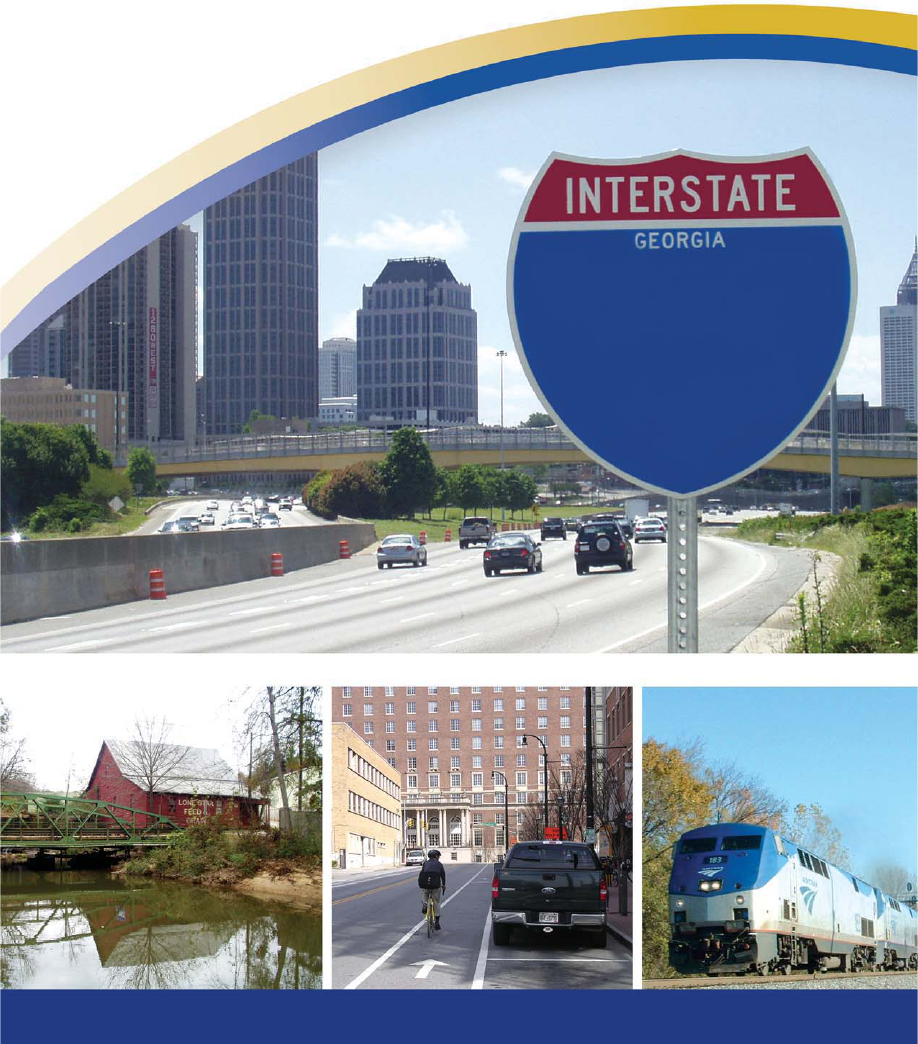
Fact Book
2006
www.dot.state.ga.us
Georgia Department of Transportation
59

Executive Editors:
Administrator
Karlene Barron
Assistant Administrator
External Communications
Vacant
Assistant Administrator
Internal Communications
Lillian Jackson
Publications Coordinator
Carla Murphy
Editor/Design & Layout
Laurie Scott
Core Values
Core Values are enduring beliefs which Georgia
DOT Leadership and employees hold in common and
put into action. Core values answer the question,
"How do we act as we move toward achieving our
mission and vision?" Georgia DOT's Leadership team
identified the Department's core values to be: Committed,
Accountable, Responsible and Ethical (C.A.R.E.).
Our Vision
Georgia's transportation system will always be a vital
component of the state's future success and ability to
compete in a global economy. Our team of motivated
professionals and quality-driven management will
maintain and improve mobility by providing a safe,
seamless, intermodal, environmentally-sensitive
transportation system.
60
TABLE OF CONTENTS
Organizational Chart . . . . . . . . . . . . . . . . . . . . . . . . . . . . . . . . . . . . . . .2
Congressional Districts . . . . . . . . . . . . . . . . . . . . . . . . . . . . . . . . . . . . . .3
State Transportation Board . . . . . . . . . . . . . . . . . . . . . . . . . . . . . . . . .4-5
Organization & Responsibilities . . . . . . . . . . . . . . . . . . . . . . . . . . . . .6-18
Primary Contacts . . . . . . . . . . . . . . . . . . . . . . . . . . . . . . . . . . . . . . .19-21
Frequently Called Numbers . . . . . . . . . . . . . . . . . . . . . . . . . . . . . . . . . .22
Georgia DOT Districts & Area Offices . . . . . . . . . . . . . . . . . . . . . . .23-26
Geographic Information Systems . . . . . . . . . . . . . . . . . . . . . . . . . . .27-28
Georgia DOT’s Web Site . . . . . . . . . . . . . . . . . . . . . . . . . . . . . . . . . . . .29
Georgia Highway Systems . . . . . . . . . . . . . . . . . . . . . . . . . . . . . . . . . .30
Major Highway Programs . . . . . . . . . . . . . . . . . . . . . . . . . . . . . . . .31-36
Transportation Programs . . . . . . . . . . . . . . . . . . . . . . . . . . . . . . . . .36-41
Office of Environment and Location . . . . . . . . . . . . . . . . . . . . . . . .42-43
Transportation Enhancements . . . . . . . . . . . . . . . . . . . . . . . . . . . . . . . .44
Scenic Byways . . . . . . . . . . . . . . . . . . . . . . . . . . . . . . . . . . . . . . . . .45-46
Wildflower Auto Tag Program . . . . . . . . . . . . . . . . . . . . . . . . . . . . .46-47
NAVIGATOR . . . . . . . . . . . . . . . . . . . . . . . . . . . . . . . . . . . . . . . . . . .48-50
HERO Unit . . . . . . . . . . . . . . . . . . . . . . . . . . . . . . . . . . . . . . . . . . . . . . .51
TIME Task Force . . . . . . . . . . . . . . . . . . . . . . . . . . . . . . . . . . . . . . . . . . .52
Bicycle & Pedestrian Plan . . . . . . . . . . . . . . . . . . . . . . . . . . . . . . . . .53-54
Safe Routes to School . . . . . . . . . . . . . . . . . . . . . . . . . . . . . . . . . . .54-55
High Occupancy Vehicle (HOV) Lanes . . . . . . . . . . . . . . . . . . . . . . . . .56
Rideshare Program . . . . . . . . . . . . . . . . . . . . . . . . . . . . . . . . . . . . . . . .57
Public Transit . . . . . . . . . . . . . . . . . . . . . . . . . . . . . . . . . . . . . . . . . .58-59
Railroads . . . . . . . . . . . . . . . . . . . . . . . . . . . . . . . . . . . . . . . . . . . . .60-65
Aviation . . . . . . . . . . . . . . . . . . . . . . . . . . . . . . . . . . . . . . . . . . . . . .66-67
Ports . . . . . . . . . . . . . . . . . . . . . . . . . . . . . . . . . . . . . . . . . . . . . . . . .68-69
Transportation Funding . . . . . . . . . . . . . . . . . . . . . . . . . . . . . . . . . .70-72
Glossary . . . . . . . . . . . . . . . . . . . . . . . . . . . . . . . . . . . . . . . . . . . . .73-79
Fast Facts . . . . . . . . . . . . . . . . . . . . . . . . . . . . . . . . . . . . . . . . . . . . . . .80
Notes . . . . . . . . . . . . . . . . . . . . . . . . . . . . . . . . . . . . . . . . . . . . . . . . . . .81
61

snoitacinummoC
orraBenelraK
n
foeciffO
diA
etatS
rreT
y
lbaG
e
foeciff
O
E
q
iu
p
nem
t
elkriPgeM
nedloGhtieK
llitsdutSdivaD
gninnalP
foeciffO
ngiseD&ytefaS
ataDnoitatropsnarT
nospmiSeimaJhtimS.He
naJ
erffeJ
y
lliH
foeciffO
foeciffO
A
ednaxelAalegn
r
foeciffO
nalepoClihP
d
foeciffO
snoitarepOciffarT
smargorP
ladomretnIfoeciffO
nosliW
laH
fonoisiviD
noitamrofnI
noitatropsnarTfonois
iviD
gnoLddoT
snoitarepO
tnempoleveDladomretnIyrneHev
e
tS ygolonhceT
noitc
u
rtsnoC
raeGenegroeG
y
5tcirtsiDfoeciffO
foeciffO
A
noitartsinimd
egoHdivaD
noitacoL/tnemnorivnE
3tcirtsiD
yaWfothgiR
secivreSlageL
amohTekiM
s
foeciffO
repooCleahciM
fonoisiviD
tnacaV
slairetaMfoeciffO
elooPtnayrB
fonoisiviD
maharG.LdivaD
noitcurtsnoC
f
onoisiviD
secivreSlageL
ssegruBardnaS
fonoisiviD
A
noitartsinimd
rerusaerT
zufhaM.LlraE
evitucexE
A
tnatsiss
senoJsirhC
renoissimmoCytupeD
nottarGydduB
reenignEfeihC
noitcurtsnocerPstcirtsiDdleiF
fonoisiviD
O
EE
foeciffOevitucexE
&,ataD,gninnalP
foeciffO
soRdlareG
s
foeciffO
secivreStegduB
lareneG
A
osniboRalegn
n
foeciffO
oddaMnwaD
x
A
roppuSnoitacilpp
t
foeciffO
rekaBffeJ
ciffarTfoeciffO mailliWynoT
s
ecnanetniaM
mirCdivaD erutcurts
arfnITI
leahcimraCevaD
skeeMpihC
foeciffO
roppuSlareneG
t
foeciffO
A
stidu
eliLluaP
s
ngiseDegdirB
foeciffO
elpoeP
draoBotyraterceS
nomsOhtebazilE
tnatsissAevitucexE
draoB
renoissimmoC
lhoknenniL
dloraH
ecivreSgnireenignE
s
fonoisiviD
A
tnatsiss
amwoBnnelG
n
remmuSnairB
s
OEE
1tcirtsiD
yarruMcMllessuR
.rJ,
nospmohThtenneK eorfneRlyreB
foeciffO
stcartnoCfoeciffO
yaMger
G
o
foeciffO
foeciffO
noitcurtsnoC
foeciffO
2tcirtsiD
smialC
/yrevileDmargorP
rakabu
bAsbaB
i
elpeeKyevraH
r
foeciffO
leiffehSeoJ
d
cnerruDnnelG
e
hcraeseR&
eg
aS
tneK
r
enilCwehttaM
foecif
fO
A
gnitnuoccsemloHalraC
rebmahCguoD
s
foeciffO
notnalByraG
llewoHsamohT
foeciffO
foeciffO
ngiseDtnatlusnoC
6tcirtsiD
7tcirtsiD
nahcuBneB
ngiseDnabrU
riAfoecif
fO
T
ropsnar
t
a
it
no
foeciffO
lennosreP
cigetartS
tnempoleveD
foeciffO
sivaDmiJ
nemeganaM
t
moclaMekiM
nosnhoJekiM
seitilitU
ssenisuBTI
secitcarP
.tmgMlaicnaniFrotStnerB
y
ngiseDdaoR4tcirtsiD
g
y
y
i
i
A
A
f
f
i
i
f
f
f
f
f
f
f
f
O
O
revoD ekiM
kcirtapkriK nhoJ
s
k
s
s
e
e
M
e
e
p
i
p
p
h
C
hh
f
o
e
c
i
f
f
f
f
O
r
o
p
p
u
S
l
a
r
a
a
e
n
e
G
t
rr
f
o
e
c
i
f
f
f
f
O
l
e
n
n
o
s
r
s
s
e
P
n
o
s
n
h
o
J
o
e
k
e
e
i
k
k
M
i
i
fo noisiviD
ylbmessA lareneGronrevoG
noitatropsnarT etatS
1
t
c
t
t
i
r
t
s
iD
y
a
y
y
r
a
a
r
r
r
u
r
r
M
u
u
c
M
c
c
l
l
l
l
e
s
s
u
s
R
a
m
o
h
T
h
h
e
k
ee
i
k
k
M
i
i
s
2
t
c
t
t
i
r
t
s
i
D
3
t
c
t
t
i
r
t
s
i
D
l
l
l
l
e
w
e
e
o
H
o
s
a
m
o
h
T
h
h
A
n
o
i
t
a
r
a
a
t
s
i
n
i
m
d
A
A
e
g
o
H
o
d
i
d
d
v
i
i
a
D
s
t
c
t
t
a
r
a
t
n
o
C
f
o
e
c
i
f
f
f
f
O
e
v
i
t
c
e
f
f
f
f
E
7
0
0
2
,
1
y
r
y
y
a
u
n
a
J
r
a
e
G
e
n
e
g
r
g
g
o
e
G
y
r
r
s
l
a
i
r
e
t
a
M
f
o
e
c
i
f
f
f
f
O
h
c
r
a
e
s
e
R
&
n
o
i
t
c
tt
u
r
t
s
n
o
C
f
o
ec
i
f
f
f
f
O
s
m
i
a
l
C
e
n
i
n
l
i
i
C
ll
w
e
h
t
h
h
t
t
t
a
M
aa
s
n
o
i
t
a
c
i
n
u
m
m
o
C
o
r
o
o
r
r
r
a
B
e
n
e
l
e
r
l
l
a
K
a
n
f
o
e
c
i
f
f
f
f
O
f
o
e
c
i
f
f
f
f
O
d
i
A
e
t
a
t
S
r
r
r
r
e
T
e
y
r
r
l
b
a
G
e
l
l
f
o
e
c
i
f
f
f
f
O
E
q
i
u
p
n
e
m
t
n
e
m
e
g
a
n
a
M
t
m
o
cl
a
M
a
e
k
e
i
k
k
M
i
i
r
e
n
o
i
s
s
i
m
m
o
C
y
t
u
p
e
D
n
o
t
o
o
t
t
t
a
r
aa
G
r
r
y
d
y
y
d
d
d
u
B
y
l
b
m
e
s
s
A
l
a
r
e
n
e
G
d
r
d
d
a
o
B
n
o
i
t
a
t
r
o
p
s
n
a
r
T
e
t
a
t
S
r
e
n
o
i
s
s
i
m
m
o
C
l
h
o
k
o
o
n
e
n
n
i
n
L
d
l
d
d
o
r
o
o
a
H
aa
t
n
a
t
s
i
s
s
A
s
s
e
v
i
t
u
c
e
x
E
r
e
v
e
e
o
D
e
k
e
e
i
k
k
M
i
i
d
r
d
a
o
B
o
t
y
r
y
y
a
t
e
r
e
e
c
e
S
n
o
m
s
O
ss
h
t
h
h
e
b
a
z
i
zz
l
i
i
E
l
l
r
o
n
r
e
v
o
G
e
l
p
o
e
P
Organizational
Chart
62
3
Metro Area Detail Map
Georgia’s Congressional Districts
Effective 2007 Election
3
13
5
4
7
8
10
12
6
11
9
1
7
11
4
5
13
9
6
3
8
2
10
12
63

4
District 1
Roy Herrington
382 East Parker Street, P. O. Box 130
Baxley, GA 31515
(912) 367-7723 • Fax (912) 367-1009
District 5
Emory McClinton
132 E. Lake Drive, SE
Atlanta, GA 30317
(404) 377-5101 • Fax (404) 373-3371
District 6
Garland Pinholster, Vice Chairman
1770 Flat Bottom Road
Ball Ground, GA 30107
(770) 735-3928 • Fax (770) 735-3928
District 2
W.P. Billy Langdale
P. O. Box 1088
Valdosta, GA 31603
(229) 242-7450 • Fax (229) 333-2534
District 3
Sam Wellborn
2110 Oak Avenue
Columbus, GA 31906
(706) 649-2233
District 4
Robert L. Brown, Jr.
250 E. Ponce de Leon Avenue, 8th floor
Decatur, GA 30030-0126
(404) 377-2460 • Fax (404) 377-5833
The Georgia DOT is governed by a 13-member State Transportation Board
which exercises general control and supervision of the Department. The Board is
entrusted with powers which include: naming the Commissioner; designating
which public roads are encompassed within the state highway system;
approving long-range transportation plans; overseeing the administration of
construction contracts; and authorizing lease agreements. Board Members are
elected by a majority of a General Assembly caucus from each of Georgia’s
thirteen congressional districts. Each board member serves a five-year term.
State Transportation Board
64

5
District 11
David Doss
P. O. Box 431
Rome, GA 30162
(770) 291-9191 • Fax (706) 291-1205
District 7
Rudy Bowen
6650 Sugarloaf Parkway, Suite 200
Duluth, GA 30097
(678) 325-4570 • Fax (678) 325-4540
District 8
Larry Walker
P. O. Box 1234
Perry, GA 31069
(478) 987-1415 • Fax (478) 987-1077
District 12
Raybon Anderson
P. O. Box 1447
Statesboro, GA 30458
(912) 764-9084 • Fax (912) 489-2783
District 9
Mike Evans, Chairman
212 Dahlonega Street
Cumming, GA 30040
(678) 771-1000 • Fax (678) 771-1329
District 10
Bill Kuhlke, Jr.
3704 Benchmark Drive, P. O. Box 14549
Augusta, GA 30919
(706) 650-8722 • Fax (706) 860-7363
District 13
Dana L. Lemon
7943 Thrailkill Road
Jonesboro, GA 30236
(770) 490-9125 • Fax (770) 957-6118
65

STATE TRANSPORTATION BOARD
Board Members are elected by a majority of a General Assembly caucus
from each of Georgia’s thirteen congressional districts. Each board member
serves a five-year term. Terms alternate to ensure two members are elected
each year.
Georgia DOT Board Secretary
Elizabeth Osmon
Suite 106 (404) 656-5211
Serves as the Board’s liaison with legislators, local officials and the general
public. Acts on behalf of the Board when requested and arranges and plans
all Board meetings, workshops and conferences for the Board.
COMMISSIONER
Harold Linnenkohl
Suite 102 (404) 656-5206
Provides principle-centered leadership to effectively operate the
Georgia Department of Transportation. Leads employees to
provide a high standard of service to the citizens of Georgia so
that multimodal transportation needs are met. Strives to fully utilize the talents
of all employees and all other resources available to the Department.
Executive Assistant to the Commissioner
Mike Dover
Suite 102 (404) 656-5206
Coordinates and attends all of the Commissioner’s meetings with state and local
officials; coordinates with senior staff on behalf of the Commissioner; answers
inquiries from state Transportation Board members, state and local officials and
the public on various Department of Transportation matters; assists the
Commissioner with administrative duties and serves as a point of contact for
the Commissioner’s office for meeting requests and project updates that may
need addressing.
DEPUTY COMMISSIONER
Buddy Gratton
Suite 108 (404) 656-5212
Assists the Commissioner in maintaining and operating the activi-
ties of the Georgia DOT. Oversees the Special Staff offices, the
Office of Equal Employment Opportunity, Field Districts, Legal
Services and Construction Divisions.
6
66

SPECIAL STAFF
Office of Communications
Karlene Barron
Administrator
Suite 315 (404) 463-6464
Serves as the Department’s external communications liaison to the public and
the media. Prepares presentations and speeches for Board members, the
Commissioner, Division Directors and office heads. Assists upper management in
public affairs and public outreach decisions for the Department. Serves as the
internal communications liaison within the Georgia DOT. Develops the
Department’s Annual Report, Fact Book, personnel newsletter, quarterly
construction status map, magazine and Web page.
Office of State Aid
Terry Gable
State Aid Administrator
Suite 201 (404) 656-5185
Provides assistance to local governments through the County/City Contract
Program (State Aid), the Local Assistance Road Program (LARP) and the
off-system Bridge Program.
Office of Equipment Management
Mike Malcom
State Equipment Management Administrator
7565 Honey Creek Court, Lithonia, GA 30038
(770) 785-6947
This office is responsible for the administration and management of the
Department’s fleet, comprised of approximately 8,600 units. Directs and
administers the program for statewide purchasing of vehicles and equipment.
Determines vehicle and equipment replacement requirements, considering both
budget and needs.
DIVISION OF CONSTRUCTION
David L. Graham
Director
Suite 134 (404) 656-5207
Responsible for advertising, letting and awarding
projects; oversight of construction projects; transportation
research; testing of materials; contract payments and contract claims.
7
67

8
Of
fice of Construction
Greg Mayo
State Construction Engineer
Suite 237 (404) 656-5306
Investigates citizens’ concerns on projects and assists in timely problem
resolution. Reviews and approves contract modifications and communicates
with construction industry.
Office of Contracts Administration
David Hoge
State Transportation Office Engineer
Suite 223 (404) 656-5325
Prepares and ensures proper execution of bid proposals, letting process
and contracts. Audits contract payment process.
Office of Materials and Research
Georgene Geary
State Materials & Research Administrator
(404) 363-7512
Tests materials used in construction and maintenance activities, maintains
qualified products lists and provides expertise in construction materials. Also
specifies material requirements, provides geotechnical services and manages
Department’s research effort.
Office of Construction Claims
Matthew Cline
Transportation Engineer Administrator
Suite 209 (404) 656-2106
Responsible for reviewing, analyzing, negotiating, mediating and
directing the Department’s defense against construction claims and
lawsuits filed by contractors.
DIVISION OF LEGAL SERVICES
Sandra Burgess
Director
Suite 329 (404) 656-5275
Responsible for advising the Commissioner and Deputy
Commissioner as well as senior staff on legal issues at the
federal and state level that might impact the Department.
68

9
Patricia Flowers
D.B.E. Assistant Administrator
Suite 142 (404) 656-1710
Of
fice of Legal Services
Kenneth Thompson, Jr.
Legal Services Administrator
Suite 321 (404) 657-5807
Provides legal research and other general legal assistance services
concerning recurring issues of interest to the Department. Provides analysis
of federal and state legislation. Reviews consultant, local government and
personal services contracts for legal accuracy.
DIVISION OF EQUAL EMPLOYMENT OPPORTUNITY
Michael Cooper
Director
Suite 142 (404) 656-5323
Responsible for ensuring internal and external compliance with
federal and state laws/guidelines as they relate to fair and
equitable employment and business practices.
Office of Equal Employment Opportunity
John Kirkpatrick
E.E.O. Assistant Administrator
Suite 142 (404) 656-5323
Adheres to state and federal regulations as they pertain to civil rights issues
concerning Title VI and Title VII of the U.S. Code of Federal Regulations.
Monitors the Disadvantaged Business Enterprise (DBE) Program and the
state’s contractor review for compliance.
Georgia DOT Districts
District One-Gainesville
Russell McMurry, District Engineer (770) 532-5526
District Two-Tennille
Mike Thomas, District Engineer (478) 552-4601
District Three-Thomasville
Thomas B. Howell, District Engineer (706) 646-6500
District Four-Tifton
Joe Sheffield, District Engineer (229) 386-3280
District Five-Jesup
Glenn Durrence, District Engineer (912) 427-5711
District Six-Cartersville
Kent Sager, District Engineer (770) 387-3600
District Seven-Chamblee
Bryant Poole, District Engineer (770) 986-1001
69

10
DIVISION OF FIELD DISTRICTS
VACANT
Director
Suite 128 (404) 656-5214
Responsible for the operation and maintenance of the transportation system
in each of Georgia DOT’s seven districts to ensure proper utilization of
resources and adherence to prevailing policies.
CHIEF ENGINEER
David E. Studstill, Jr.
Suite 122 (404) 656-5277
Supervises and directs all engineering-related activities within
the Department to ensure the effective and efficient planning,
design, construction, operation and maintenance of transporta-
tion systems statewide. The Division of Preconstruction, Division of Operations,
Division of Transportation Planning, Data and Intermodal Development as well
as the Office of Engineering Services report directly to the Chief Engineer.
Office of Engineering Services
Brian Summers
Project Review Engineer
Suite 266 (404) 656-6843
Provides oversight of federally-funded projects. Directs project review process,
manages standard specifications and provides project cost estimates
DIVISION OF PRECONSTRUCTION
Todd Long
Director
Suite 129 (404) 656-5187
Develops environmental studies, right-of-way plans, construction
plans and bid documents through a cooperative effort that
results in project design and implementation.
Office of Environment/Location
Harvey Keepler
State Environmental/Location Engineer
3993 Aviation Circle, Atlanta, GA 30336
(404) 699-4401
Responsible for the environmental analysis and permitting of every project
let to construction by the Department. This office also is responsible for
70

11
location and feasibility studies for new projects, traffic projections, perform-
ing and processing aerial photography, and providing the surveys, mapping
and cross-sections needed for construction plans and earthwork payment of
contractors.
Office of Right-of-Way
Phil Copeland
Administrator
Suite 409 (404) 656-5372
Responsible for the acquisition of properties necessary for transportation
projects. This task includes plan design review and approval, appraisal,
relocation assistance, condemnation, negotiation and property management.
Both DOT acquisitions as well as local government acquisitions (if they
include state or federal funds) are monitored by this office.
Office of Road Design
Brent Story
State Road and Airport Design Engineer
Suite 444 (404) 656-5386
Responsible for the conceptual development and design of roadways,
including the preparation of preliminary construction plans, right-of-way
plans and final construction plans. Develops and designs roadways outside
of the urban area boundaries, including the Governor’s Road Improvement
Program (GRIP) and the rural interstate system.
Office of Urban Design
Ben Buchan
State Urban Design Engineer
Suite 356 (404) 656-5436
Develops and coordinates conceptual layouts, preliminary and final
construction plans and right-of-way plans for projects within major urban
areas. Responsibilities include extensive public involvement with federal
and state agencies, local governments, neighborhoods, businesses and the
general public.
Office of Program Delivery/Consultant Design
Babs Abubakari
State Consultant Design Engineer
Suite 432 (404) 463-6133
Enables the Department’s compliance with federal and state guidelines as
they relate to fair and equitable hiring and employee practices.
71

12
Of
fice of Bridge Design
Paul Liles
State Bridge and Structural Design Engineer
Suite 258 (404) 656-5280
Responsible for structural design of highway bridges, culverts and retaining
walls. Also oversees the hydraulic design of bridge structures.
DIVISION OF OPERATIONS
Steve Henry
Director
Transportation Management Center
935 E. Confederate Ave., Atlanta, GA 30316
(404) 635-8043
Ensures a safe and efficient transportation system by setting policies that
control operational features, address maintenance needs and regulate the
proper use of the state highway system.
Office of Maintenance
David Crim
State Maintenance Engineer
Transportation Management Center
(404) 635-8734
Coordinates all statewide maintenance activities such as bridge and sign
maintenance, landscaping, the Wildflower Program, roadway striping, routine
maintenance of state highway system, emergency response (both roadway
and weather-induced) and the Adopt-a-Highway Program. Develops contract
documents for letting maintenance projects.
Office of Traffic Operations
Vacant
State Traffic Operations Engineer
Transportation Management Center
(404) 635-8038
Responsible for traffic signal repair, timing and emergency installation pro-
gram of the Department. Also responsible for the warehousing of
electrical/signal materials, the timing of signal systems and the centralized
repair support for approximately 1,650 signals statewide. Manages the
Intelligent Transportation Systems (ITS) including operation of the
Transportation Management Center (TMC) and the Highway Emergency
72

13
Response Operators (HEROs) providing service to the traveling public 24-
hours a day, 365 days-a-year.
Office of Utilities
Jeff Baker
State Utilities Engineer
Transportation Management Center
(404) 635-8045
The State Utilities Office ensures the public’s interest is served through our
commitment to develop and administer reasonable utility and railroad poli-
cies, procedures, standards and regulations for the safe and efficient use of
highway right-of-way. Provides expert technical assistance and functional
guidance on utility and railroad encroachments, adjustments, relocations,
agreements and billings to meet diverse needs of stakeholders.
Office of Traffic Safety and Design
Keith Golden
State Traffic Safety and Design Engineer
Transportation Management Center
(404) 635-8115
The Office of Traffic Safety and Design is responsible for traffic engineering
and the traffic safety program statewide. The program includes vehicle crash
analysis, traffic studies and projects for safety improvements to the state
highway system. This Office designs the signs, pavement markings and traffic
signals for Georgia DOT projects. It also is responsible for the Department’s
programs for railroad crossing safety and access as well as commercial
driveways and freeway signage.
DIVISION OF PLANNING, DATA &
INTERMODAL DEVELOPMENT
Gerald Ross
Director
Suite 127 (404) 656-0610
This Division manages the statewide transportation planning
process and the collection and sharing of transportation data,
including vehicle volumes and the state route network. The Division researches,
develops and implements transit, port, freight and passenger rail opportunities.
73

14
Of
fice of Intermodal Programs
Hal Wilson
Intermodal Programs Administrator
West Annex 2nd Floor
276 Memorial Drive, Atlanta, GA 30334
(404) 651-9201
Manages Georgia’s planning and operations programs in support of the
transit, rail, port, waterway and aviation systems. This Office manages the
statewide transportation planning process and the collection and sharing of
transportation data, including vehicle volumes and the state route network. In
addition, this Office researches, develops and implements transit, port,
freight and passenger rail opportunities across the state.
Office of Planning
Angela Alexander
State Transportation Planning Administrator
Suite 372
(404) 656-5411
Manages Georgia’s transportation planning program, in addition to
developing the Statewide Transportation Plan (SWTP) and the Statewide
Transportation Improvement Program (STIP). Also manages the Department’s
Transportation Enhancement Program, designed to improve the quality of the
transportation experience. Has responsibility for the Bicycle and Pedestrian
Program, the Congestion and Mitigation/Air Quality (CMAQ) coordination
and the Scenic Byways Program.
Office of Transportation Data
Jane H. Smith
Transportation Data Administrator
5025 New Peachtree Road, Chamblee, GA 30341
(770) 986-1360
The Office of Transportation Data is responsible for collecting, processing and
disseminating data to support transportation planners, designers and key
decision-makers. The types of data provided include: official state public
road mileage; average annual daily traffic; volume and classification; truck
weight information; vehicle miles traveled; road characteristics data; and
visual road imagery (video log). The Office also oversees the administration
of highway system and roadway functional classifications changes, and
updates and distributes the official state of Georgia Highway and
Transportation Regular and Large Print Maps and County Maps.
74

15
TREASURER
Earl Mahfuz
Suite 148 (404) 656-5224
Manages all financial matters for the Georgia DOT. Responsible
for acquiring and accounting all funds the Department is entitled
to receive. Develops policies for administering funds for the
Department. Oversees the Division of Administration, Division of Information
Technology, Office of Audits, Budget Services and the Office of Personnel.
DIVISION OF INFORMATION TECHNOLOGY
Jeffrey Hill
Director
Suite 180 (404) 656-6034
Manages Department’s new and existing computer applications
and computer network. Oversees Department’s electronic
processing budget, configuration and asset management. Also develops
information technology policy, standards and strategic planning functions.
Office of Information Technology Infrastructure
Gary Blanton
Administrator
Suite 179 (404) 656-6034
Responsible for the operation and management of the Department’s
computer hardware and software and consists of Database Support,
Server Support, Network Support, Client Support and the Solutions Center.
Office of Application Support
Doug Chambers
Administrator
West Annex
(404) 463-2860 Ext. 103
This Office is composed of an Applications Development Section and an
Applications Support Section. The Development Section manages the
development of new applications for the Department. It is also home to the
Geographic Information System (GIS) coordination for the Department. The
Support Section supports and maintains the Department’s computer
applications including Computer-Aided Design (CAD), Web, COTS (off-the-
shelf) and enterprise-wide shared resources.
75

Office of Information Technology
Business Practices
Tony Williams
Administrator
Suite 183 (404) 656-6034
This office handles much of the administrative needs of the Information
Technology Division. It is composed of three working groups: the Operations
Group, the Configuration Management Group and the Policy and Standards
Group. The Operations Group handles the day-to-day administrative duties,
including personnel issues, payroll, leave records, budget and purchasing
needs. The Configuration Management Group maintains records of all IT
resources and also plays a major role in maintaining the Department's Asset
Management for IT equipment. The Policy and Standards Group maintains
and updates IT-related policies and standards in the Department.
DIVISION OF ADMINISTRATION
Meg Pirkle
Director
Suite 143 (404) 656-5239
Manages and oversees statewide administrative
activities for the Georgia DOT. Handles the payroll for all
employees and provides payment to contractors, consultants and all vendors
doing business with the Department. Maintains all accounting records, tracks
project expenditures and prepares financial statements for the Department.
Develops and manages the budget of the Department of Transportation.
Office of Budget Services
Angela Robinson
Budget Administrator
Suite 150 (404) 656-5237
Develops and manages the nearly $2 billion budget of the Department.
Serves as an advisor to the Treasurer and upper management in funding
matters. Also serves as liaison to the Office of Planning & Budget and the
Legislative Budget Office.
16
76

Office of General Accounting
Dawn Maddox
Transportation Accounts Administrator
Suite 169 (404) 656-5193
Manages the payout and receipt of the Department’s funds, which includes
issuing checks to vendors, contractors, cities/counties, consultants and commodi-
ty/service vendors. Also handles payroll and travel reimbursement for nearly
6,000 employees. Other tasks include keeping the Department’s books of
accounts and assuring all accounting records are accurate and are prepared
in a timely manner. The Units housed within the General Accounting Office
include Administration, Payroll, Cash Disbursement, Accounts Payable,
Contracts Payable, Central Cashier and Revenue.
Office of Financial Management
Jamie Simpson
Financial Management Administrator
Suite 170 (404) 463-2799
Prepares and manages the Department’s six-year Construction Work
Program (CWP) and project information system (Tpro). Requests and pre-
pares documents for authorization and billing for federal aid, bond and
state funds. Develops, submits and tracks project expenditures in the
Department’s project accounting system (PeopleSoft).
Of
fice of Air Transportation
Dave Carmichael
Air Transportation Administrator
175 South Airport Road, Atlanta, GA 30336
(404) 699-4483
Operates and maintains a fleet of six aircraft, based at Fulton County
Airpor
t. Also provides air transportation for state officials and conducts
aerial photography flights to acquire precision mapping for the complete
design and construction of highways.
Of
fice of Audits
Beryl Renfroe
Transportation Accounts Administrator
Suite 301 (404) 656-5598
Audits Division offices as well as contractors and consultants who do work for
the Depar
tment.
17
77

18
Of
fice of General Support
Chip Meeks
Transportation Accounts Administrator
Suite 170 (404) 656-5239
Provides all offices with office equipment and supplies. The Office is
comprised of Asset Management/Telecommunication, Cost Accounting and
Inventory Control, Procurement, Facility Management, Fuel and Purchasing
Card Program Administration, Records Management, General Office Motor
Pool and Warehouse and Safety/Risk Management.
Office of Personnel
Mike Johnson
Director
Suite 270 (404) 656-5260
Responsible for developing, implementing and administering all personnel-
related functions and programs for the Department. These include benefits,
recruiting, training, job evaluation and compensation, employee relations,
employee assistance, performance management and personnel transaction
processing and drug/alcohol testing program for commercial driver’s license
holders.
Office of Strategic Development
Jim Davis
Director
276 Memorial Drive, Atlanta, GA 30303
(404) 656-5181
Responsible for employee training and development, organizational
development, strategic planning and strategic management.
78

19
Commissioner/Special Staff
Email Address/Phone #
Harold Linnenkohl
Commissioner
Harold.Linnenkohl
@
dot.state.ga.us
(404) 656-5206
Buddy Gratton
Deputy Commissioner
Buddy.Gratton
@
dot.state.ga.us
(404) 656-5212
David E. Studstill, Jr.
Chief Engineer
David.Studstill
@
dot.state.ga.us
(404) 656-5277
Mike Dover
Executive Assistant to Commissioner
Mike.Dover
@
dot.state.ga.us
(404) 656-5206
Glenn Bowman
Executive Assistant to Chief Engineer
Glenn.Bowman
@
dot.state.ga.us
(404) 651-8355
Karlene Barron
Communications Administrator
Karlene.Barron
@
dot.state.ga.us
(404) 463-6464
Brian Summers
Project Review Engineer
Brian.Summers
@
dot.state.ga.us
(404) 656-6843
Terry Gable
State Aid Administrator
Terry.Gable
@
dot.state.ga.us
(404) 656-5185
Mike Malcom
Statewide Equipment Mgt. Adm.
Mike.Malcom
@
dot.state.ga.us
(770) 785-6947
Elizabeth Osmon
DOT Board Secretary
Elizabeth.Osmon
@
dot.state.ga.us
(404) 656-5211
Division of Construction
Email Address/Phone #
David Graham
Director of Construction
David.Graham
@
dot.state.ga.us
(404) 656-5207
David Hoge
State Trans. Office Eng.-Contract Adm.
David.Hoge
@
dot.state.ga.us
(404) 656-5325
Matthew Cline
Trans. Eng. Admin.-Const. Claims
Matthew.Cline
@
dot.state.ga.us
(404) 656-2106
Georgene Geary
State Materials & Research Adm.
Georgene.Geary
@
dot.state.ga.us
(404) 363-7512
Greg Mayo
State Construction Engineer
Greg.Mayo
@
dot.state.ga.us
(404) 656-5306
Division of Equal
Employment Opportunity
Email Address/Phone #
Michael Cooper
Director
Michael.Cooper
@
dot.state.ga.us
(404) 656-5323
Division of Field Districts
Email Address/Phone #
Vacant
Director of Field Districts
(404) 656-5214
Russell McMurry
District One - Gainesville
Russell.McMurry
@
dot.state.ga.us
(770) 532-5526
Mike Thomas
District Two - Tennille
Mike.Thomas
@
dot.state.ga.us
(478) 552-4601
Thomas Howell
District Three - Thomaston
Thomas.Howell
@
dot.state.ga.us
(706) 646-6500
Joe Sheffield
District Four - Tifton
Joe.Sheffield
@
dot.state.ga.us
(229) 386-3280
PRIMARY CONTACTS
79

Division of Field Districts
Email Address/Phone #
Glenn Durrence
District Five - Jesup
Glenn.Durrence
@
dot.state.ga.us
(912) 427-5711
Kent Sager
District Six - Cartersville
Kent.Sager
@
dot.state.ga.us
(770) 387-3602
Bryant Poole
District Seven - Metro Atlanta
Bryant.Poole
@
dot.state.ga.us
(770) 986-1011
Division of Legal Services
Email Address/Phone #
Sandra Burgess
Director of Legal Services
Sandra.Burgess
@
dot.state.ga.us
(404) 657-5808
Kenneth Thompson
Legal Services Administrator
Ken.Thompson
@
dot.state.ga.us
(404) 657-5806
Division of Operations
Email Address/Phone #
Steve Henry
Director of Operations
Steve.Henry
@
dot.state.ga.us
(404) 656-5214
David Crim
State Maintenance Engineer
David.Crim
@
dot.state.ga.us
(404) 635-8734
Jeff Baker
State Utilities Engineer
Jeff.Baker
@
dot.state.ga.us
(404) 635-8045
Vacant
Transp. Engineer Admin.-Traffic Ops
(404) 635-8038
Mark Demidovich
Asst. State Traffic Operations Engineer
Mark.Demidovich
@
dot.state.ga.us
(404) 635-8014
Keith Golden
Safety Traffic & Design Engineer
Keith.Golden
@
dot.state.ga.us
(404) 635-8115
Kathleen Gibson
Oversize Permit Unit Admin.
Kathleen.Gibson
@
dot.state.ga.us
(404) 635-8176
Division of Preconstruction
Email Address/Phone #
Todd Long
Director of Preconstruction
Todd.Long
@
dot.state.ga.us
(404) 656-5187
Genetha Singleton
Assistant Dir. of Preconstruction
(404) 651-7455
Brent Story
State Road & Airport Design Engineer
Brent.Story
@
dot.state.ga.us
(404) 656-5386
Ben Buchan
State Urban Design Engineer
Ben.Buchan
@
dot.state.ga.us
(404) 656-5436
Paul Liles
State Bridge/Structural Design Engineer
Paul.Liles
@
dot.state.ga.us
404) 656-5280
Harvey Keepler
State Environmental/Location Engineer
Harvey.Keepler
@
dot.state.ga.us
(404) 699-4401
Phil Copeland
State Right-of-Way Administrator
Phil.Copeland
@
dot.state.ga.us
(404) 656-5372
Babs Abubakari
State Consultant Design Engineer
Babs.Abubakari
@
dot.state.ga.us
(404) 463-6133
20
PRIMARY CONTACTS
80

Division of Planning, Data
& Intermodal Development
Email Address/Phone #
Gerald Ross
Dir. of Planning, Data, & Intermodal
Gerald.Ross
@
dot.state.ga.us
(404) 656-0610
Hal Wilson
Intermodal Programs Admin.
Hal.Wilson
@
dot.state.ga.us
(404) 651-9200
Angela Alexander
State Trans. Planning Admin.
Angela.Alexander
@
dot.state.ga.us
(404) 656-5411
Jane H. Smith
State Trans. Data Admin.
Jane.H.Smith
@
dot.state.ga.us
(770) 986-1360
Office of the Treasurer/
Division of Administration
Email Address/Phone #
Earl Mahfuz
Treasurer
Earl.Mahfuz
@
dot.state.ga.us
(404) 656-5224
Mike Johnson
Personnel Director
Mike.Johnson
@
dot.state.ga.us
(404) 656-5260
Meg Pirkle
Administration Director
Meg.Pirkle
@
dot.state.ga.us
(404) 656-5239
Beryl Renfroe
Trans. Accts. Admin.-Gen Acct.
Beryl.Renfroe
@
dot.state.ga.us
(404) 656-5247
Angela Robinson
Budget Administrator
Angela.Robinson
@
dot.state.ga.us
(404) 656-5237
Chip Meeks
General Support Trans Accounts Admin.
Chip.Meeks
@
dot.state.ga.us
(404) 463-6029
Dawn Maddox
Trans. Accts. Admin.-Gen. Acct.
Dawn.Maddox
@
dot.state.ga.us
(404) 656-5193
Jamie Simpson
Financial Management Admin.
Jamie.Simpson
@
dot.state.ga.us
(404) 463-2799
Dave Carmichael
Air Trans. Administrator
Dave.Carmichael
@
dot.state.ga.us
(404) 699-4483
Jim Davis
Strategic Development Admin.
Jim.Davis
@
dot.state.ga.us
(404) 656-5181
Division of Information
Technology
Email Address/Phone #
Jeffrey Hill
Director of Information Technology
Jeffrey.Hill
@
dot.state.ga.us
(404) 656-6034
Gary Blanton
Office of Infrastructure Admin.
Gary.Blanton
@
dot.state.ga.us
(404) 651-7136
Doug Chambers
Office of I.T. Applications Admin
Doug.Chambers
@
dot.state.ga.us
(404) 463-2860 Ext. 103
Tony Williams
Office of I.T. Business Practices
Tony.Williams
@
dot.state.ga.us
(404) 656-6034
21
PRIMARY CONTACTS
81

22
FREQUENTLY CALLED NUMBERS
Accident Location Traffic Safety & Design (404) 635-8131
Sites
Adopt-A-Highway Maintenance Office
(404) 635-8194
Bicycle Paths State Bic
ycle & (404) 657-6692
Pedestrian Coordinator
Auto Tags & Title (404) 362-6500
Commercial Georgia Depar
tment of (678) 413-8825
Vehicle Enforcement Driver Services
Drivers License www.dds.ga.gov (404) 657-9300
Information (678) 413-8400
Handicap Parking (404) 657-9300
Permits
Motor Vehicle (
678) 413-8400
Reports
Driv
eway Permits Traffic Safety & Design
(404) 635-8042
GA 400 Cruise State R
oad &
Cards/Violations Tollway Authority (
404) 365-7780
Natural Disasters 1.
Contact local law (404) 635-7000
enforcement agency24-Hour Line
2. Contact GEMA
(404) 635-7200
Outdoor Advertising Maintenance Activities Unit
404) 363-7625
Overweight Truck Ov
ersize Permit Unit 1-800-570-5428
Permits Cust. Service-
1-888-262-8306
Rest Areas Office of
Maintenance (404) 635-8174
Road Work Office of
Construction
(404) 656-3606
State Maps Map Sales Unit
(770) 986-1436
Traffic Counts Traffic Count Customer Srv.
(770) 986-1436
Traffic Incident TIME T
ask Force (404) 635-8463
Mgt. Enhancement General Info
Traffic Signals T
raffic Safety & Design (404) 635-8115
Transp. Enhancement State
wide Planning Bureau (404) 656-5411
Program
Transp. Mgt Center Info (404) 624-1300
Transp. Statistical Office of Transportation Data (770) 986-1364
Data (
770) 986-1360
Up-to-date Traffic T
ransportation Mgt. Center (404) 635-6800
Information AT&T Cingular, Verizon and 1-888-635-8287
Sprint *DOT (*368)
Wildflower Program Office of
Maintenance
(404) 635-8174
INFORMATION CONTACT PHONE #
82
The Georgia Department of Transportation is divided into seven districts which
are responsible for operating and maintaining the transportation system at the
local level. Each district has a District Engineer, who is responsible for planning,
organizing and directing the activities of the district. The districts are subdivided
by area offices which are overseen by Area Engineers.
6
5
2
4
3
7
1
Thomaston
Gainesville
Tennille
District Responsibilities:
Tifton
Jesup
Cartersville
Chamblee
Georgia DOT Districts
23
District One
District Engineer: Russell McMurry
(770) 532-5526
2505 Athens Highway, SE
P.O. Box 1057
Gainesville, GA 30503
Communications Officer: Teri Pope
(770) 718-3924
Website: www
.dot.state.ga.us/dot/fielddistricts/d1/Index.shtml
Area Offices Counties Served Phone
Gainesville Dawson,
Forsyth, Hall (770) 535-5759
Clarkesville Banks, Habersham, Rabun, Stephens (706) 754-9559
Carnesville Elbert, Franklin, Hart, Madison (706) 384-7269
Cleveland Lumpkin, Union, Towns, White (706) 348-4848
Lawrenceville Barrow, Gwinnett (770) 339-2308
Athens Clarke, Jackson, Oconee, Walton (706) 369-5627
OGLETHORPE
WILKES
LINCOLN
COLUMBIA
M
cDUFFIE
TA
L
I
A
F
E
R
R
O
RICHMOND
BURKE
JEFFERSON
G
L
AS
C
O
C
K
WARREN
HANCOCK
WASHINGTON
SCREVEN
JENKINS
EMANUEL
BULLOCH
EFFINGHAM
CHATHAM
BRYAN
EVANS
LIBERTY
LONG
McINTOSH
GLYNN
WAYNE
BRANTLEY
PIERCE
CAMDEN
CHARLTON
WARE
CLINCH
ECHOLS
ATKINSON
L
AN
IE
R
BERRIEN
LOWNDES
BROOKS
COOK
THOMAS
GRADY
COLQUITT
MITCHELL
DECATUR
SEMINOLE
MILLER
BAKER
EARLY
CALHOUN
DOUGHERTY
WORTH
TIFT
IRWIN
COFFEE
BEN HILL
BACON
APPLING
JEFF
DAVIS
TOOMBS
TATTNALL
CANDLER
TREUTLEN
JOHNSON
LAURENS
BALDWIN
WILKINSON
TELFAIR
WHEELER
DODGE
WILCOX
PULASKI
TWIGGS
HOUSTON
MACON
DOOLY
CRISP
SUMTER
LEE
TERRELL
RANDOLPH
CLAY
W
E
B
ST
E
R
QUI
T
M
AN
STEWART
MARION
CHATTA-
HOOCHEE
BIBB
JONES
CRAWFORD
MONROE
LAMAR
UPSON
PIKE
SPALDING
BUTTS
TALBOT
HARRIS
TROUP
ME
RIW
ET
H
E
R
HEARD
COWETA
F
A
Y
E
T
TE
DOUGLAS
C
L
A
Y
TO
N
HENRY
DEKALB
NEWTON
COBB
MORGAN
GREENE
JASPER
PUTNAM
M
ON
TGOM
ER
Y
PEACH
BL
E
CKL
EY
SCHLEY
TURNER
RO
C
KD
A
LE
MUSCOGEE
FULTON
TAYLOR
CARROLL
HARALSON
PAULDING
POLK
FLOYD
BARTOW
CHEROKEE
PICKENS
GORDON
CHATTOOGA
WALKER
GILMER
FANNIN
MURRAY
WHITFIELD
CATOOSA
DADE
TOWNS
UNION
RABUN
WHITE
LUMPKIN
DAWSON
HALL
FORSY
TH
HABERSHAM
BANKS
STEPHENS
FRANKLIN
HART
JACKSON
GWINNETT
BARROW
WALTON
OCONEE
CLARKE
MADISON ELBERT
• Roadway Maintenance and Operations
• Roadway Location and Design
• Construction Contract Administration
• Utility Conflicts (permits & relocation)
• Right-of-Way Acquisition
• Environmental Review
• Highway Beautification
• Coordination of Transit Systems
• Traffic Signals and Signs
• Permits
• Park & Ride Lots
• Public Outreach
83

24
District Two
District Engineer: Mike Thomas
(478) 552-4601
801 Highw
ay 15 South
P.O. Box 8
Tennille, GA 31089-0008
Communications Officer: Cissy McNure
(478) 552-4656
W
ebsite: www
.dot.state.ga.us/dot/fielddistricts/d2/Index.shtml
Area Offices Counties Served Phone
Sandersville Glascoc
k, Hancock, Washington, (478) 552-2464
Johnson
Swainsboro Emanuel, Jenkins, Screven (478) 289-2614
Louisville Burke, Jefferson, McDuffe, Warren (478) 625-3681
Augusta Columbia, Lincoln, Richmond, Wilkes (706) 855-3466
Madison Greene, Morgan, Newton, (706) 343-5836
Oglethorpe, Taliaferro
Milledgeville Baldwin, Jasper, Putnam, Wilkinson (478) 445-5130
Dublin Bleckley, Dodge, Laurens, Treutlen (478) 275-6596
District Three
District Engineer: Thomas B. Howell
(706) 646-6500
715 Andrews Drive
Thomaston, GA 30286-4524
Communications Officer: Barry Hancock
(706) 646-6257
Website: www
.dot.state.ga.us/dot/fielddistricts/d3/Index.shtml
Area Offices Counties Served Phone
Thomaston Crawford, Upson, Taylor, Pike, Lamar (706) 646-6630
Americus Marion, Schley, Stewart, Sumter, Webster (229) 931-2434
Perry Dooley, Houston, Macon, Peach, Pulaski (478) 988-7151
Macon Bibb, Jones, Monroe, Twiggs (478) 757-2601
Griffin Butts, Fayette, Henry, Spalding (770) 228-7205
LaGrange Coweta, Heard, Meriwether, Troup (706) 845-4115
Columbus Chattahoochee, Harris, Muscogee, Talbot (706) 568-2165
OGLETHORPE
WILKES
LINCOLN
COLUMBIA
McDUFFIE
TAL
IAFE
RRO
RICHMOND
BURKE
JEFFERSON
G
L
A
S
C
O
C
K
WARREN
HANCOCK
WASHINGTON
SCREVEN
JENKINS
EMANUEL
BULLOCH
EFFINGHAM
CHATHAM
BRYAN
EVANS
LIBERTY
LONG
McINTOSH
GLYNN
WAYNE
BRANTLEY
PIERCE
CAMDEN
CHARLTON
WARE
CLINCH
ECHOLS
ATKINSON
L
A
NIER
BERRIEN
LOWNDES
BROOKS
COOK
THOMAS
GRADY
COLQUITT
MITCHELL
DECATUR
S
E
MI
NO
L
E
MILLER
BAKER
EARLY
CALHOUN
DOUGHERTY
WORTH
TIFT
IRWIN
COFFEE
BEN HILL
BACON
APPLING
JEFF
DAVIS
TOOMBS
TATTNALL
CANDLER
TREUTLEN
JOHNSON
LAURENS
BALDWIN
WILKINSON
TELFAIR
WHEELER
DODGE
WILCOX
PULASKI
TWIGGS
HOUSTON
MACON
DOOLY
CRISP
SUMTER
LEE
TERRELL
RANDOLPH
CLAY
W
EBSTE
R
QUITMAN
STEWART
MARION
CHATTA-
HOOCHEE
BIBB
JONES
CRAWFORD
MONROE
LAMAR
UPSON
PIKE
SPALDING
BUTTS
TALBOT
HARRIS
TROUP
MERIWETHER
HEARD
COWETA
F
AYE
T
T
E
DOUGLAS
C
L
A
Y
T
ON
HENRY
DEKALB
NEWTON
COBB
MORGAN
GREENE
JASPER
PUTNAM
MONTGOMERY
PEACH
B
LEC
K
L
EY
SCHLEY
TURNER
R
O
C
K
D
A
L
E
MUSCOGEE
FULTON
TAYLOR
CARROLL
HARALSON
PAULDING
POLK
FLOYD
BARTOW
CHEROKEE
PICKENS
GORDON
CHATTOOGA
WALKER
GILMER
FANNIN
MURRAY
WHITFIELD
CATOOSA
DADE
TOWNS
UNION
RABUN
WHITE
LUMPKIN
DAWSON
HALL
F
O
R
S
Y
TH
H
A
B
E
R
SH
A
M
BANKS
STEPHENS
FRANKLIN
HART
JACKSON
GWINNETT
BARROW
WALTON
O
CO
N
E
E
CLARKE
MADISON ELBERT
2
OGLETHORPE
WILKES
LINCOLN
COLUMBIA
McDUFFIE
TALIAFERR
O
RICHMOND
BURKE
JEFFERSON
G
L
A
S
C
O
C
K
WARREN
HANCOCK
WASHINGTON
SCREVEN
JENKINS
EMANUEL
BULLOCH
EFFINGHAM
CHATHAM
BRYAN
EVANS
LIBERTY
LONG
McINTOSH
GLYNN
WAYNE
BRANTLEY
PIERCE
CAMDEN
CHARLTON
WARE
CLINCH
ECHOLS
ATKINSON
L
A
NIER
BERRIEN
LOWNDES
BROOKS
COOK
THOMAS
GRADY
COLQUITT
MITCHELL
DECATUR
S
E
M
I
N
O
L
E
MILLER
BAKER
EARLY
CALHOUN
DOUGHERTY
WORTH
TIFT
IRWIN
COFFEE
BEN HILL
BACON
APPLING
JEFF
DAVIS
TOOMBS
TATTNALL
CANDLER
TREUTLEN
JOHNSON
LAURENS
BALDWIN
WILKINSON
TELFAIR
WHEELER
DODGE
WILCOX
PULASKI
TWIGGS
HOUSTON
MACON
DOOLY
CRISP
SUMTER
LEE
TERRELL
RANDOLPH
CLAY
W
EBSTER
QUITMAN
STEWART
MARION
CHATTA-
HOOCHEE
BIBB
JONES
CRAWFORD
MONROE
LAMAR
UPSON
PIKE
SPALDING
BUTTS
TALBOT
HARRIS
TROUP
MERIWETHER
HEARD
COWETA
F
A
YE
T
T
E
DOUGLAS
C
L
A
Y
T
ON
HENRY
DEKALB
NEWTON
COBB
MORGAN
GREENE
JASPER
PUTNAM
MONTGOMER
Y
PEACH
BLEC
K
LEY
SCHLEY
TURNER
RO
C
K
D
AL
E
MUSCOGEE
FULTON
TAYLOR
CARROLL
HARALSON
PAULDING
POLK
FLOYD
BARTOW
CHEROKEE
PICKENS
GORDON
CHATTOOGA
WALKER
GILMER
FANNIN
MURRAY
WHITFIELD
CATOOSA
DADE
TOWNS
UNION
RABUN
WHITE
LUMPKIN
DAWSON
HALL
F
O
R
S
Y
T
H
H
A
B
E
R
S
H
A
M
BANKS
STEPHENS
FRANKLIN
HART
JACKSON
GWINNETT
BARROW
WALTON
O
CO
NEE
CLARKE
MADISON ELBERT
84

District Four
District Engineer: Joe Sheffield
(229) 386-3280
710 W
est 2nd Street
P.O. Box 7510
Tifton, GA 31793-7510
Communications Officer: Craig Solomon
(229) 391-6852
W
ebsite: www
.dot.state.ga.us/dot/fielddistricts/d4/Index.shtml
Area Offices Counties Served Phone
Valdosta Clinc
h, Echols, Lanier, Lowndes (229) 333-5287
Douglas Atkinson, Coffee, Berrien, Irwin (912) 389-4201
Fitzgerald Ben Hill, Crisp, Turner, Wilcox, Worth (229) 426-5244
Moultrie Brooks, Colquitt, Tift, Thomas, Cook (229) 891-7130
Albany Baker, Dougherty, Lee, Mitchell (229) 430-4198
Cuthbert Calhoun, Clay, Early, Quitman,
Randolph, Terrell (229) 732-3066
Donalsonville Decatur, Grady, Miller, Seminole (229) 524-5760
I-75 Reconstr. Crisp, Turner, Tift, Cook, Lowndes (229) 556-9433
District Five
District Engineer: Glenn Durrence
(912) 427-5700
204 North Highway 301
P.O. Box 610
Jesup, GA 31598
Communications Officer: Sherry Beal
(912) 530-4075
W
ebsite: www
.dot.state.ga.us/dot/fielddistricts/d5/Index.shtml
Area Offices Counties Served Phone
Baxley Appling, Jeff Davis, Telfair, (912) 366-1090
Wheeler, Montgomery
Waycross Charlton, Brantley, Pierce, Ware, Bacon (912) 285-6009
Brunswick Camden, Glynn, McIntosh (912) 264-7247
Glennville Long, Tattnall, Toombs, Wayne, Liberty (912) 654-2940
Savannah Chatham, Bryan (912) 651-2144
Statesboro Bulloch, Candler, Effingham, Evans (912) 871-1103
25
OGLETHORPE
WILKES
LINCOLN
COLUMBIA
McDUFFIE
TALIAFE
RRO
RICHMOND
BURKE
JEFFERSON
G
L
A
S
C
O
C
K
WARREN
HANCOCK
WASHINGTON
SCREVEN
JENKINS
EMANUEL
BULLOCH
EFFINGHAM
CHATHAM
BRYAN
EVANS
LIBERTY
LONG
McINTOSH
GLYNN
WAYNE
BRANTLEY
PIERCE
CAMDEN
CHARLTON
WARE
CLINCH
ECHOLS
ATKINSON
L
A
NIER
BERRIEN
LOWNDES
BROOKS
COOK
THOMAS
GRADY
COLQUITT
MITCHELL
DECATUR
S
E
MI
NO
L
E
MILLER
BAKER
EARLY
CALHOUN
DOUGHERTY
WORTH
TIFT
IRWIN
COFFEE
BEN HILL
BACON
APPLING
JEFF
DAVIS
TOOMBS
TATTNALL
CANDLER
TREUTLEN
JOHNSON
LAURENS
BALDWIN
WILKINSON
TELFAIR
WHEELER
DODGE
WILCOX
PULASKI
TWIGGS
HOUSTON
MACON
DOOLY
CRISP
SUMTER
LEE
TERRELL
RANDOLPH
CLAY
WEB
STER
QUITMAN
STEWART
MARION
CHATTA-
HOOCHEE
BIBB
JONES
CRAWFORD
MONROE
LAMAR
UPSON
PIKE
SPALDING
BUTTS
TALBOT
HARRIS
TROUP
MERIWETHER
HEARD
COWETA
F
AYE
T
T
E
DOUGLAS
C
L
A
Y
T
ON
HENRY
DEKALB
NEWTON
COBB
MORGAN
GREENE
JASPER
PUTNAM
MONTGOMERY
PEACH
BLEC
K
LEY
SCHLEY
TURNER
R
O
CK
D
AL
E
MUSCOGEE
FULTON
TAYLOR
CARROLL
HARALSON
PAULDING
POLK
FLOYD
BARTOW
CHEROKEE
PICKENS
GORDON
CHATTOOGA
WALKER
GILMER
FANNIN
MURRAY
WHITFIELD
CATOOSA
DADE
TOWNS
UNION
RABUN
WHITE
LUMPKIN
DAWSON
HALL
F
O
R
S
Y
TH
H
A
B
E
R
SH
A
M
BANKS
STEPHENS
FRANKLIN
HART
JACKSON
GWINNETT
BARROW
WALTON
O
CO
N
E
E
CLARKE
MADISON ELBERT
OGLETHORPE
WILKES
LINCOLN
COLUMBIA
McDUFFIE
TALIAFERRO
RICHMOND
BURKE
JEFFERSON
G
L
A
S
C
OC
K
WARREN
HANCOCK
WASHINGTON
SCREVEN
JENKINS
EMANUEL
BULLOCH
EFFINGHAM
CHATHAM
BRYAN
EVANS
LIBERTY
LONG
McINTOSH
GLYNN
WAYNE
BRANTLEY
PIERCE
CAMDEN
CHARLTON
WARE
CLINCH
ECHOLS
ATKINSON
L
ANIE
R
BERRIEN
LOWNDES
BROOKS
COOK
THOMAS
GRADY
COLQUITT
MITCHELL
DECATUR
S
E
MI
N
O
L
E
MILLER
BAKER
EARLY
CALHOUN
DOUGHERTY
WORTH
TIFT
IRWIN
COFFEE
BEN HILL
BACON
APPLING
JEFF
DAVIS
TOOMBS
TATTNALL
CANDLER
TREUTLEN
JOHNSON
LAURENS
BALDWIN
WILKINSON
TELFAIR
WHEELER
DODGE
WILCOX
PULASKI
TWIGGS
HOUSTON
MACON
DOOLY
CRISP
SUMTER
LEE
TERRELL
RANDOLPH
CLAY
W
EBSTER
QUITMAN
STEWART
MARION
CHATTA-
HOOCHEE
BIBB
JONES
CRAWFORD
MONROE
LAMAR
UPSON
PIKE
SPALDING
BUTTS
TALBOT
HARRIS
TROUP
MERIWETHER
HEARD
COWETA
F
AY
E
T
T
E
DOUGLAS
C
L
A
Y
T
O
N
HENRY
DEKALB
NEWTON
COBB
MORGAN
GREENE
JASPER
PUTNAM
MONT
GOMERY
PEACH
B
LEC
K
L
EY
SCHLEY
TURNER
R
O
C
K
D
A
L
E
MUSCOGEE
FULTON
TAYLOR
CARROLL
HARALSON
PAULDING
POLK
FLOYD
BARTOW
CHEROKEE
PICKENS
GORDON
CHATTOOGA
WALKER
GILMER
FANNIN
MURRAY
WHITFIELD
CATOOSA
DADE
TOWNS
UNION
RABUN
WHITE
LUMPKIN
DAWSON
HALL
F
O
R
SY
T
H
H
A
B
E
R
S
HAM
BANKS
STEPHENS
FRANKLIN
HART
JACKSON
GWINNETT
BARROW
WALTON
O
CON
E
E
CLARKE
MADISON ELBERT
85

26
OGLETHORPE
WILKES
LINCOLN
COLUMBIA
McDU
F
FIE
TAL
IA
FERR
O
RICHMOND
BURKE
JEFFERSON
G
L
A
SCOC
K
WARREN
HANCOCK
WASHINGTON
SCREVEN
JENKINS
EMANUEL
BULLOCH
EFFINGHAM
CHATHAM
BRYAN
EVANS
LIBERTY
LONG
McINTOSH
GLYNN
WAYNE
BRANTLEY
PIERCE
CAMDEN
CHARLTON
WARE
CLINCH
ECHOLS
ATKINSON
L
AN
IE
R
BERRIEN
LOWNDES
BROOKS
COOK
THOMAS
GRADY
COLQUITT
MITCHELL
DECATUR
SEMINOLE
MILLER
BAKER
EARLY
CALHOUN
DOUGHERTY
WORTH
TIFT
IRWIN
COFFEE
BEN HILL
BACON
APPLING
JEFF
DAVIS
TOOMBS
TATTNALL
CANDLER
TREUTLEN
JOHNSON
LAURENS
BALDWIN
WILKINSON
TELFAIR
WHEELER
DODGE
WILCOX
PULASKI
TWIGGS
HOUSTON
MACON
DOOLY
CRISP
SUMTER
LEE
TERRELL
RANDOLPH
CLAY
WEBSTER
QUITM
AN
STEWART
MARION
CHATTA-
HOOCHEE
BIBB
JONES
CRAWFORD
MONROE
LAMAR
UPSON
PIKE
SPALDING
BUTTS
TALBOT
HARRIS
TROUP
ME
R
I
W
E
T
H
E
R
HEARD
COWETA
F
A
YE
T
T
E
DOUGLAS
C
LA
Y
TO
N
HENRY
DEKALB
NEWTON
COBB
MORGAN
GREENE
JASPER
PUTNAM
M
ONTGO
ME
RY
PEACH
B
LEC
K
L
E
Y
SCHLEY
TURNER
RO
CKD
A
L
E
MUSCOGEE
FULTON
TAYLOR
CARROLL
HARALSON
PAULDING
POLK
FLOYD
BARTOW
CHEROKEE
PICKENS
GORDON
CHATTOOGA
WALKER
GILMER
FANNIN
MURRAY
WHITFIELD
CATOOSA
DADE
TOWNS
UNION
RABUN
WHITE
LUMPKIN
DAWSON
HALL
FORS
Y
TH
HA
B
E
RS
HAM
BANKS
STEPHENS
FRANKLIN
HART
JACKSON
GWINNETT
BARROW
WALTON
OC
O
NE
E
CLARKE
MADISON ELBERT
6
6
OGLETHORPE
WILKES
LINCOLN
COLUMBIA
Mc
DU
F
F
IE
TA
L
I
A
F
ER
R
O
RICHMOND
BURKE
JEFFERSON
G
LA
S
C
OC
K
WARREN
HANCOCK
WASHINGTON
SCREVEN
JENKINS
EMANUEL
BULLOCH
EFFINGHAM
CHATHAM
BRYAN
EVANS
LIBERTY
LONG
McINTOSH
GLYNN
WAYNE
BRANTLEY
PIERCE
CAMDEN
CHARLTON
WARE
CLINCH
ECHOLS
ATKINSON
L
A
N
I
E
R
BERRIEN
LOWNDES
BROOKS
COOK
THOMAS
GRADY
COLQUITT
MITCHELL
DECATUR
S
E
M
I
N
O
L
E
MILLER
BAKER
EARLY
CALHOUN
DOUGHERTY
WORTH
TIFT
IRWIN
COFFEE
BEN HILL
BACON
APPLING
JEFF
DAVIS
TOOMBS
TATTNALL
CANDLER
TREUTLEN
JOHNSON
LAURENS
BALDWIN
WILKINSON
TELFAIR
WHEELER
DODGE
WILCOX
PULASKI
TWIGGS
HOUSTON
MACON
DOOLY
CRISP
SUMTER
LEE
TERRELL
RANDOLPH
CLAY
W
EB
S
T
E
R
Q
U
ITM
A
N
STEWART
MARION
CHATTA-
HOOCHEE
BIBB
JONES
CRAWFORD
MONROE
LAMAR
UPSON
PIKE
SPALDING
BUTTS
TALBOT
HARRIS
TROUP
MERIWET
HER
HEARD
COWETA
FAYETT
E
DOUGLAS
CL
A
YT
O
N
HENRY
DEKALB
NEWTON
COBB
MORGAN
GREENE
JASPER
PUTNAM
MONTGOMERY
PEACH
B
L
E
C
KL
E
Y
SCHLEY
TURNER
R
O
C
K
D
A
LE
MUSCOGEE
FULTON
TAYLOR
CARROLL
HARALSON
PAULDING
POLK
FLOYD
BARTOW
CHEROKEE
PICKENS
GORDON
CHATTOOGA
WALKER
GILMER
FANNIN
MURRAY
WHITFIELD
CATOOSA
ADE
TOWNS
UNION
RABUN
WHITE
LUMPKIN
DAWSON
HALL
FORSY
TH
H
A
B
E
R
SH
A
M
BANKS
STEPHENS
FRANKLIN
HART
JACKSON
GWINNETT
BARROW
WALTON
OCONEE
CLARKE
MADISON ELBERT
District Six
District Engineer: Kent Sager
(770) 387-3602
500 J
oe Frank Harris Parkway
P.O. Box 10
Cartersville, GA 30120-0010
Communications Officer: Mohamed Arafa
(770) 387-4081
W
ebsite: www
.dot.state.ga.us/dot/fielddistricts/d6/Index.shtml
Area Offices Counties Served Phone
Cartersville Bar
tow, Cherokee, Gordon (770) 387-3680
Ellijay Fannin, Gilmer, Pickens (706) 635-5551
Dalton Catoosa, Dade, Murray, Walker, (706) 272-2211
Whitfield
Rome Chattooga, Floyd, Polk (706) 295-6025
Buchanan Haralson, Paulding, Carroll (770) 646-5522
District Seven
District Engineer: Bryant Poole
(770) 986-1011
5025 New Peachtree Road
Chamblee, GA 30341
Communications Officer: Mark McKinnon
770) 986-2801
Website: www
.dot.state.ga.us/dot/fielddistricts/d7/Index.shtml
Area Offices Counties Served Phone
Decatur DeK
alb, Rockdale (404) 299-4386
Marietta Cobb, North Fulton (770) 528-3238
Hapeville Clayton, South Fulton, Douglas (404) 559-6699
Atlanta City of Atlanta (404) 624-2444
86

27
Geographic Information System (GIS)
The Geographic Information System (GIS) links data that contains a place or a
location to mapping or geospatial data. It is composed of a collection of
computer hardware, software,
data, and people who use the
system. Software applications are
used or developed to facilitate
geospatial data collection,
analysis, or visualization.
Commonly, geospatial data is
arranged as ‘layers’ of informa-
tion, one on top of the other.
Users ask questions through the
"layers" of data concerning a
specific location or area of inter-
est. This allows the Department to
better understand spatial relationships or where things are in relation to each
other. For example, what bridges would be affected by a new road widening
project or what is the traffic volume within a mile of the interstate? These
results can then be presented as maps, graphs and tables.
GIS within Georgia DOT
Through a variety of business functions, the Georgia DOT collects a
significant amount of data that references a location, such as a GPS (Global
Positioning System) coordinate of a truck weigh station. Locations can also be
collected as a street address, a zip code, or more commonly in the Georgia
DOT as a route number and mile marker. This data is then loaded or published
to a centralized database repository that contains additional geospatial data.
The database is organized to bring together all of these different types of
location referencing methods. This allows multiple software applications across
the Department to all work with the same mapping information.
The Georgia DOT is implementing an Enterprise GIS (EGIS) Program to better
leverage this technology to support the mission of the Department. Seven key
service initiatives will be developed under this program:
• Mapping on Demand - Provide non-GIS users with the ability to
create, modify, and print multiple types of maps in multiple formats
online.
• Computer Aided Design (CAD) Integration - Provide interoperability
between CAD and GIS environments to facilitate access to CAD data
sets within GIS and vice versa.
87
28
• Asset Location - Provide centralized GIS data to allow identification
and location of Georgia DOT transportation structures, facilities and
equipment.
• Data Analysis - Provide applications to support analysis of
environmental, safety, traffic, inter-modal connectivity, project
planning/location and economic data.
• Work Activity Tracking - Provide real-time tracking applications to
monitor the status and retain the history of work being performed by
mobile field workers.
• Open Data Exchange - Provide data transformation, metadata and
data delivery services to facilitate free and open exchange of spatial
data within Georgia DOT and with its federal and local government
partners in transportation.
• Building the GDOT GIS - Provide a framework to support the collection,
maintenance, security, accessibility, performance, replication, and
versioning of the Georgia DOT GIS. This framework includes the
development of enterprise GIS architecture, infrastructure and services.
Overall, the Georgia DOT GIS is used and developed to improve transporta-
tion decision-making and operational efficiency.
Georgia DOT GIS Data for the Public
The Georgia DOT GIS is also being used in a variety of Web applications on
the Internet to serve the information and business needs of the general public.
For example, the Transportation Explorer (http://trex.dot.state.ga.us)
application provides the public with the locations of active and planned
transportation projects in
their neighborhoods. Utility
companies use the Georgia
Utilities Permitting System
(GUPS) to request permits
for constructing or moving
utilities. Property developers
might use the Access
Management Permitting
System (AMPS) to request
per
mission to connect the
traffic from a new subdivi-
sion to a state route.
The Georgia DOT, along with other state agencies, also provides the GIS data
to the public through the Georgia GIS Data Clearinghouse
(http://gis.state.ga.us).
88
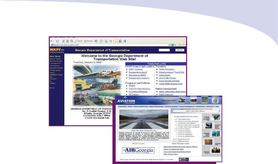
29
z Georgia DOT general information
z Frequently asked questions
z List of primary contacts
z Responsibilities and breakdown of
Georgia DOT divisions and offices
z Traveler information
What the Web site has to offer:
z MY NaviGAtor information
z Up-to-date traffic conditions
z Current construction projects
z Transportation maps
z HOV system and facts
z General permit information
Georgia DOT Web Site
Strategic Development
Creation of the Office of Strategic Development (OSD) was announced by
Commissioner Harold Linnenkohl on May 1, 2004. OSD’s mission is to contribute
to the success of the Department by promoting strategic management,
professional development and organizational effectiveness. OSD supports
the integration of organizational performance through its programs and
processes using performance standards, performance measures and quality
improvements to maintain and improve the organization’s health. One of OSD’s
key principles is to incorporate the concepts of Principle-Centered Leadership
with strategic management. This infuses the values of integrity and service in
the Department’s execution of daily business actions and decision-making
processes.
89

30
0
20,000
40,000
60,000
80,000
100,000
Rural Areas
Mileage
Daily Vehicle
Miles Traveled
Statewide Highway System
*
14,066
73,801,309
Interstates
715
27,577,932
County Roads
62,131
35,435,302
City Streets
3,453
2,050,025
Small Urban Areas
Statewide Highway System
*
1,084
13,150,652
Interstates
69
3,556,086
County Roads
2,695
3,838,745
City Streets
3,360
4,130,360
Urban Areas
Statewide Highway System
*
2,934
103,394,503
Interstates
460
52,255,173
County Roads
18,723
50,169,272
City Streets
7,556
17,328,527
* State Highway System includes Interstates
Total Miles of Public Roads in Georgia:
116,002
The Georgia Department of Transportation provides a safe and efficient
highway system designed to network Georgia’s interstates, county roads, city
streets and state highway system together to provide mobility and efficiently
connect travelers to their destinations.
Miles of Georgia Road 2005
72%
72%
Georgia Highway Systems
Roadway Miles 2005
83,549
16%
12%
18,084
14,369
County Roads
Statewide
Highway System
City Streets
90
31
Georgia’s transportation system consists of the following major
highway programs:
• National Highway System (NHS)
• Fast Forward
• Local Assistance Road Program (LARP)
• Governor’s Road Improvement Program (GRIP)
• Surface Transportation Program (STP)
ationa
ig a
stem
ap
Revised May 2005
Federal Highway Administration
U.S. Department of Transportation
91

32
National Highway System
The Intermodal Surface Transportation
Efficiency Act (ISTEA) of 1991 established
the National Highway System (NHS) to serve
as a network of highways linking together
different modes of transportation such as:
public transportation, airports, intermodal
facilities and major shipping ports. Economic
vitality nationwide is increased by the linking
of these transportation systems.
NHS FACTS
Total GA NHS Mileage
5,385
Total GA Interstate Mileage
1,245
NHS Major Intermodal
Connector Routes
54
Other NHS Routes
4,086
Fast Forward Transportation Program
In Spring 2004, Governor Perdue approved the sale of $4.5 billion worth of
bonds over six years to accelerate much-needed transportation projects. These
projects were in addition to the Georgia DOT’s regular program of projects of
$11 billion.
Fast Forward Program is working to provide:
• Short-Term Congestion Relief: Intelligent Transportation System,
Highway Emergency Response Operators (HERO) Expansion, Ramp
Metering Expansion, Signal Timing and Synchronization Upgrades
• Long-Term Congestion Relief: High Occupancy Vehicle (HOV)
Lane Expansion, Arterial Roadway Improvements and New Transit
Corridors Implementation
The Fast Forward Program has been funded using a blend of Grant
Anticipation Revenue Vehicle (GARVEE) bonds, Guaranteed Revenue Bonds
(GRB) and General Obligation (GO) bonds.
TOTAL PROGRAMMED
PROJECTS FY 05 - FY 06
$1.43 Billion
TOTAL AUTHORIZED
PROJECTS FY 05 - FY 06
$1.77 Billion
Congestion/GARVEE
Program Total
GO
Program Total
GO
Program Total
Fast Forward FY 05 - FY 06
Congestion/GARVEE and GO Program Summary
$625 Million
808 Million
$808 Million
92
33
The Local Assistance Road Program
Initiated in 1978, the Local Assistance Road Program (LARP) is a resurfacing
program designed to help local governments preserve the integrity of their
paved road systems.
How It Works
Each year, during late summer or early fall, every
city and county in the state of Georgia is asked to
submit a LARP priority list to the Georgia DOT.
The LARP priority list identifies roads or streets in
each city or county jurisdiction which need to be
resurfaced. Georgia DOT reviews each road and
street submitted and develops a needs assessment
and cost estimate.
LARP Funding
Funding for LARP projects comes from the Motor
Vehicle Fuel Tax. Each year Georgia DOT reviews
the lists of projects received from each local
government and makes selections based on need
and availability of funds once the level of funding
is established.
LARP Facts
• There are currently 69,088 miles of paved
roads on the county and city systems.
• The Local Governments submitted over $188 million of paving
needs for FY 06.
• The Department resurfaced 1,107 miles of roads under LARP
contracts in 2006.
Before LARP
After LARP
Total Program Highlights since Fast Forward Began:
• Over $2.25 billion in contract awards in FY 06, marking the largest
award amount for one year in Georgia DOT’s history.
• Over $1.27 billion in contractor payments, ‘cash out the door’ between
December 2005 and November 2006, the largest 12- payout in
Georgia DOT history.
• Over $241 million in the month of June 2006 marked the largest monthly
payment in Georgia DOT’s history.
93

34
Governor’s Road Improvement Program
Initiated in 1989 by a resolution of the state legislature and the Governor,
the Governor’s Road Improvement Program (GRIP) will connect 95 percent of
the cities in Georgia with a population of 2,500 or more to the interstate sys-
tem. The GRIP system will also ensure that 98 percent of all areas of
Georgia will be within 20 miles of a four-lane road.
GRIP is currently made up of nineteen corridors (economic development high-
ways), three truck access routes and 3,314 miles of roadway. Project devel-
opment activities are underway for 2,651 miles of GRIP.
For up-to-date GRIP fact sheets, visit: http:
//www.dot.state.ga.us /DOT/plan-
prog/planning/programs/grip/Index.shtml
2006 GRIP FACTS
z 72 percent or 1,914 miles of GRIP Corridors with project
development activities underway are open or under construction.
z 58 percent of the total GRIP system is open or under
construction.
z 8 projects were opened to traffic in calendar year 2005.
z The projects opened to traffic added 40 miles of multi-lane
roadway to the GRIP system.
z The projects opened to traffic were constructed at a cost of
$109.3 million.
z The estimated cost to complete the GRIP Corridors with
project development activities underway is $2.618 billion.
z The estimated cost to complete the total GRIP system is
$3.967 billion.
94
35
Appalachian Developmental Highway
South Georgia Parkway
US 319
Golden Isles Parkway
Fall Line Freeway
SR 72
Savannah River Parkway
US 19
US 1/SR 17
US 27
US 441
US 84
Sunbelt Parkway
Power Alley/US 280
SR 32
SR 40
East-West Highway
SR 15
SR 125
Governor’s
Road Improvement
Program (GRIP)
October 2006 Map
Open
Under Construction
Right of Way
Preliminary Engineering
No Activities
GRIP Corridors
95

36
Surface Transportation Program
The Surface Transportation Program (STP) provides flexible funding that
may be used by the Department for projects on any Federal-aid highway,
including the National Highway System (NHS), Interstate system, bridge proj-
ects on any public road, transit capital projects, and public bus terminals and
facilities. Funds are distributed to states based on lane miles of federal-aid
highways; total vehicle miles traveled on federal-aid highways and estimated
contributions to the Highway Account of
the Highway Trust Fund. Each state must
set aside a portion of their STP funds (10
percent or the amount set aside in 2005,
whichever is greater) for transportation
enhancement activities. 62.5 percent of
the remaining STP funding (after the 10
percent transportation enhancement set-
aside) must be divided among the state's
urbanized areas; the remaining 37.5 per-
cent of the STP funding may be distrib-
uted at the discretion of the State.
To meet its responsibilities in the most-responsive and cost-efficient manner,
the Georgia DOT has participated in the following transportation-related
programs and initiatives:
• State Transportation Improvement Program (STIP)
• Statewide Transportation Plan (SWTP)
• Air Quality Improvement
• Public Private Initiatives (PPI)
State Transportation Improvement Program (STIP)
This is a three-year multimodal program that contains federally-funded proj-
ects identified through the planning process. Every year, proposed projects for
the STIP are presented to local officials in non-metropolitan areas of the state
for their comment and review as per Georgia DOT's "Consultation Process
With Local Officials in Non-Metropolitan Areas of the State" policy. Within
metropolitan areas, public involvement for federally-funded transportation
projects are handled by the Metropolitan Planning Organizations (MPOs).
TRANSPORTATION PROGRAMS
96

37
Roads and Bridges
To operate, maintain and improve
the safety of the existing
state highway system
Intermodal
Programs
To meet transportation needs of
citizens and businesses in Georgia
by providing various modes of
travel, including public
transportation, rail, airports
and deep-water ports
Transportation Enhancements
To enrich the traveling experience
of the highway user through
enhancements to the
transportation system
Metropolitan
Planning
Organization (MPO)
Areas
The STIP is presented for public review and comment at meetings throughout
the state and is available at libraries throughout the state. The STIP is also
available on Georgia DOT’s Web site at: http://www.dot.state.ga.us/DOT/
plan-prog/planning/programs/index.shtml.
Types of projects in the STIP include:
97

38
Statewide Transportation Plan (SWTP)
Federal and state laws require that the state's transportation program align
with a long-range strategy in the Statewide Transportation Plan (SWTP). This
plan is updated every five years and maintains a minimum 20-year horizon.
The current update of the SWTP was initiated in 2005 and it developed a
plan for transportation improvements extending to the 2035 horizon year. The
2005 to 2035 SWTP was completed in the fall of 2005, when the State
Transportation Board adopted the plan in January 2006.
The Department worked with nationally-recognized experts in the develop-
ment of the SWTP. This allowed us to incorporate planning experience, state-
of-the-art information management and analytical tools to develop alternative
program scenarios, investigate future funding levels (revenue and project
costs), evaluate impacts and produce the plan update.
The current 2005 to 2035 Statewide Transportation Plan can be found online
at: http://www.dot.state.ga.us/dot/plan-prog/planning/swtp/index.shtml
Total Available Transportation Revenue by Source
($86.1 Billion) 2006-2035
FHWA
+
/$32.5
38%
Local Transit/$1.2
1%
MARTA Revenue/$3.0
3%
MARTA Sales Tax/$10.2
12%
State/$16.7
19%
Local Highway/$13.0
15%
FTA
+
/$6.2
7%
Passenger Rail Revenue
*
/$3.5
4
%
2005 Dollars (in Billions)
* Assumes complete system is built.
+ Assumes SAFETEA-LU authorization levels.
98
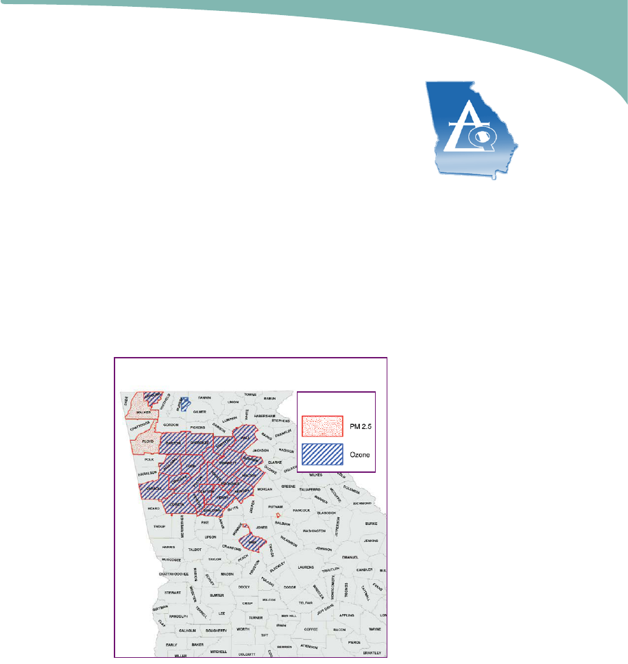
39
Air Quality Improvement
The Department participates in the effort for clean air in
Georgia and maintains a strong commitment to improve air
quality in the state through the Congestion Mitigation and
Air Quality Improvement (CMAQ) Program. Although the
effects of transportation on air pollution are continuing to
diminish, a new standard for air quality has been set by the
Environmental Protection Agency (EPA) in addition to the 8-hour ozone
standard.
EPA recently added a new pollutant to Georgia's nonattainment area classifi-
cations. Particulate Matter (PM) is a complex mixture of extremely small parti-
cles and liquid matter. Increased exposure to PM has been linked to a range
of respiratory and cardiovascular health problems. Two types of PM are cur-
rently regulated by EPA: PM 10 and PM 2.5. Georgia has areas in nonattain-
ment for PM 2.5. Unlike ozone, PM 2.5 is a problem throughout the year.
Georgia's major source of PM 2.5 are coal burning power plants, outdoor
burning and diesel engines.
Counties designated
in nonattainment of
PM 2.5 include the
20-county metro
Atlanta area, as well
as parts of Putnam
and Heard counties.
Counties outside the
metro Atlanta area
include: Floyd,
Walker, Catoosa,
Bibb and a portion of
Monroe.
CMAQ funds are
used to implement a
variety of projects
aimed at reducing
emissions by relieving
traffic congestion.
One effective initia-
tive is a regional
transportation demand management (TDM) program across metro Atlanta.
Since the development of the program in 1999, changes in transportation
behavior have been accomplished in the Atlanta region through programs to
educate, encourage and facilitate the use of alternatives to driving alone.
Georgia’s Nonattainment Areas
Pollutant
99

40
The Department is directing a new broad-based regional program expected
to have a significant effect on congestion and air quality. The program
includes a project of signal synchronization across city limits and county lines
within the metro Atlanta region. The program includes retiming of about 2,500
traffic signals to form interconnected systems. This program involves coordina-
tion among many state and
local agencies, local govern-
ments and others; the improve-
ment will be felt both locally
and regionally.
The Department is assisting
areas across the state that are
now confronting air quality
problems. The Department
facilitates a collaborative
approach at the state level
to address air quality in
partnership with the
Environmental Protection
Division of the Department of
Natural Resources, the
Georgia Regional Transportation Authority and the Georgia Environmental
Facilities Authority. A goal of these state partners is to use available resources
to implement the most effective projects and programs to reduce congestion
and to improve air quality.
For more information, please visit the Air Quality Branch's Web site
http://www.dot.state.ga.us/DOT/plan-prog/planning/aq/.
Public-Private Transportation Initiatives (PPI)
Georgia is challenged by a fast-growing population and expanding
commerce, which impact our transportation infrastructure needs. Traffic
congestion is the number one transportation issue in Georgia's metropolitan
areas, whereas in other parts of the state, improving access to education and
jobs drive transportation priorities. With current funding and delivery methods,
there are not enough resources to meet all of our state's transportation needs
in a timely manner. PPI allows the Department to partner with private/corpo-
rate businesses to help finance, design, construct, operate and/or maintain
transportation projects.
In 2003, the Georgia legislature lawfully created the process that allows the
Georgia DOT to consider unsolicited proposals from private companies to
build transportation improvement projects. In 2005, the Georgia General
100

Assembly amended the PPI law to give Georgia DOT the ability to solicit pro-
posals for much-needed transportation projects, to extend the time for receiv-
ing competing proposals from 90 to 135 days, and most importantly, provide
more opportunities for public review and input.
PPI gives us a faster and more efficient way to solve our transportation
challenges without compromising quality. Private partners bring innovation,
new technology, finance and
private resources to a
project, which frees up state
resources and dollars for
other transportation needs.
Whether or not the PPI
proposal develops into a
final contract for construction,
Georgia DOT may continue
to use the design and engi-
neering documents produced
by the private partner to
continue working on the
project.
What are the
benefits of PPI?
Georgia is one of the
fastest-growing states in the nation; PPI gives us a faster and more efficient
way to solve our transportation problems without compromising quality.
PPI allows the Georgia DOT to accept and evaluate solicited and unsolicited
proposals from private/corporate businesses for transportation projects.
For the latest news and information about PPI and current proposals visit:
www.dot.state.ga.us/ppi
41
.
PPI Proposal Criteria
Proposals are evaluated on:
1. Unique and innovative
methods and technical merits
2. Potential contribution to the
Department's mission
3. The proposing entity's
qualifications and experience
4. Whether proposal is consistent
with Board's Network Vision,
including free existing general
purpose lanes
101
42
Environment and Location
Georgia DOT Receives GPTQ Award for Public Involvement and
Context-Sensitive Design
The Georgia Department of Transportation partnered with the Federal
Highway Administration (FHWA) Georgia Division and Fulton County to
streamline the environmental process of two proposed projects in Fulton
County: the widening of Johnson Ferry and Abernathy roads and the
Abernathy Road Greenspace Project sponsored by Fulton County. The goal
of including both the road-widening project and greenspace project in the
same environmental document was to streamline the environmental process
since both projects would be capturing federal funds for their implementation
and both were located along Abernathy Road. The Johnson Ferry Road
project consisted of widening the road approximately 1.24 miles, including
widening the bridge spanning the Chattahoochee River. The Abernathy Road
project consisted of widening the existing two-lane facility to four-lanes from
Johnson Ferry Road to Roswell Road. This project was also discussed in the
environmental document and proposal to construct a greenspace linear park
utilizing approximately 40 residential properties.
The environmental process began for both projects in September of 2003. The
public involvement process was begun at a very early stage of project plan-
ning in order for interested residents, neighborhood groups, businesses, govern-
ment officials, and the general public to become involved in the environmental
decision-making process. A Citizens Advisory Committee (CAC), consisting of
approximately 25 representatives of local neighborhoods, businesses, civic
associations, and government agencies, has been meeting since the spring of
2002. The CAC acted as a steering committee to give information and opin-
ions to Georgia DOT, FHWA and Fulton County and to evaluate and recom-
mend design features and design alternatives for both the proposed widening
and greenspace projects. Through a series of four meetings and two work-
shops, the CAC provided the project team with a wealth of information about
the public's needs and desires concerning both transportation and greenspace
Neighborhood Park
With Trail Access
Community
Center
Multi-Use
Neighborhood
Playground
Existing
Arts Center
Neighborhood
Playground
8‘ Wide Sidewalk
Creek
Multi-Use Trail
Pond
Overloo
k
Gazebo
Trail
Brandon Mill Road
Johnson Ferry Road
Johnson Ferry Road
Abernathy Parkway
Abernathy Parkway
Shopping
Center
Wright Road
Illustration of Abernathy Parkway in Sandy Springs, Georgia
102

43
projects. The CAC has been very adamant throughout the planning process that
both the road widening project and greenspace project remain and progress
together through the planning and environmental phase. Their support of the
road- widening project was contingent upon the successful design and progress
of the greenspace plan.
Coordination with other federal and state agencies was needed to progress
the projects through the NEPA process. Coordination with the National Park
Service (NPS) was required to coordinate the purchase of land from the
Chattahoochee River National Recreation Area along Johnson Ferry Road,
resulting in a Section 4(f) impact.
Because of the extensive public involvement activities and coordination of both
projects with state and federal agencies at the onset of project planning, the
Draft Environmental Assessment (EA) with Section 4(f) was approved within 18
months from the initiation of the environmental process. An Environmental
Assessment/Finding of No Significant Impact (EA/FONSI) with Section 4(f) was
approved June 13, 2005.
Public Outreach Project
Georgia DOT has proposed a project to construct pedestrian safety improve-
ments along the Buford Highway corridor from the DeKalb/ Fulton County
line to Shallowford Terrace, a distance of approximately 4.8 miles. This would
include the construction of a raised median from the county line north to
Clairmont Road; the construction of
pedestrian refuge islands in nine
locations throughout the project
corridors; the construction of sidewalks;
and the installation of new traffic
signals at five locations. These
improvements were designed as a
result of a 10-month long public
involvement process which engaged
both residents and business owners
located in the corridor.
Public outreach within the community consisted of several events. The first was
a face-to-face survey of five Hispanic-owned businesses. The purpose of the
survey was to conduct a needs assessment based on input from those who lived
and worked in the corridor.
Outreach to the Asian business community was addressed in a different man-
ner. The Center for Pan Asian Community Services was retained to identify
four Vietnamese, four Chinese, and four Korean business owners and to conduct
interviews with these business owners to determine their perceptions of the
impact of a raised median. Before-and-after visualizations were used to show
possible design scenarios for Buford Highway.
103
44
Douglas Streetscape
Brunswick TE Projects: the images above show the Waterfront Farmers Market,
Waterfront longview and Waterfront sidewalk
Transportation Enhancement Program
Georgia DOT is responsible for more than just building roads and highways.
Created by ISTEA legislation in 1991and extended by SAFETEA-LU, the
Transportation Enhancement (TE) program focuses on the cultural, natural and
scenic elements of the statewide transportation network. Through the TE pro-
gram, governmental agencies (state and local), public universities, and authori-
ties created via the General Assembly may apply for federal funds to imple-
ment projects that fall within the eligible criteria.
TE projects may fit into one or more of the following categories:
z multi-use facilities, such as biking/pedestrian trails or paths
z safety and educational activities for pedestrians and cyclists
z historic preservation, such as railroad depots
and abandoned rail corridors
z transportation aesthetics, such as streetscape,
landscaping and scenic beautification projects
z acquiring scenic easements
z control and removal of outdoor advertising
z archaeological planning and research
z environmental mitigation
z transportation museums
The TE program implemented its first ever Web-based application process for
the fiscal year '06 - '07 TE call for projects. Through the innovative partnership
of Georgia DOT's IT Department and the Office of Planning, Georgians in all
13 Congressional districts were able to electronically submit their applications
for consideration of TE funding. The call for TE projects extended from July to
September 23, 2005 and 275 applications were received statewide. Of
these, 152 were selected for funding.
104
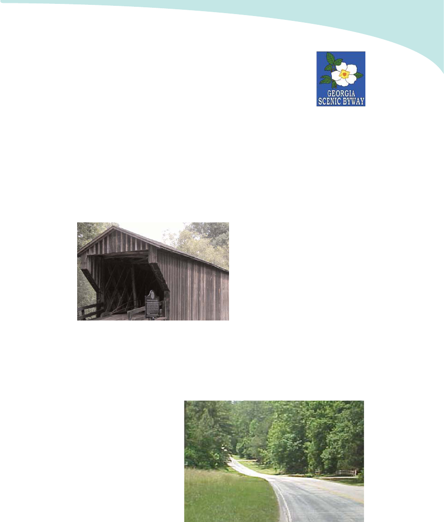
45
Georgia Scenic Byways Program
The Georgia Scenic Byways Program is a grassroots effort to
preserve, promote, protect and interpret treasured corridors
throughout the state. A Georgia Scenic Byway is defined as
any designated highway, street, road or route which features
certain intrinsic qualities that should be protected or enhanced. Scenic, natural,
recreational, historical, cultural, or archeological qualities give each byway its
character and appeal. There are currently nine scenic byways in Georgia that
give travelers extraordinary views of their surroundings.
Designation
To obtain designation, a local sponsor must complete a multi-stage process of
identifying a route, submitting an application, developing a Corridor
Management Plan and receiving approval by the Georgia DOT. The applica-
tion defines the route, acknowl-
edges local support of the byway
and assesses the intrinsic qualities
and potential issues of the route.
The Corridor Management Plan
(CMP), with significant public
involvement, documents the vision
for the byway and future steps to
be taken to achieve the goals of
promotion, preservation and
enhancement.
Ninth Scenic Byway
The State Transportation Board designated the Ocmulgee-Piedmont Scenic
Byway in Jones County as Georgia's ninth Scenic Byway at its December
2006 Board meeting. Visitors to this byway will observe vestiges of 200 years
of Jones County history as
well as pre-historic and
historic sites of the Creek
Indians who lived there in
the 17th and 18th cen-
turies. Civil War battle
sites, the Piedmont National
Wildlife Refuge, and the
setting for the 1991 film
Fried Green Tomatoes are
some of the many attrac-
tions featured on this corri-
dor.
Red Oak Creek Bridge in Meriwether County
105
46
For more information about Scenic Byways, please visit the Web site:
http://www.dot.state.ga.us/DOT/plan-prog/planni
ng/projects/scenic_byways/
index.shtml
Scenic Byways
Altamaha: 17 miles
Cohutta-Chattahoochee: 54 miles
Historic Piedmont: 82 miles
Meriwether-Pike: 55 miles
Monticello Crossroads: 29 miles
Ocmulgee-Piedmont: 21 miles
Ridge and Valley: 51 miles
Russell-Brasstown: 41
South Fulton: 29
The total mileage for the 9 scenic
byways is 379
Wildflower Program
This year, Georgia DOT's Office of Maintenance planted approximately 400
acres of wildflowers. Of total wildflowers planted, 350 acres were planted
using funds from the Wildflower Auto Tag,
which is the only guaranteed source of
revenue for the Wildflower Program.
The Maintenance office performs ongoing
research of Georgia native species and
updates conservation techniques to keep our
wildflowers blooming on the roadsides each
year.
The wildflower mixture includes:
z Indian Blanket (Gaillardia pulchella)
z Lemon Mint (Monarda citriodora)
z Black-eyed Susan (Rudbeckia hirta)
z Clasping Coneflower (Rudbeckia amplexicaulis)
z Purple Coneflower (Echinacea purpurea)
z Golden-Wave (Coreopsis basalis)
Purple Coneflower
Georgia Scenic Byway
National Scenic Byway
106

Program
Maintenance
The Wildflower
Program experienced
phenomenal growth as
public awareness
efforts had a direct
influence on increased
Wildflower tag sales.
Helpful information
about the Wild-flower
Program is included on
the Georgia
Department of
Transportation Website.
The site even provides
growing tips that encourage Georgians to cultivate their own wildflower
gardens!
Program Promotion
Georgia DOT employees also expanded the Program's reach as a proud
participant in the 2005 Southeastern Flower Show. The
Department’s participation in the Flower Show provided
a platform to share information about cultivating wild-
flowers and to further increase the public's education
of the Wildflower Program. The Flower Show also
featured a "roadside garden" developed by
Department employees for patrons to view in the
event's Discovery Zone.
Ongoing Stewardship
For a one-time fee of $25, Georgians may purchase the Wildflower Auto Tag
and provide critical funding to sustain the
Program. The auto tag can be
purchased any time at local county tag
offices. For more information, visit
www.dot.state.ga.us or
http://www.etax.dor.ga.gov
47
Lanceleaf Coreopsis planted along I-285 in District 7
Black-eyed Susan
107

48
NaviGAtor, Georgia's Intelligent Transportation System (ITS), is a joint venture
between the Georgia Department of Transportation, Federal Highway
Administration (FHWA), Metropolitan Atlanta Rapid Transit Authority (MARTA)
and Atlanta Regional Commission.
Launched in 1996 in time for the Summer
Olympic Games, NaviGAtor integrates state-of-
the-art technology, information processing and
communication to make Georgia's roadways
safer and easier to travel. Housed at the
Transportation Management Center (TMC) in
Atlanta, NaviGAtor's operators monitor traffic
cameras, answer calls from 911 Centers for
assistance, and dispatch emergency responders.
Customer Service Representatives respond to
calls from the general public, who report inci-
dents and road hazards. Together, the team works
to confirm incidents, verify construction projects,
and communicate this information to the public in real time.
NaviGAtor Technology
z 367 full-color, pan-tilt-zoom, closed-circuit (CCTV) cameras confirm and
monitor traffic incidents on state routes and interstates. They are spaced
every one mile.
z 207 arterial CCTV cameras are
operated by area Traffic Control
Centers (TCCs).
z 1,361 Video Detection System (VDS),
fixed-position, black and white,
cameras, provide continuous speed an
volume data to the TMC and generate
travel times for Changeable Message
Signs (CMS). They are spaced every
one-third mile.
z 101 Changeable Message Signs (CMS)
display trip times, incident information, air quality, child abduction and
highway safety messages.
Transportation Management
Center
CCTV and VDS Cameras
108
49
z 48 Weather Stations statewide provide current
weather conditions to the TMC and the public.
They are used to aid in dispatch of emergency
crews during severe weather.
z Ramp Meters are placed at key access points
on metro-area interstates. Similar to a traffic
signal, they allow one motorist at a time to
merge onto an interstate. Ramp Meters reduce
interstate congestion by 22 percent.
z Remote Traffic Microwave Sensors (RTMS), also known as Radar
Vehicle Detectors, use real-time video to detect and verify road
congestion and traffic incidents. RTMS are found on SR 141and SR 166.
Web Site
The NaviGAtor Web site,
www.georgia-navigator.com, features
live traffic cameras, trip times,
weather, news and travel alerts, and
color-coded metro, regional, and
statewide maps displaying congestion
levels, traffic incidents, and active
construction. It also features
MyNaviGAtor, a free service that
provides subscribers with customized
traffic information for their own
routes. Users can log onto
www.myganav.com, create personal-
ized travel profiles, and get real-time
information sent directly to their cell
phones, computers, or PDAs.
TICKERAlert: Community Alert Networks
TICKERAlert is a community alert network of LCD billboards that supports the
national emergency response initiatives as an early warning alert network. Its
innovative news and marketing system provides timely, custom broadcasts to the
public. While offering effective news services, TICKERAlert gives immediate
notification in the event of a child abduction, homeland security alert or similar
emergency.
NaviGAtor’s TICKERAlert network is located throughout the state in the rest
areas and welcome centers in Atlanta, Macon, Savannah, Augusta, Columbus,
Valdosta, West Point, Tallapoosa, Ringgold, Lavonia and Kingsland. For more
information, go to www.tickeralert.com.
Weather Monitoring
Station
109

EMnet
EMnet is a secure, satellite-based messaging system designed for the
emergency management community. Messages are transmitted to our
EMnet server via an Internet connection, and then are delivered to the
intended stations by satellite broadcast. User-friendly EMnet provides
a platform for composing, sending, receiving and broadcasting Emergency
Alert System (EAS) messages in order to:
z Issue and monitor Amber Alerts and weather alerts.
z Monitor EAS messages issued by National Weather Service and
others.
z Provide a single, efficient interface for inbound hazard notices and
outbound warning systems.
The TMC currently utilizes EMnet computer software, designed to give
information about major emergency events throughout the state of Georgia.
For more information about EMnet, go to http://www.comlabs.com/products.php
Coastal Evacuation System
This is a traffic management, data collection and traveler information system
installed on evacuation routes along Georgia's Coastal Region for the purpose
of improving traffic flow and providing real-time information during an
evacuation due to such events as a hurricane. The Coastal Evacuation System
consists of data collection devices, changeable message signs and surveillance
cameras.
Accident Investigation Sites (AIS)
Accident Investigation Sites (AIS) are 100-foot long shoulder extensions that
provide a safe area for motorists involved in accidents to exchange informa-
tion away from the danger of on-coming traffic. Approximately 51 AISs have
been constructed along I-20, I-75, I-85 and I-285.
Get real-time traffic information or report a road hazard 24 hours a
day, 7 days a week
• *DOT (368) is available for
Cingular, T-Mobile, Sprint and
Verizon wireless customers who
see or are involved in an accident
or traffic congestion.
• 404-635-6800 - landline and
other wireless carriers
• 1-888-635-8287 - toll-free
50
110

51
Highway Emergency Response Operators (HERO)
z Assist in reducing traffic congestion and delays
z Provide support to law
enforcement, first responders,
and other emergency
management agencies
z Patrol 21 routes on 220
miles of metro Atlanta
interstates 7 days a week
z Operate on three shifts from
5 a.m. Monday until 5:30 a.m.
Saturday
z One shift of HEROs patrol routes Saturday and Sunday from 9:30 a.m. -
9:30 p.m.
z Shift supervisors and managers are on call 24 hours a day, 7 days a
week
z Trained as first responders
- 360 hours in class and 200 hours on the road
When not responding to traffic incidents, HEROs assist stranded motorists by
providing such services as: changing flat tires, jump-starting weak batteries,
providing fuel or coolant, transporting motorists to safe areas away from
traffic, providing road and travel information, offering use of a courtesy
cellular phone, administering first aid, and performing minor mechanical
repairs.
HERO Unit Facts (2005)
Total HERO Unit Personnel: 78
Total Vehicles in Fleet: 62
• 59 Ford F-450 Incident Response vehicles
• 1 supply truck
• 2 Blazers (Management vehicles)
Total Assists/Accidents Worked: 63,457 for 2005
Average Response Time: 8 minutes
111

52
TIME Task Force
The Traffic Incident Management Enhancement (TIME) Task Force was formed in
2002 to address the critical issues related to incident management in the Metro
Atlanta region. Its members represent incident response teams from transportation
agencies, fire and rescue, police, towing and recovery, emergency medical
services and medical examiners/coroners.
Mission: Develop and sustain a region-wide incident management program to
facilitate the safest and fastest roadway clearance, lessening the impact on
emergency responders and the motoring public.
TIME holds general meetings on a quarterly basis to distribute
information on training and workshops, present updates on
incident management initiatives and provide its members
opportunities to network and share resources. Each autumn,
TIME facilitates an annual two-day conference for first responder
organizations to exchange ideas on inci-
dent management and discuss opportuni-
ties for improvement. Nationally-recog-
nized experts share their "best practices"
from jurisdictions all over the country.
The TIME Task Force is led by a Board of
Directors and four committees:
Operations Committee: focus is on how to
address the standardization of response
and clearance as well as the institutional
and jurisdictional barriers that reduce the
efficiency of incident management.
Communications Committee: focus is to coordinate timely and open
comm
unication, internally between transportation and public safety
agencies and externally with the public and media.
Program and Institutional Issues: focus is on issues that can be addressed by
polic
y changes and institutional coordination.
After-Incident-Review (AIR) Subcommittee: AIR is responsible for debriefing
incidents in the Metr
o Atlanta region by meeting with primary responders to
obtain incident overviews, determine expectations, note strengths and
weaknesses, and share information.
Annual Conference Planning: responsible for the planning and oversight of
the annual TIME Conference
.
The TIME Purpose
1. To continue the dialogue on
ways to improve inter-
agency coordination and
cooperation.
2. To create an opportunity
for multi-agency training
which promotes teamwork.
3. To serve as a platform for
participants to develop
common operational strategies.
For more information about the TIME Task Force, see our Web site at
www
.timetaskforce.com or call 404-635-8035.
112

53
Bicycle and Pedestrian Program
The Department of Transportation is
committed to improving bicycle and
pedestrian access and safety. Through
its Bicycle and Pedestrian Program,
Georgia DOT is implementing the
recommendations from the 1997
Georgia Bicycle and Pedestrian Plan,
and will be updating this plan in the
coming year. The Department also
sponsored and facilitated the develop-
ment of 15 regional bicycle and
pedestrian plans in conjunction with the Regional Development Centers. For
more information, visit www.dot.state.ga.us/bikeped/.
Examples of Georgia DOT's bicycle and pedestrian initiatives:
Georgia Guidebook for Pedestrian Planning
Completed in June 2006, the Guide assists local governments, regional
agencies, and other public and private entities in developing and
implementing pedestrian plans. The book details strategies for
evaluating, prioritizing, and funding pedestrian facilities.
Georgia Bike Sense: A Guide for Cyclists and Motorists
Published in March 2005, the Guide teaches cyclists and motorists how to
safely and legally share the road. It provides tips on safety and techniques,
rules of the road and also contains a listing of local, state and national bicycle
resources. So far, 200,000 copies of this popular Guide have been distributed
to schools and colleges, welcome centers, Department of Driver Services
locations and many more sites throughout Georgia.
Pedestrian and Streetscape
Guide
This manual provides direction to
design professionals, planners,
developers, municipalities and
others on the design, construction,
and maintenance of pedestrian
facilities. The Guide is also used by
Georgia DOT's design engineers
when designing pedestrian facilities
on state highways.
113

54
Georgia Bicycle & Pedestrian Conference
Georgia DOT hosted its first statewide bicycle and
pedestrian conference in October 2006 in Decatur,
Georgia. The conference provided a valuable
opportunity to bring together professionals from
diverse disciplines working toward a common goal:
improving bicycle and pedestrian access and safety
throughout the state and making Georgia a
healthier, more sustainable place to live. The conference was attended by
160 planning, engineering and public health professionals, law enforcement
officers, local government officials, students and non-profit organizations from
all over the state, including a few from neighboring states.
Metro Atlanta Safe Routes to School Demonstration Project
The Atlanta Bicycle Campaign, under contract with Georgia DOT, is conducting
a Safe Routes to School (SRTS) program in four metro-Atlanta schools. This
four-year pilot program (currently in its last year) will produce a
final report on the effectiveness of SRTS programs, as well as a
statewide "how to" manual on developing SRTS programs. The
"how to" guide will be instrumental in preparing schools for the
new federally-funded Georgia Safe Routes to School program.
Safe Routes to School Program
Safe Routes to School (SRTS) is a new program created by the federal
transportation bill, SAFETEA-LU. The Program's goal is to increase the number
of children in grades K-8 who bicycle and walk to school. The Program's
enabling legislation guides how this will be implemented: 1) by increasing
awareness; 2) developing
locally-driven and supported
programs; 3) improving
bicycling and walking condi-
tions near the qualifying
schools; and 4) evaluating at
the project and Program
levels. Benefits of the
Program include: reduced
congestion and increased
safety near participating
schools; reduced air pollution
in route to and near partici-
pating schools; and
increased physical activity of
children.
114

55
Safe Routes to School is a
comprehensive program that
includes the 5 E's:
The 5 E's include:
1) Evaluation - Monitoring and
researching outcomes and
trends through the collection
of data, including the collection
of mode share before and after
the program intervention(s).
2) Encouragement - Using events and activities to promote walking and
bicycling.
3) Education - Teaching the school community about the broad range of
transportation choices, instructing them in important life-long safety skills
and offering school-bound and school area driver safety campaigns.
4) Engineering - Creating operational and physical improvements to
the infrastructure surrounding schools that reduce speeds and establishing
safer crosswalks, walkways, trails and bikeways.
5) Enforcement - Partnering with local law enforcement to ensure rivers obey
traffic laws, initiating community enforcement such as crossing guard
programs and ensuring that policies are enforced.
Summary of Georgia SRTS Program:
z Georgia $1.00 Million (FY05), $2.7Million (FY06), $3.0 Million
(FY07), $4.5 Million (FY08), $5.6 Million (FY09)
z SRTS projects will be federally-funded at 100 percent, based
on the approved application
z Eligible applicants: state, local, and regional agencies, including
nonprofits and public schools
z Primary beneficiaries must be K-8 grade students
z Infrastructure projects must be within two miles of a school and
on public property or private land with legal public-access
z Competitive application process administered by Georgia DOT.
z Award recipient must comply with stringent federal and state funding
requirements
115
56
High Occupancy Vehicle (HOV)
HOV lanes decrease driving times, reduce stress and improve
the region's air quality. How? The system is designated for
carpools, vanpools, and transit buses — all ways of travel that
reduce single-occupant vehicles on our busy roads.
HOV Occupancy Requirements
• Two or more occupants per vehicle
• Certified Alternative Fuel Vehicles (AFV), such as electrically-powered cars
and compressed natural gas (CNG) vehicles
• Motorcycles
• Emergency vehicles
• Buses
Hours of Operation
HOV lanes on I-75, I-85 and I-20 are all operated 24 hours a day, seven
days a week.
For more information on HOV lanes, visit the Georgia DOT Web site at:
www.dot.state.ga.us/specialsubjects/hov/index.shtml
Marietta
Smyrna
Mableton
Jonesboro
Union
City
Douglasville
Palmetto
McDonough
Lawrenceville
East Point
Stockbridge
Kennesaw
Sandy
Springs
Alpharetta
Buford
Conyers
Stone
Mountain
Lilburn
Duluth
Woodstock
Austell
Morrow
Chapel Hill
GWINNETT
HENRY
NEWTON
FAYETTE
FULTON
DOUGLAS
PAULDING
CHEROKEE
FULTON
WALTO
ROCKDALE
DEKALB
COBB
FORSYTH
Chamblee
Forest Park
Roswell
Norcross
Lithonia
Tucker
Powder
Springs
Fayetteville
Riverdale
Villa Rica
Lithia Springs
Decatur
285
675
20
20
285
575
985
400
23
29
78
278
78
29
23
41
278
ATLANTA
85
75
BARTOW
Legend:
HOV Lanes
Priority HOV Lanes
HOV Lane Map
116
57
Rideshare Program
The Georgia Rideshare Program offers residents a safe and convenient way to
commute through the operation of carpools, vanpools and Park & Ride lots.
Park & Ride Lots
NEWTON
BUTTS
DADE
WALKER
CATOOSA
CHATTOOGA
FLOYD
GORDON
FANNIN
GILMER
BARROW
CHEROKEE
UNION
LUMPKIN
DAWSON
FORSYTH
HALL
WHITE
TOWNS
RABUN
H
A
B
E
R
S
H
A
M
BANKS
STEPHENS
FRANKLIN
HART
MADISON
CLARKE
OCONEE
OGLETHORPE
WILKES
LINCOLN
COLUMBIA
RICHMOND
WARREN
GREENE
HANCOCK
MORGAN
PUTNAM
JASPER
WALTON
BARTOW
JACKSON
GWINNETT
R
O
C
K
D
A
L
E
HENRY
CLAYTON
FAYETTE
FULTON
COBB
POLK
CARROLL
HEARD
TROUP
HARRIS
MUSCOGEE
MERIWETHER
TALBOT
COWETA
SPALDING
PIKE
LAMAR
UPSON
TAYLOR
CRAWFORD
PEACH
BIBB
MONROE
JONES
TWIGGS
WILKINSON
LAURENS
JOHNSON
WASHINGTON
BALDWIN
JEFFERSON
BURKE
JENKINS
SCREVEN
EMANUEL
EFFINGHAM
BULLOCH
CANDLER
BRYAN
EVANS
LIBERTY
LONG
APPLING
JEFF DAVIS
DODGE
TELFAIR
BLECKLEY
HOUSTON
MACON
SUMTER
MARION
C
H
A
T
T
A
H
O
O
C
H
E
E
STEWART
WEBSTER
DOOLY
PULASKI
WILCOX
WORTH
LEE
TERRELL
RANDOLPH
QUITMAN
CLAY
CHATHAM
McINTOSH
WAYNE
GLYNN
CAMDEN
BRANTLEY
CHARLTON
WARE
PIERCE
BACON
COFFEE
ATKINSON
CLINCH
LANIER
IRWIN
BEN HILL
BERRIEN
LOWNDES
ECHOLS
TURNER
TIFT
COOK
COLQUITT
BROOKS
THOMAS
GRADY
DECATUR
SEMINOLE
MITCHELL
DOUGHERTY
BAKER
MILLER
EARLY
MURRAY
PAULDING
HARALSON
ELBERT
TALIAFERRO
McDUFFIE
GLASCO
CK
TREUTLEN
WHEELER
M
O
N
T
G
O
M
E
R
Y
TOOMBS
TATTNALL
CRISP
SCHLEY
WHITFIELD
CALHOUN
DEKALB
DOUGLAS
PICKENS
1-87-RIDEFIND is a confidential
regional rideshare database
that matches commuters in the
Atlanta region with potential
carpool partners.
Active Park & Ride Lots 96
A
vailable Spaces 8,454
Percent Statewide Usage 28 percent
Avg. Daily Number of Spaces Used 2,326
2005 Park & Ride Facts
117
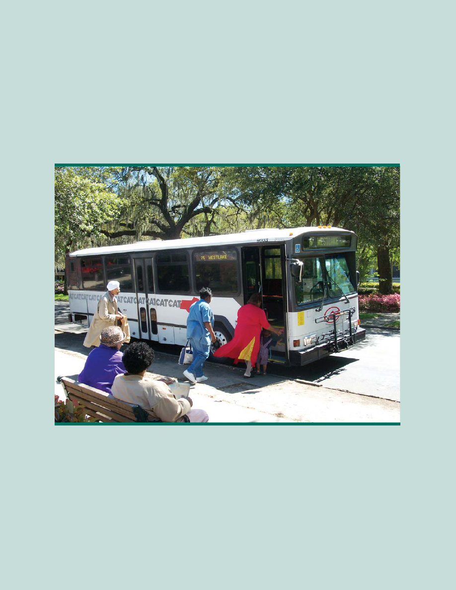
58
2005 Urban Transit Facts
Urban Transit Systems (statewide): 14
Total Revenue Vehicles: 1037 buses & 338 rail cars
Revenue Vehicle Miles: 62,354,992
Number of Passenger Trips: 158,638,939
Public Transit
2005 Rural Transit Facts
Number of Rural Transit Programs: 99
Total Revenue Vehicles: 355
ADA Compliant 181
Revenue Vehicle Miles: 9,526,913
Number of Passenger Trips: 1,612,520
118
59
1. Albany Transit System (ATS)
2. Athens Transit System (ATS)
3. Augusta Public Transit (APT)
4. Chatham Area Transit Authority (CAT)
5. Clayton County Transit (C-TRAN)
6. Cobb Community Transit (CCT)
7. Columbus Transit System (METRA)
8. County Rideshare*
9. Gwinnett County Transit (GCT)
1. Cedartown
2. Social Circle
3. Unadilla
Rural City Transit Systems
Urban Transit Systems
* Vanpool services provided
** Express Bus Service Only
Urban Transit System
Rural County Transit System
Rural City Transit System
Regional Urban Transit System
Urban and Rural Transit Map
4. Vienna
5. Americus
6. Canton
NEWTON
BUTTS
DADE
WALKER
CATOOSA
CHATTOOGA
GORDON
FANNIN
GILMER
PICKENS
BARROW
CHEROKEE
UNION
LUMPKIN
DAWSON
FORSYTH
WHITE
TOWNS
RABUN
H
A
B
E
R
S
H
A
M
BANKS
STEPHENS
FRANKLIN
HART
MADISON
OCONEE
OGLETHORPE
WILKES
LINCOLN
COLUMBIA
RICHMOND
WARREN
GREENE
HANCOCK
MORGAN
PUTNAM
JASPER
WALTON
BARTOW
JACKSON
R
O
C
K
D
A
L
E
HENRY
FAYETTE
FULTON
COBB
POLK
CARROLL
DOUGLAS
HEARD
TROUP
HARRIS
MERIWETHER
TALBOT
COWETA
SPALDING
PIKE
LAMAR
UPSON
TAYLOR
CRAWFORD
PEACH
MONROE
JONES
TWIGGS
WILKINSON
LAURENS
JOHNSON
WASHINGTON
BALDWIN
JEFFERSON
BURKE
JENKINS
SCREVEN
EMANUEL
EFFINGHAM
BULLOCH
CANDLER
BRYAN
EVANS
LIBERTY
LONG
APPLING
JEFF DAVIS
DODGE
TELFAIR
BLECKLEY
HOUSTON
MACON
SUMTER
MARION
C
H
A
T
T
A
H
O
O
C
H
E
E
STEWART
WEBSTER
DOOLY
PULASKI
WILCOX
WORTH
LEE
TERRELL
RANDOLPH
QUITMAN
CLAY
McINTOSH
WAYNE
GLYNN
CAMDEN
BRANTLEY
CHARLTON
WARE
PIERCE
BACON
COFFEE
ATKINSON
CLINCH
LANIER
IRWIN
BEN HILL
BERRIEN
LOWNDES
ECHOLS
TURNER
TIFT
COOK
COLQUITT
BROOKS
THOMAS
GRADY
DECATUR
SEMINOLE
MITCHELL
BAKER
MILLER
EARLY
MURRAY
PAULDING
HARALSON
ELBERT
TALIAFERRO
McDUFFIE
GLASCOCK
TREUTLEN
WHEELER
M
O
N
T
G
O
M
E
R
Y
TOOMBS
TATTNALL
CRISP
SCHLEY
WHITFIELD
CALHOUN
City of Arlington
City of Americus
City of Unidilla
City of Vienna
City of Canton
City of
Dawson
City of Sylvester
City of
Social Circle
City of Cedartown
CLARKE
GWINNETT
DEKALB
CLAYTON
FLOYD
CHATHAM
DOUGHERTY
MUSCOGEE
BIBB
HALL
10. Georgia Regional
11. Transportation Authority (GRTA)**
12. Hall Area Transit
13. Macon-Bibb County Transit Authority (MBTA)
14. Metropolitan Atlanta Rapid Transit Authority
(MARTA)
15. Rome Transit Department (RTD)
119
Georgia Rail System
The Georgia Railroad System consists of over 5,000 route miles.
Freight Rail
The leading rail freight commodities originating and terminating in Georgia
are: coal, wood products, and non-metallic minerals.
Two major freight railroad companies, CSX Transportation and the Norfolk
Southern Corp., own and operate 71 percent of the total state system.
• CSX operates 1,626 miles of railroad
in Georgia.
• Norfolk Southern operates 1,930 miles
of railroad in Georgia.
Railroad Facts
Light Density lines
z 29 percent (1,455 miles) of the state’s railroad system is operated by
23 independent or short line operators.
z Norfolk Southern has approximately 851 miles of light density lines
and CSX has another 242 miles.
z Georgia’s light density lines carry less than five million gross tons of
freight per year and function as local-service operators, primarily in
rural agricultural areas.
Corridor Preservation
z Georgia DOT seeks to preserve and enhance rail freight access for
the state’s shippers through the strategic acquisition and rehabilitation
of shortline trackage in danger of abandonment.
z Georgia DOT owns nearly 540
miles of light density line.
Approximately 90 percent of this
mileage is leased to a short-line
operator. The remaining 10 percent
is either leased to the Department
of Natural Resources and used as a
bicycle and pedestrian trail or is not
leased and the rail line is inactive.
Mainlines
z 2,436 miles of the rail system are classified as “mainline track.”
z Some Georgia main-lines transport more than 80 million gross tons per
year, ranking them among the most heavily used in the country.
60
120
61
LEGEND
Georgia Rail Map
Shortline Railroad Name
ABR The Athens Branch
CBR Chattahoochee Bay
CIRR Chattahoochee Industrial
CCKY Chattooga & Chickamauga
FCRD First Coast Railroad
FCR Fulton County Railway
GCR Georgia Central
GDOT Georgia Dept. of Transportation
GFRR Georgia & Florida Railway
GMR Georgia Midlands
GNRR Georgia Northeastern
GSWR Georgia Southwestern
GWRC Georgia Woodlands
GRWR Great Walton Railroad
GITM Golden Isles Terminal
HOG Heart of Georgia
HRT Hartwell
LW Louisville & Wadley
RSOR Riceboro Southern
SAN Sandersville
SAPT Savannah Port Terminal
SMWR Saint Mary’s West Railroad
VR Valdosta Railway
121
62
Commuter Rail
The Georgia Rail Passenger Program (GRPP) contains seven commuter rail
lines, seven lines of intercity rail service as well as the Multi-Modal
Passenger Terminal (MMPT). The state’s seven commuter lines serve 55 com-
munities. The intercity lines link nine of Georgia’s largest cities and towns
with the metro Atlanta/Macon area, as well as link two of the largest travel
markets in adjoining states. Once the 425-mile system is complete, commuter
trains will transport over 40,000 people to and from work every day.
Intercity trains will run on on over a thousand miles of Georgia’s railroads,
connecting communities all over the state.
Commuter Rail Service Map
122

Rail Passenger Program
This program involves two distinct kinds of
rail transportation: Commuter trains, which
will serve inbound commuters to work in the
Atlanta area in the mornings and then
home in the evenings, and Intercity trains,
which will connect communities throughout
Georgia and the Southeast.
Intercity Rail Passenger Service in Georgia is provided by the National
Railroad Passenger Corporation, known commonly as “AMTRAK.”
AMTRAK operates the following routes in Georgia:
z The Crescent operates daily between New York and New Orleans with
stops in Atlanta, Gainesville, and Toccoa. This train offers coach and
sleeping car accommodations, as well as full dining car and lounge car
service.
z The Silver Meteor and the Silver Star
operate daily between New York
and points in Florida with stops in
Savannah and Jesup. These trains
offer coach and sleeping car
accommodations, as well as
full dining car and lounge car
service.
z The Palmetto operates daily between New York and Savannah via
Charleston, S.C. The train offers coach and business class
accommodations along with lounge car service.
Proposed High-Speed
Passenger Rail Service
Studies are continuing on
developing High-Speed Passenger
Rail Service on two corridors:
• Macon to Atlanta to
Greenville, SC to
Charlotte, NC
• Atlanta to Chattanooga
63
AMTRAK at Buford, Georgia
2005 Georgia Rail Passenger Ridership
Station Passengers
Atlanta 87,811
Gainesville 4,721
Toccoa 3,994
Savannah 39,332
Jesup 6,190
Totals 142,048
Silver Star in Folkston, Georgia
123
64
Proposed Intercity Passenger Rail Service
A two-tiered intercity passenger rail network has been proposed for the state
of Georgia. Recommendations for implementation are
as follow:
• Atlanta to Macon via Griffin
• Savannah to Jacksonville via
Jesup
• Macon or Savannah via either
Vidalia or Eastman and Jesup
• Macon to Albany via Americus
• Atlanta to Augusta via Madison
• Atlanta to Columbus via Griffin
• Atlanta to Greenville via
Gainesville and Toccoa
Georgia Rail Lines Map
First Priority Corridors
Second Priority Corridors
Silver Meteor departs in Savannah
124

65
Railroad Company Miles
Class 1 Railroads
Norfolk Southern 1,930
CSX Transportation 1,626
Shortline Railroads
The Athens Branch (ABR) 19
Chattahoochee Bay (CBR) 2
Chattahoochee Industrial (CIRR) 16
Chattooga & Chickamauga (CCKY) 70
First Coast Railroad (FCRD) 8
Fulton County Railway (FCR) 25
Georgia Central (GCR) 173
Georgia & Florida Railway (GFRR) 232
Georgia Midlands (GMR) 78
Georgia Northeastern (GNRR) 100
Georgia Southwestern (GSWR) 270
Georgia Woodlands (GWRC) 17
Golden Isles Terminal (GITM) 16
Great Walton (GRWR) 36
Hartwell (HRT) 58
Heart of Georgia (HOG) 232
Louisville & Wadley (LW) 10
Riceboro Southern (RSOR) 19
Saint Mary’s (SM) 18
Saint Mary’s West Railroad (SMWR) 23
Sandersville (SAN) 13
Savannah Port Terminal (SAPT) 10
Valdosta Railway (VR) 10
TOTAL Railroad Mileage 5,011
Estimated Track Route Mileage
For more information about Georgia’s Rail Programs, visit
www.dot.state.ga.us/dot/plan-prog/intermodal/rail/
125

66
Georgia Airport System
Aviation Programs guides and directs the development of the state’s system of
airports in support of economic development and Georgia’s participation in
the global marketplace.
GEORGIA AIRPORTS
Total number of Landing Areas (Public and Private) 468
General Aviation and Air Carrier Airports 105
Publicly Owned and Open to the Public 103
Privately Owned and Open to the Public 2
General Aviation Airports 243
Heliports 116
PUBLIC USE AIRPORTS
PRIVATE USE AIRPORTS/HELIPORTS
RUNWAY LENGTH NUMBER
5500´ and Longer 39
5000´ to 5499´ 22
4000´ to 4999´ 20
Less than 4000´ 24
Air Carrier Airports 9
INSTRUMENT LANDING CAPABILITY
Precision Approach-ILS 27
Non-Precision Approach 58
LEGEND
126
67
Airports Providing Scheduled
Air Carrier Service
Number of Passengers 88.7 Million
International Airports (Atlanta and Savannah) 2
Number of Airport Employees 63,000+
AIR CARRIER FACTS 2005
Air Carrier Airports 9
5500' and Longer Runway
Precision Approach-ILS
LEGEND
127

68
Georgia Ports Authority (GPA)
The Port of Savannah and Port of Brunswick reported record gains in FY 06.
For the first time in history, the Port of Savannah surpassed two million TEUs
(Twenty-foot Equivalent Units) in FY06, an increase of 15.9 percent from the
previous year. Total GPA intermodal rail lifts also rose 23.1 percent for the
year, further increasing Georgia's reach into expanding markets.
Georgia’s deepwater ports and inland barge terminals support more than
275,968 jobs throughout the state annually and contribute $10.8 billion in
income, $35.4 billion in revenue and $1.4 billion in state and local taxes to
Georgia’s bustling economy.
In FY06, business grew at a rate above 11 percent in Brunswick, to almost 2.6
million tons. More
than 368,000 auto
and machinery units
were handled at
Colonel's Island
Terminal, a 13
percent increase
over FY05. In a
year when new car
sales in this country
grew at only .5
percent, Brunswick
recorded its best
year ever, expand-
ing market share
and improving
service to valued
customers.
Other GPA Highlights include:
• For the first time in history, GPA surpassed 20 million tons of cargo.
Savannah alone handled 17.6 million tons of cargo, a 10.1 percent
increase over the previous year.
• GPA experienced a 23.1percent growth in intermodal traffic.
• Savannah currently has more direct services to and from Asia than any
other port on the East Coast. Today, 36 shipping services call on the Port
of Savannah.
• The completion of phase one of Container Berth 8 (CB-8), part of the
largest single container facility in the USA.
• The Port of Brunswick rose in its status as a major auto port from
the position of 8th largest to 6th largest in the nation.
Savannah shipping photo credit courtesy of the Georgia
Department of Economic Development
128
69
• An ambitious rail expansion program was approved that will increase rail
capacity at the Port of Brunswick by 100%.
• Both Target and IKEA announced a total of four million additional square
feet of distribution space at the Savannah International Trade Park, four
miles from the Garden City Terminal at the Port of Savannah.
The number one priority for the Georgia Ports Authority, and one that is
critical to the economic growth of Savannah, the State of Georgia and the
entire nation, is the Savannah Harbor Expansion Project, or the SHEP. This
harbor deepening project from 42 to 48 feet is not only critical to every
industry along the
river, but to the
future vitality and
staying power of
our economy. After
more than $32
million and ten
years of study,
GPA is nearing
completion of the
study phase of this
project.
Future Plans
In the coming
fiscal year, the
GPA will invest
more than $70
million in four new
Super Post
Panamax cranes, 15 new Rubber-Tired Gantry Cranes (RTGs), and other
infrastructure upgrades on-terminal, such as the completion of an additional
30 acres of container storage behind Container Berth 8, terminal paving and
overlay.
Examples of major capital projects for the Port of Brunswick in 2007 include a
Grain Storage Tank, Southside Colonel’s Island Development and Completion
of North/South Colonel’s Island Connector Road.
For updated information about Georgia’s ports, visit www.gaports.com.
The Authority’s Board of Directors has approved
partial funding of $2.5 million for a major expansion of
Anguilla Junction that, when complete, will increase rail
capacity at the Port of Brunswick by up to 100 percent.
129

70
SAFETEA-LU
Federal funding is a key component in financing state and local transportation
improvement programs. The Safe, Accountable, Flexible, Efficient Equity Act: A
Legacy for Users, referred to as SAFETEA-LU, was enacted by Congress in
2005 and provides guaranteed funding of $286.5 billion for highways, high-
way safety and transit programs for FYs 2005-2009. Average annual federal
highway funding to Georgia is projected to be 29 percent higher, or about
$285 million per year, compared to the previous reauthorization bill.
However, Georgia highway users contribute a larger share of federal fuel tax
revenue to finance the federal highway program than the share of funding the
state receives from the federal highway programs. Thus, it is referred to as a
"donor" state. Georgia highway users "donated" about $1 billion to fund high-
way projects in other states during FYs 1998-2003. Georgia worked with
other donor states to increase the minimum rate of return for formula highway
funds relative to a state's share of contributions. As a result, the state's overall
rate of return for highway funds is projected to increase from 85 percent
under the previous bill to 88 percent under SAFETEA-LU. This contributed to
the increased federal highway funding to the state under SAFETEA-LU.
Average annual transit formula funding to Georgia for FYs 2006-2009 is pro-
jected to be 40 percent higher, or about $42 million per year, compared to
the last four years. Funding for highway safety programs such as encouraging
the use of safety belts and child car seats, inspecting heavy trucks for safety
and combating drunk and drugged driving will increase as well.
Major Programs FY 2003 FY 2004 FY 2005 FY 2006
Interstate Maintenance
$281
Million
$260
Million
$252
Million
$240
Million
National Highway
System
$185
Million
$253
Million
$235
Million
$217
Million
Surface Transportation
$253
Million
$347
Million
$336
Million
$281
Million
Bridges
$68
Million
$92
Million
$74
Million
$70
Million
Congestion Mitigation
and Air Quality
$36
Million
$49
Million
$51
Million
$48
Million
Summary
$733
Million
$1,001
Million
$948
Million
$900
Million
Funding from Selected Federal Highway Categories
130

71
Georgia has several major sources for funding public-sector
transportation programs.
1. Motor Fuel Tax Funds
Georgia collects a motor fuel tax of 7.5 cents per gallon on gasoline,
diesel fuel, gasohol, liquid propane and any other substance sold as
motor fuel. It also levies a retail motor fuel sales tax for transportation at
a rate of 3 percent.
2. Federal Funds
The Transportation Equity Act for the 21st Century (TEA-21)
authorizes funding for highway, highway safety, transit and other
surface transportation programs for the next three years.
The Federal Transit
Authority provides
mass-transit grants
that are used for
actions such as buying
buses and covering
operating expenses for
urban and rural public
transportation.
FY 2006 Actual Expenditures
$2,979,715,856.98
$923,250,662.28
Motor Fuel
Funds
Federal
Funds
State General
Funds
Other
Funds
$1,820,009,335.56
$14,293,095.70
$222,162,763.44
Annual Operating Budget for FY2007
Motor Fuel Tax $696,759,400
Federal Funds $1,176,511,379
State General Funds $17,272,062
Other Funds $9,457,265
Totals $1,850,000,106
131

72
STIP* Funds by Category for
2005-2007
New
Construction
$520,959
Bridges
$1,412,651
Reconstruction/Rehab
$2,590,212
Other
$854,522
Maintenance
$614,824
Enhancement
$400,721
Safety
$755,482
Transit
$819,138
* Statewide Transportation Improvement Program
* Costs are in the thousands
Total STIP Program Estimate
$7.9 Billion
3. Georgia General Assembly
The Georgia General Assembly funds transportation programs from
motor fuel tax and general funds or through the issuance of general
obligation bonds. Projects funded by the Georgia General Assembly can
include local roads, the Governor’s Road Improvement Program (GRIP)
and intermodal projects such as public transportation, rail, ports and
aviation.
4. State Road and Tollway Authority
The State Road & Tollway Authority provides guaranteed revenue bond
funding. These funds will be used to accelerate transportation needs in
Georgia.
132

73
GLOSSARY
Accident Investigation Sites (AIS)
Interstate shoulder extensions that provide safe areas for motorists involved in
accidents to exchange information.
Alternative Mode
Transportation modes other than one person in a motorized private
vehicle, such as transit, walking, bicycling or carpooling.
American Association of State Highway and Transportation
Officials (AASHTO)
AASHTO serves member state departments of transportation, the U.S. DOT,
and Congress by providing leadership, technical services, information and
advice as well as by contributing to national policy on transportation issues.
Arterial
A major highway that is primarily for through traffic and usually on a continu-
ous route; it serves major traffic movements while providing access to abutting
land.
Bicycle Lane or Bike Lane
A portion of a roadway that has been designated by striping, signing and
pavement markings for preferential or exclusive use of bicycles.
Categorical Exclusion
Examples of categorical exclusions are actions which, based on past experi-
ence with similar actions, do not do any of the following: induce significant
impacts to planned growth or land use for the area; require the relocation of
significant numbers of people; have a significant impact on any natural, cultur-
al, recreational, historic or other resource; involve significant air, noise or
water quality impacts; have significant impacts on travel patterns; or other-
wise—either individually or cumulatively—have any significant environmental
impacts.
Changeable Message Sign (CMS)
Used to advise drivers of traffic or roadway
conditions ahead on I-20, I-75, I-85 and
Georgia 400 and, in some cases, recommend
alternate routes; the CMS also reduces driver
frustration by providing advanced warning.
A CMS is also referred to as a Variable
Message Sign (VMS); also utilized for Amber
Alerts and Levi Calls which aide in locating lost,
missing or kidnapped individuals.
133

The Clean Air Campaign
The Clean Air Campaign is a non-profit organization that
works to reduce traffic congestion and improve air quality
through a variety of voluntary programs and services. It
serves as a clearinghouse for a multitude of organizations
that have programs in place to address traffic congestion
and air pollution.
Commuter Rail
Conventional rail passenger service within a metropolitan area, usually
operating over existing, inter-city railroad tracks; a diesel locomotive pulling
three (or more) passenger coaches normally provides service primarily in the
morning and afternoon home-to-work travel periods.
Conformity
The requirement that state or metropolitan transportation plans, programs
and projects be consistent with the State Implementation Plan and attaining
federal and state air quality standards. A conformity finding by the U.S. EPA
is required as part of the federal review of Transportation Plans and
Transportation Improvement Programs.
Congestion Management System (CMS)
A systematic process which provides information on transportation system
performance and alternative strategies to alleviate congestion and enhance
the mobility of persons and goods. A CMS includes methods and evaluates
performance, identifies alternative actions, accesses and implements cost-
effective actions.
Congestion Mitigation and Air Quality
Improvement Program (CMAQ)
A special provision of the ISTEA that directs funds toward projects in Clean Air
Act Non-Attainment areas for ozone and carbon monoxide.
Construction Work Program
A listing of all projects to be funded by/through the Department in a six-year
time frame. The project may include Preliminary Engineering (PE), Right of
Way (R/W), and/or Construction (CST) phases; most projects are roadway
and bridge construction projects. However, the CWP includes other non-road-
way projects as well (e.g., transit, bike and pedestrian, railroad crossings, etc.).
*DOT (*368)
Free cellular phone service for motorists who see or are involved in an acci-
dent or traffic congestion. This phone number connects to the Traffic
Management Center’s operators, who can provide information on roadway
incidents.
74
134

75
Daily Vehicle Miles Traveled (DVMT)
A daily average of the amount of miles a vehicle travels on Georgia’s public
roads.
Development of Regional Impact
Any development that, because of its character, magnitude or location, would
have substantial effect on the health, safety or welfare of more than one
county, city, town or other political subdivision.
District
A management region defined by the Georgia DOT; the
Department’s seven district offices throughout the state
provide localized services.
Environmental Assessment (EA)
A document that assesses an action that is not a categorical exclusion and does
not clearly require the preparation of an environmental impact statement (EIS);
or where the Federal Highway Administration believes an environmental
assessment would assist in determining the needs for an EIS.
Environmental Documents
Environmental impact reports and statements, negative declarations, initial
studies and environmental assessments under CEQA and NEPA.
Environmental Impact Statement (EIS)
A detailed statement prepared under NEPA presenting studies and information
needed to identify and assess the significant effects a project may have on the
quality of the human environment.
Environmental Justice (EJ)
According to the EPA, it is the fair treatment of people of all races, income
and culture with respect to the development, implementation and enforcement
of environmental laws, regulations and policies. Fair treatment implies that no
person or group of people should shoulder a disproportionate share of
negative environmental impacts resulting from the execution of this country’s
domestic and foreign policy programs.
Environmental Protection Agency (EPA)
A federal agency charged with protecting the natural resources of
the nation.
Environmental Protection Division (EPD)
A federal agency charged with protecting the natural environment.
135

Feasibility Study
A study about a project’s feasibility that is summarized in a document; the
study addresses issues including the project’s cost, effectiveness, alternatives
considered, analysis of alternative selection, environmental effects, public
options and other factors. The Major Investment Study replaced the Feasibility
Study for major projects involving federal funds under the ISTEA.
Final Environmental Impact Statement (FEIS)
An environmental document is prepared following the Draft Environmental
Impact Statement (DEIS), which includes the results of the public involvement
process and agency input of the DEIS; this document summarizes the
substantive comments on social, economic, environmental and engineering
issues made as a result of the public involvement process, and documents
compliance with requirements of all applicable environmental laws, executive
orders and other related requirements.
Flexible Funding
Authority given to the recipients of federal funds to carry out transportation
projects and provide transportation services with minimal governmental restric-
tions; this can be applied to state and local funds.
Geographic Information System (GIS)
An organized collection of data that utilizes computer software and a hard-
ware system to assemble, store, analyze and display geographically refer-
enced information.
Georgia Rideshare Program
Transportation program that provides a safe and convenient way to commute
to and from destinations through the operation of carpools, vanpools and Park
& Ride lots.
Governor’s Road Improvement Program (GRIP)
A system of four-lane highways that enhance economic development through-
out the state. It was initiated in 1989 by a resolution of the state legislature
and the Governor to connect 95 percent of our state's cities (with a population
of 2,500 or more) to the Interstate System.
High-Occupancy Vehicle (HOV) Lane
Travel lanes designated only for vehicles
carrying two or more occupants, motorcycles,
alternative fuel vehicles and emergency
vehicles travelling on I-20, I-75 and I-85
within the metro Atlanta area.
76
136

77
Highway Emergency Response Operators (HEROs)
Georgia DOT employees who are skilled at offering
assistance to motorists with vehicle problems or individuals
involved in accidents on Atlanta interstates.
Infrastructure
In transportation planning, all the relevant elements of the environment in which
a transportation system operates; in transit systems, all the fixed components of
the system such as rights-of-way, tracts, signal equipment, stations, park-and-
ride lots, bus stops and maintenance facilities.
Intelligent Transportation Systems (ITS)
Initiatives by government and industry to improve safety, mobility, efficiency,
productivity and environmental quality of transportation systems through the
use of modern electronics and communications technologies.
Intermodal Management Systems (IMS)
A systematic process of identifying key linkages between one or more modes
of transportation, where the performance or use of one mode will affect
another, defining strategies for improving the effectiveness of these modal
interactions, and evaluation and implementation of these strategies to enhance
the overall performance of the transportation system.
Intermodal Surface Transportation Efficiency Act (ISTEA)
Surface transportation legislation created by Congress in 1991 to guide and
fund the nation’s transportation system. The law expired in 1997, but much of
the program was carried forward by TEA-21.
Interstate
A freeway that is part of the Dwight D. Eisenhower National System of
Interstate and Defense Highways (the Interstate System); a divided highway
which can be accessed only by on and off ramps.
Local Assistance Road Program (LARP)
The Georgia resurfacing program designed to assist local governments in pre-
serving their paved road systems.
Major Investment Study (MIS)
A study and resulting document that replaces Feasibility Studies under ISTEA
for major improvement projects involving significant Federal funds. A MIS
includes the study of factors that may justify a proposed project such as its cost
effectiveness and overall effectiveness and incorporation or intermodal trans-
portation. The MIS also requires consideration of other transportation modes
as well as broader public and agency input.
137

78
National Environmental Policy Act (NEPA)
The national environmental law that establishes procedures for conducting an
environmental analysis for a project involving federal action.
National Highway System (NHS)
A network consisting of the Interstates and other specifically designated routes
which provide access to major intermodal facilities and to key military bases.
NaviGAtor
Georgia’s integrated Intelligent Transportation System designated to minimize
congestion of highways and improve traveler safety within the metro Atlanta
area.
Non-attainment Areas
These are geographical areas, defined by the Environmental Protection
Agency, whose air quality does not meet Federal air quality standards
designed to protect public health.
Park & Ride
Transit access mode in which passengers drive or bicycle to a transit station,
park in a specified area and ride the transit system from there to their desti-
nation.
Right-of-Way (ROW)
The land acquired for or devoted to transportation purposes; for example,
highway ROW and railroad ROW.
SAFETEA-LU
The Safe, Accountable, Efficient, Transportation Equity Act- A Legacy for Users
or SAFETEA-LU, is a bill that authorizes spending for a six-year reauthorization
of the nation’s surface transportation program.
Scenic Byway
Any designated highway, street, road or route which features certain intrinsic
qualities that should be protected or enhanced.
Statewide Transportation Improvement Plan (STIP)
A list of federally funded, priority transportation projects
proposed to be carried out in the first three years of
adoption. The Office of Planning oversees the STIP public
involvement process for the six rural Georgia DOT Districts.
138

79
Statewide Transportation Plan (SWTP)
An outline for meeting Transportation 2000 objectives over a 20-year period.
Surface Transportation Assistance Act of 1982 (STAA)
A highway program that designates national routes for oversized trucks to
move freight throughout the state.
Surface Transportation Program (STP)
A block grant program that can be used for any roads that are not
functionally classified as local or rural minor collector roads.
Transportation Control Centers (TCC)
Satellite transportation management facilities that are linked directly to the
TMC, establishing a regional transportation management system.
Transportation Enhancements (TE)
A transportation enhancement project that uses
funding from TEA-21 to enhance the public’s
transportation experience by concentrating on
cultural, natural and scenic areas.
Transportation Equity Act for the 21st Century (TEA-21)
Legislation that provided $198 billion in federal funding for highways,
highway safety, transit and other transportation programs (1998-2003).
Transportation Control Centers (TCC)
Satellite transportation management facilities that are linked directly to the
TMC, establishing a regional transportation management system.
Transportation Management Center (TMC)
The state-of-the-art facility — located in the Wayne Shackelford Building —
that houses Georgia’s NAVIGATOR system.
Unified Planning Work Program (UPWP)
Document required by the ISTEA that contains a description of all proposed
transportation-related planning activities and air quality planning activities
undertaken in a metropolitan region in a given year.
Urban Transit Service
Public transportation service located within an urban area that operates on a
fixed schedule along designated routes.
Vehicle Miles Traveled (VMT)
The total number of miles traveled on all roadways by all vehicles; reducing
VMT can help ease traffic congestion and improve air quality.
139

80
z The Department currently owns nearly 15,000 acres of wetland
mitigation stream banks.
z Georgia consists of more than 18,000 state highway system miles,
1,245 interstate miles, 83,000 county road miles and 14,000 city street
miles.
z There are 15,000 bridges in the state highway system.
z Georgia has 382 miles of Scenic Byways.
z
Georgia boasts 3,000 miles of bicycle and pedestrian routes.
z 101 Changeable Message Signs on interstates 20, 75, 85,
285 and GA 400 aler
t motorists of traffic incidents and Levi’s Calls.
z HERO Units assisted in more than 63,400 roadway incidents in 2005.
z 90 miles of HOV lanes on interstates 20, 75 and 85 operate
24 hours a da
y, 7 days a week
z 14 urban transit systems statewide made over 158.6 million passenger
trips in 2005.
z 99 rural transit systems statewide made over 1.6 million passenger
trips in 2005.
z 96 Park & Ride Lots statewide provide about 8,454 available spaces
to comm
uters.
z 3,100 mainline rail track miles transport more than 80 million gross
tons of
freight per year.
z 4 ports – Savannah, Brunswick, Bainbridge and Columbus – generate
$35.4 billion in rev
enue.
z 20,800 acres of dredged material containment areas provided
b
y Georgia DOT for harbor/waterway maintenance.
z 1.4 million square y
ards of pavement surround Georgia’s 103
publicly-owned, public-use airports and their 3.25 million takeoffs
and landings each year.
z Georgia collects a 7.5 cents-per-gallon Motor Fuel Tax and a 3
percent sales tax.
GEORGIA DOT’s FAST FACTS
140

NOTES
141

Georgia Department of Transportation
c
Office of Communications
2 Capital Square, S.W.,
Atlanta, Georgia 30334
(404) 656-5267
www.dot.state.ga.us
142

Road And Access Pitfalls When Handling
Real Estate Transactions
Submitted by James A. Langlais
• Introduction
• Title Insurance
• Determining Legal Access By Deed Or Other
Public Records
• Conclusion
143

NATIONAL BUSINESS INSTITUTE
ROAD AND ACCESS LAW: RESEARCHING AND RESOLVING COMMON
DISPUTES
Atlanta, Georgia
July 17, 2007
ROAD AND ACCESS PITFALLS
WHEN HANDLING REAL ESTATE TRANSACTIONS
James A. “Jim” Langlais
Alston & Bird, LLP
One Atlantic Station
1201 West Peachtree Street
Atlanta, Georgia 30309
(404) 8881-7490
Copyright © 2007 National Business Institute; James A. “Jim” Langlais
I. Introduction
The importance of roads and legal access to rights-of-way to real estate
practitioners and professionals cannot be overstated. The quality of ownership (e.g.,
value, marketability, etc.) of real property interests naturally depends upon the quality of
the title acquired. Lack of access or disputes about access to a parcel can negatively
affect the property’s title, which in turn can negatively affect a property’s marketability,
insurability, and value, and can result in significant expenses for purchasers, developers
and lenders. There are, however, a few practical steps that can be taken to avoid (or at
least minimize) costly and time-consuming access issues or disputes, such as obtaining
title insurance and carefully examining public (e.g., deeds) and non-public records.
II. Title Insurance
Title insurance is a policy that provides a measure of essential protection to an
owner, lessee, mortgagee, or some other holder of an estate, lien,
1
or other interest in real
property. The policy also provides protection against costs and expenses incurred in
defending the insured estate or interest. Title policies generally insure the warranty of the
title contained in the property deed and not the seller’s representations.
2
1
In Georgia, liens on a piece of property may include mortgages, construction or mechanic’s
liens, judgment liens, unpaid taxes, unpaid municipal utilities (water and sewer), or past due
support liens.
2
White v. Lawyers Title Ins. Corp., 197 Ga. App. 780, 399 S.E.2d 526 (1990).
144

Typically, a standard title policy indemnifies against loss that may be sustained
because of:
• title to the estate or other property interest described in the policy being vested
other than as stated therein;
• a defect in or lien or encumbrance on the title; and
• unmarketability of the title.
Title policies will also usually typically cover losses and damages suffered if title to the
property is unmarketable.
3
Matters typically excluded from coverage include loss or damage, costs, attorneys’
fees or expenses resulting from:
• surveying errors;
4
• errors regarding existence of easements that affect marketability of title;
5
• building and zoning laws, ordinances, or regulations restricting, regulating,
prohibiting or relating to the occupancy, use, or enjoyment of the land, except to
the extent that a notice of the enforcement thereof or a notice of a defect, lien or
encumbrance resulting from a violation or alleged violation affecting the land has
been recorded in the public records at the effective date of the policy;
• eminent domain rights unless notice of the exercise thereof has been recorded in
the public records at the effective date of the policy; and
• any defects, liens, encumbrances, adverse claims or other matters created, assumed
or agreed to by the insured; or not known to the insurer, not recorded in the public
records at the policy’s effective date, but known to the insured and not disclosed in
writing to the insurer by the insured claimant prior to the date the insured claimant
became an insured under the policy.
Even the most comprehensive title search, however, cannot protect against all title defects
and claims. The most common examples of these hidden risks are fraud, forgery, altered
documents, incapacity of parties, and inadequate or lack of powers of agents or
3
A title is unmarketable if it would be unacceptable to a “reasonable purchaser exercising
reasonable business prudence”, who is informed of the facts creating or affecting it and their
legal meaning, because it appears subject to material defect, grave doubt or to the likelihood of
litigation. See Black’s Law Dictionary (4
th
Ed. West Publishing Co. 1951).
4
U.S. Life Title Ins. Co. of Dallas v. Hutsell, 164 Ga. App. 443, 296 S.E.2d 760 (1982).
5
Green v. Sams, 209 Ga. App. 491, 433 S.E.2d 678 (1993).
145

fiduciaries.
In some cases, title to a property can also have technical issues related to access to
the property (i.e., egress and ingress). While a survey and a diligent search of the public
and non-public records should provide the information necessary to determine whether
there is legal access to the property, it is prudent to obtain a title policy that protects
against such loss. While many standard title policies provide coverage against loss for
lack of access to the land, it is prudent to closely review the title policy to determine
exactly what coverage is covered or excluded since in Georgia title policies are indemnity
contracts and are subject to the same rules of construction as other insurance policies.
6
Policy coverage extends only to the specific risks insured against.
7
In other words, courts
will only look to the four corners of the policy and will strictly construe the terms of the
contract.
8
In light of the importance of access to property, it is essential that title holders and
title insurers alike understand what constitutes a legal right-of-way. For example, in
Chandler v. Robinson, the Georgia Supreme Court held that even though the DOT’s road
map, and various closing documents, including surveys, indicated that a road ran across
properties adjacent to a buyer’s, the road was not a public road and the party seeking
access was forced to look elsewhere for access.
9
Before a title policy issues, the title insurance company conducts a title search,
10
which typically involves an extensive search, examination and interpretation of relevant
public records to determine possible rights, claims, liens or encumbrance that affect the
property. Insurance agents from most title insurance companies are instructed not to
issue a title policy if they are unable to determine that the insured property has a legal
right of access. Alternatively, title insurers may take exception in their policy such that
title is not insured against a lack of access. Should a private landowner subsequently have
6
Chicago Title Ins. Co. v. Citizens and Southern Nat. Bank, 821 F. Supp. 1492 (N.D. Ga. 1993),
aff”d, 20 F.3d 1175 (11th Cir. 1994).
7
Security Union Title Ins. Co. v. RC Acres, Inc., 269 Ga. App. 359, 604 S.E.2d 547 (2004), cert.
denied, (Nov. 22, 2004).
8
Lynburn Enterprises, Inc. v. Lawyers Title Ins. Corp., 191 Ga. App. 710, 382 S.E.2d 599
(1989); U.S. Life Title Ins. Co. of Dallas v. Hutsell
, 164 Ga. App. 443, 296 S.E.2d 760 (1982);
Green v. Sams
, 209 Ga. App. 491, 433 S.E.2d 678 (1993); Black v. Pioneer Nat. Title Ins. Co.,
138 Ga. App. 138, 225 S.E.2d 689 (1976); Security Union Title Ins. Co. v. RC Acres, Inc.
, 269
Ga. App. 359, 604 S.E.2d 547 (2004), cert. denied, (Nov. 22, 2004)( where an insured purchased
property subject to a flowage easement, which was recorded and disclosed in a survey to which
the deed referred for its legal description, the court ruled that the title policy did not cover the
alleged loss from the easement because the policy excluded all preexisting encumbrances and the
easement was reflected in the purchase price of the property).
9
Chandler, 269 Ga. at 883.
10
Fidelity Nat. Title Ins. Co. v. Matrix Financial Services Corp., 255 Ga. App. 874, 567 S.E.2d
96 (2002).
146

to pursue rights to access property, he could be subject to great personal expense. If he
has title insurance that covers situations where there is a lack of access, however, it will
be the insurance company (in most instances) who bear the burden for such expense.
Moreover, while a standard title policy typically insures the policy holder against
loss of legal right of access, it does not insure or guarantee the quality of the legal access.
III. Determining Legal Access by Deed or Other Public Records
The starting point for determining whether legal access exists is a title search of
the real property deeds. Beginning with the most recent deed, a qualified professional
should search the legal description of the property for a specific reference to a public
road. A property owner has a legal right of access to land appurtenant to a public
highway; whether the fee of the highway is owned by the public or owned by private
ownership, but dedicated to the public. For example, a reference to a road in a legal
description might be described in one or more of the following manners:
Northerly to the road to Pirates Bluff; thence westerly along said road;
or
Northerly to a point along the southern property line of Forest Glen Road; then
easterly along said Forest Glen Road;
or
Lot 23 on a plot plan of land described and entitled as the “Glen Lakes
Subdivision” recorded in the Simms County Registry of Deeds as Plot Plan No.
346 (with the plan specifically showing Lot 43 to be abutting a dedicated way).
A road may also be described in a legal description by exclusion
. For example, the deed
may include the following legal description”
[i]ncluding all with the above-mentioned bounds with the exception of a road
traversing in a northerly direction through said parcel beginning at the northern
property line of the adjacent property described and entitled as the “Glen Lakes
Subdivision” recorded in the Simms County Registry of Deeds as Plot Plan No.
346 and ending at Scenic Road.
A road may also be described in a deed as an easement benefiting the parcel described in
the deed which runs over and through the property of another to a public road. Therefore,
it is critical that the specifically referenced easement be searched as a separate parcel of
land to insure that the easement’s description was not made in error or modified in any
way. For example, an easement description may have been improperly given at its origin
and later refined, or it may have been revoked or abandoned at one time and not carried
147
over into subsequent deed references or legal descriptions.
In instances where the deed makes no reference to a public road or an easement,
one should look next to the plans of record identified in the deed for such references.
Practically speaking, plans for recently built subdivisions will specifically describe and
illustrate the access to each parcel created by the subdivision.
In other instances, the property in question may have access to a private road
which then leads to a public road. The private road may not, however, be described or
referenced in the deed, but instead may be part of the covenants for homeowner’s
association. Consequently, it is prudent to not only have the property deeds investigated
and evaluated, but to also look at the plans and covenants associated with the property in
question to determine whether legal access exists. Other possible sources of information
potentially identifying property access include deeds of adjacent property owners;
declarations of taking; Department of Transportation records, plans or layouts;
declarations of discontinuance by affected municipalities; public works department plans;
surveys and records of municipal surveyors and engineers; U.S.G.S. maps
Furthermore, even when legal access is described in a deed, care must be taken to
discern whether the road is public or private, or whether any restrictions or encumbrances
exist in the record that limit access to that road in any way. Likewise, even though a deed
may specifically refer to or describe legal access to a parcel and a public road, the mere
reference or description does not automatically insure legal rights of access. It is critical
to not only evaluate the easement owner’s rights but also the ownership rights of the
party purporting to grant the easement; a party cannot not give away what it does not
own.
IV. Conclusion
Access disputes can have a significant effect on title to property. Without a legal
right of access, the title is not deemed to be insurable or marketable. Even though the
title history to a property may be sound, the fact that the property has no legal right of
access renders it unmarketable and uninsurable. Moreover, the property value could
suffer, leading to losses upon resale. Therefore, prior to any real estate transaction, to
avoid costly and time-consuming mistakes, is it prudent that purchasers ands lenders
obtain sufficient title insurance, as well as determine whether legal access to the subject
property exists through a diligent search of public and non-public records by a qualified
real estate professional.
148

Common Road And Access Problems And Solutions
Submitted by A. McCampbell Gilson
• Disputes Between Private Landowners
• Impact Of Road And Access Disputes On Title
• Landlord/Owner Liability For Third Party Or
Public Use Easements
• Overweight Vehicle Permits
149

COMMON ROAD AND ACCESS PROBLEMS AND SOLUTIONS
A. McCampbell Gibson, Esq.
∗
and
Mike H. Shanlever, Esq.
∗∗
I. Disputes Between Private Landowners.
Some of the most common road and access problems are disputes between two or
more private landowners about whether or not a neighboring landowner, or the public in
general, has a legal right to use a particular road. The purpose of this section is to create
a basic framework through which one can efficiently evaluate the issues and reach an
effective solution.
The first question parties in a road or access dispute should ask themselves is, “Is
the road a public road or a private road?”
1
If a party can prove that a road is public,
while there may still be room for disagreement over issues, such as the width or length of
the road, there can be very little dispute over whether or not parties may access the road
and use it as a means of travel because no private property owner possesses rights to
public roads to the exclusion of others.
Property can become public roads in three primary ways: (1) condemnation;
(2) dedication; or (3) prescription. Although it is conceivable private landowners may
dispute the public use of property that the State has condemned (e.g., because the
property subject to condemnation was not adequately described in the petition), in most
∗
A. McCampbell (“Mac”) Gibson is a Partner in Alston & Bird’s Litigation and Trial Practice group. Mac
focuses his practice on real estate disputes, and co-chairs the firm’s Real Estate Litigation Team. He
represents and counsels national retailers, developers, mall, hotel, industrial, and office owners, REITs,
property management companies, petroleum companies, restaurants, and convenience stores in contract
disputes, lease enforcement, easement, restrictive covenant, trespass and nuisance claims, mining rights,
brokerage disputes, zoning, premises liability, and eminent domain matters. See
http://www.alston.com/mac_gibson/.
∗∗
Mike Shanlever focuses his practice on commercial litigation, including business and real estate disputes.
As part of his business litigation practice, Mike’s real estate litigation practice involves private landowner
disputes, as well as counseling clients on lawful real estate development and transactional practices See
http://www.alston.com/mike_shanlever/.
1
In Georgia, the term ‘public road’ [refers to] a highway, road, street, avenue, toll road, tollway, drive,
detour, or other way open to the public and intended or used for its enjoyment and for the passage of
vehicles in any county or municipality of Georgia, including but not limited to . . . surface, shoulders, and
sides; bridges; causeways; viaducts; ferries; overpasses; underpasses; railroad grade crossings; tunnels;
signs, signals, markings, or other traffic control devices; buildings for public equipment and personnel used
for or engaged in administration, construction, or maintenance of such ways or research pertaining thereto;
wayside parks; parking facilities; drainage ditches; canals and culverts; rest areas; truck-weighing stations
or check points; and scenic easements and easements of light, air, view, and access.” O.C.G.A. § 32-1-
3(24).
150

cases, disputes between private parties will arise when parties disagree about whether
private property has been converted to public property through either dedication or
prescription. Accordingly, this section will focus on an analysis of dedication and
prescription issues.
A. Is the road a public road?
1. Public roads through statutory or condemnation proceedings.
The State of Georgia’s possesses general condemnation power allowing the State
to permanently assert its dominion over any property within the State so long as it is for
the public good.
2
Private landholders subject to condemnation receive “just and
adequate” compensation for their property.
3
By statute, the State also has the ability to accept dedications of land from public
and private landowners in the form of donations, transfers, or devises of land, in the form
of a fee interest or some lesser interest, so long as the land is suitable for public road
purposes.
4
In such cases, the State takes on the responsibility of recording such
acquisitions in counties where the subject property is situated.
5
When property is approved to become party of the State highway system, counties
and municipalities have the duty to acquire the property.
6
The county or municipality
through which the road will pass is responsible for compensating the private landholder.
7
Municipalities may also acquire and/or accept gifts of private property in
furtherance of a municipal street system,
8
as well as perform all acts which are necessary
or incidental to the creation and maintenance of a municipal street system.
9
2. Dedication of private property for use as a public road.
The concept of “dedicating” a piece of private property for the public’s use as a
road is defined as the “donation by the owner, either expressly or impliedly, and
acceptance by the public of property for public road purposes, in accordance with
statutory or common-law provisions.”
10
Private property owners often utilize this
process because it can make for a mutually beneficial arrangement: by donating a small
piece of property, the property owner creates a means by which the government can
provide him access to the remaining portion of property; likewise, the government
2
O.C.G.A. § 22-1-2.
3
O.C.G.A. § 22-1-5.
4
O.C.G.A. § 32-3-3(a).
5
Id.
6
O.C.G.A. § 32-4-90.
7
O.C.G.A. §§ 32-3-3(e), 32-5-25.
8
O.C.G.A. § 32-4-92(a)(3).
9
O.C.G.A. § 32-4-92 (b).
10
O.C.G.A. § 32-1-3(8).
151

acquires property through which is can provide a means for the entire community to
is personal use and devotion of
e same to the public use. “Acceptance” is simply the acceptance of the dedication by
) express
edication/express acceptance; (2) express dedication/implied acceptance; (3) implied
s, or in the alternative, protecting property from public invasion. Each
rm of dedication and acceptance can take on a life of its own, and requires individual
examination.
r to the State, a county, or a municipality. In these most
ommon situations, private parties have little room to disagree about the validity of the
reference to such a map or plat that reflects the common use of a road. Likewise, when
surveys or plats that conform to Georgia Code indicate the existence of public roads and
travel efficiently.
The mechanism of dedication requires two elements – there must be (1) a
dedication by the property owner, and (2) acceptance by the public. “Dedication” is
defined as consent to the abandonment of the land for h
11
th
the proper public authorities, or by the general public.
12
Both the dedication
13
and the acceptance
14
can be express or implied. As a
result, there are ultimately four manners in which the “dedication” may occur: (1
d
dedication/express acceptance; and (4) implied dedication/implied acceptance.
As you might expect, these complications are not found in the letter of §32-1-
3(8), but they can form the basis of significant disputes between private parties seeking
access to road
fo
a. Express dedication.
Express dedications simply require “[a] private landowner…setting [land] apart
for public use.”
15
Express dedications typically take the form of written deeds and grants
from a private property owne
c
public’s use of the property.
In rarer cases, though, courts find that while a private party did not execute a
formal deed or grant to a public authority, the party still expressly intended to “set land
apart for public use.” For example, courts presume that a property owner expressly
dedicates land to the public for use as a road when the owner subdivides a tract of land
and either records a plat showing lots with designated streets, or sells the lots with
16
11
Cobb County v. Crew, 267 Ga. 525, 527 (1997); Postnieks v. Chick-fil-A, Inc., No. A07A0270, 2007 WL
at 1365406, at *3 (Ga. Ct. App. May 10, 2007); Smith v. State, 248 Ga. 154, 158 (1981); Ross v. Hall
County Bd. of Comm’rs, 235 Ga. 309, 310 (1975); Chandler v. Robinson, 269 Ga. 881, 882 (1998); R.G.
Foster & Co. v. Fountain, 216 Ga. 113, 123 (1960); Dunaway v. Windsor, 197 Ga. 705, 706 (1944); Irwin
County v. Owens, 256 Ga. App. 359, 361 (2002).
12
Id.
13
Crew, 267 Ga. at 527; Chick-fil-A, 2007 WL 1365406, at *3 (“There is no particular form of making a
dedication. It may be done in writing, or by parol; or it may be inferred from the owner’s acts, or implied,
in certain cases, from long use.”); Ross, 235 Ga. at 310.
14
Crew, 267 Ga. at 528; Chick-fil-A, 2007 WL 1365406, at *3; Ross, 235 Ga. at 310.
15
Ross, 235 Ga. at 310.
16
Crew, 267 Ga. at 527; Bruce, 248 Ga. at 159; Ross, 235 Ga. at 311; Dunaway, 197 Ga. at 709.
152

are filed with county commissioners, the maps serve as presumptive evidence of an
express dedication to the public.
17
Express dedications can also be oral, and can be proved by parol evidence.
18
No
written instrument is required, so long as there is evidence of an express intention to set
property aside for public use.
19
b. Implied dedication.
Examples of express dedication, including deeds, grants, maps, and even oral
agreements, all exhibit instances of a property owner taking action for the purpose of
communicating to others that he intends to dedicate his private property for public use.
By contrast, implied dedications are inferred from the conduct of a property owner, and
therefore require a heightened standard of scrutiny.
In Georgia, “[b]efore a dedication of property will be implied by conduct, it must
be shown that a property owner’s acts clearly manifested an intention to dedicate the
property for public use…the facts relied on must be such as to clearly indicate a purpose
on the part of the owner to abandon his personal dominion over the property and to
devote it to a definite public use.”
20
The dedication of land must be proved by “proof of
unequivocal and unambiguous words or acts of such owner…not an intention hidden in
the mind of the land-owner, but an intention manifested by his acts. It is the intention
which finds expression in conduct, and not that which is secreted in the heart of the
owner, that the law regards.”
21
Ultimately, though, in order to determine whether a landowner’s conduct exhibits
an implied dedication of use, courts do not look solely to the landowner’s conduct, but to
the landowner’s reaction to the public’s enduring use of his property.
22
The prevailing
notion is that implied dedication may be shown through a landowner’s “acquiescence by
the owner in the use of his property by the public. Acquiescence, however, means a tacit
knowledge of those things which are acquiesced in.”
23
Indeed, implied dedications result from the combination of the public’s use and
the landowner’s acquiescence. As you might expect then, proving an implied dedication
may be quite daunting because in many cases, “acquiescence” consists simply of
17
Fountain, 216 Ga. at 122; compare with Chandler, 269 Ga. at 883 (“[A] road’s placement on an official
highway map is ‘administrative . . . as between the state, counties and municipalities. Its purpose [is] not to
ascertain and fix the status of the public right of use of every road in Georgia’…[and] fails to support a
claim of implied dedication.”).
18
Chick-fil-A, 2007 WL 1365406, at *3 (citing Chatham Motorcycle Club, Inc. v. Blount, 214 Ga. 770, 775
(1959) (“There is no particular form of making a dedication. It may be done in writing or by parol; it may
be inferred from the owner’s acts, or implied, in certain cases, from long use.”)).
19
Id.
20
Chandler, 269 Ga. at 882, 883; Dunaway, 197 Ga. at 706-08.
21
Windsor, 197 Ga. at 708.
22
Fountain, 216 Ga. at 123-24; Dunaway, 197 Ga. at 708-09.
23
Dunaway, 197 Ga. at 709.
153

allowing the public to use the property without raising objection. In cases of implied
dedication, the permitted use is critical in establishing whether there has been a
dedication -- “there is no dedication implied beyond the use.”
24
For example,
“[P]ermitting public authorities to occasionally scrape and grade a private road…does not
manifest an intention to dedicate the roadway….[O]ccasional and customary
maintenance…[does] not implicitly dedicate [a] roadway for public use.” Chandler,
269 Ga. at 882-83; Owens, 256 Ga. App. at 361. And it should not, because the owner
never acquiesced in the use of the road by the public, only that the public can clean it.
Another way of viewing implied dedication is to analyze the elements in reverse
order, asking first whether the public accepted the property, and second whether, in
hindsight, it appears the property owner intended it as a dedication. The fluidity of the
analysis highlights the fact-intensive analysis of the issues and the flexibility courts have
to rationalize their decisions. As one court instructed, “[I]t must appear that the land has
been in the exclusive control of the public long enough to raise the presumption of a
gift…accompanied by evidence of such acquiescence on the part of the owner as would
manifest an intention to make a gift.”
25
In addition, courts have held that acquiescence must be at least somewhat
enduring. While implied dedication may be proved by showing the landowner’s assent,
mere use by a city from time to time, without more, will not create a dedication of such
property for that purpose forever.
26
On the contrary, use of a piece of property by a small portion of the public will
not amount to a dedication of the property to a public use, even if the use is for an
extended period of time.
27
c. Express acceptance.
Much like express dedication, express acceptance is rarely the source of much
debate amongst private landowners. Express acceptance of a dedication of private
property can be accomplished in a variety of ways, including board meetings of county
commissioners or municipalities.
28
In at least one instance, a county expressly accepted
(or was forced to accept) roads simply by passing ordinances that required them to accept
roads whenever a private party’s dedication met certain standards.
29
24
Fountain, 216 Ga. at 119 (owner with land abutting road allowed public to use property as sidewalk, but
the public cannot later try to turn the sidewalk into a road without going through proper purchase or
eminent domain procedures); Crew, 267 Ga. at 528.
25
Fountain, 216 Ga. at 123-24.
26
Dunaway, 197 Ga. at 708.
27
Owens, 256 Ga. App. at 361; Dunaway, 197 Ga. at 706.
28
Ross, 235 Ga. at 311.
29
Rabun County v. Mountain Creek Estates, 280 Ga. 855, 860 (2006).
154

In many instances, public authorities have express statutory obligations to record
grants or acquisitions of private property which the public authority intends to convert to
a public way.
30
As a result, when there is express evidence of acceptance by a public
authority, disputes between private parties over whether the public has a right to use a
road usually revolve around whether there was a valid dedication.
d. Implied acceptance.
While dedications must always be made by the private property owner, public
acceptance of a dedication may be accomplished by the public authorities, or by the
general public.
31
Instances of implied acceptance of a dedication are most common when
a dedication is accepted by the public, as opposed to public authorities, because there is
rarely conclusive evidence of such acceptance as the general public would not make
public recordings and certainly does not keep meeting minutes.
As a result, courts have crafted flexible standards to accommodate such a question
of fact. For example, “Georgia cases have not required that the public use the land for
any specific period of time in order to impliedly accept the offer of dedication; rather the
cases have indicated that the use must simply be over a period of time long enough to
indicate an intent or purpose to accept the offer” which is established when “the public
accommodation and private rights might be materially affected by the interruption of the
enjoyment.”
32
Essentially, the public need only show that it has some interest, such as by making
improvements to the road, or maintaining its upkeep.
33
Likewise, when the public
assumes control of part of a road, but not another tract, the court “must presume that the
dedication of that [latter] tract was declined.”
34
3. Acquisition of a public road through prescription.
The most significant distinction between the public’s acquisition of a road
through dedication versus prescription is that dedication involves a voluntary conveyance
on behalf of the landowner, whereas prescription requires unbroken possession under a
claim of right against the landowner.
35
Accordingly, since the landowner has not
dedicated his property to the public, “[t]o allow a person to acquire prescriptive rights
over the lands of another is a harsh result for the burdened landowner. Thus, Georgia
30
See footnote 5, supra.
31
See footnote 12, supra.
32
Smith, 248 Ga. at 160; Chick-fil-A, 2007 WL 1365406, at *5; Chatham Motorcycle Club, 214 Ga. at 774-
75.
33
Crew, 267 Ga. at 528; Ross, 235 Ga. at 312 (implied acceptance found where county officials approved
grading, listed roads on county books, prepared roads for paving, patched the roads, inspecting the roads).
34
Crew, 267 Ga. at 528.
35
O.C.G.A. §§ 44-5-161; Dunaway, 197 Ga. 705; see footnote 12, supra.
155

courts gave strictly construed the elements of O.C.G.A. § 44-9-1 against the party who
asserts a right of entry over the lands of another.”
36
There are two ways to acquire a public way by prescription in Georgia:
(1) prescription via public use; and (2) prescription via adverse possession.
37
Prescription via public use takes place when the public “incorporate(s) into its system of
public roads any road on private land which has come to be a public road by the exercise
of unlimited public use for the preceding seven years or more.
38
On the other hand,
prescription via adverse possession requires the customary showing that the possession
did not originate in fraud, is public, continuous, exclusive, uninterrupted, peaceable, and
accompanied by a claim of right such that the use is adverse rather than permissive.
39, 40
Due to Georgia courts’ distinguishing between the methods it is necessary to explore
each separately.
a. Prescription via public use.
ust overcome the fact that the owner never
anifested an intent to burden his property.
42
foundation of prescripti[on]” found in §
4-5-161 (the elements of adverse possession).
Even when the private landowner has no intention to dedicate his land for public
use, if the public takes possession and uses it and maintains it as a highway for the seven
years preceding the claim of right, “a highway by prescription becomes complete.”
41
While, in the case of an implied acceptance of a dedication, there is no specific period of
use required, the legislature requires seven years of “unlimited public use” to acquire an
easement by prescription because the public m
m
Since Shearin, courts have had little opportunity to apply the standard for
prescription via public use (even in Shearin, the court found prescription via adverse
possession and declined ruling on the prescription via public use portion of the case).
43
Because § 32-3-3(c) expressly authorizes acquisition by “prescription,” it incorporates
the elements necessary “for possession to be the
4
36
Norton v. Holcomb, No. A06A2437, 2007 WL 926056, at *3 (Ga. Ct. App. Mar. 29, 2007); Moody v.
Degges, 258 Ga. App. 135, 137 (2002).
37
Shearin v. Wayne Davis & Co., 281 Ga. 385, 387 (2006) (the adoption of the adverse possession criteria
does not necessarily include adoption of a 20 year period of use requirement in all situations).
38
O.C.G.A. § 32-3-3(c).
39
O.C.G.A. §§ 44-5-161, 44-5-163.
40
Prior to Shearin, courts generally combined the two prescription mechanisms such that parties had to
prove not only that they had previously acquired the property via adverse possession, but that they had been
in “unlimited use” of the property for the immediately preceding seven years. See Irwin County v. Owens,
256 Ga. App. 359 (2002); Harbor Co. v. Copelan, 256 Ga. App. 79 (2002); and Chandler v. Robinson,
269 Ga. 881 (1998). The Shearin court specifically disapproved of this over-burdensome construction, and
held that the legislature intended there to be two means of prescription. Shearin, 281 Ga. 385.
41
Windsor, 197 Ga. at 711; see, e.g., Chandler, 269 Ga. at 881 (even when there was continuous use for a
long period of time prior to the claim of prescriptive rights, if the owner blocked the path in question for a
period of time prior to the claim, a party cannot satisfy the requirements for prescription via public use).
42
Dunaway, 197 Ga. at 711.
43
See footnote 36, supra.
156

The primary difference between prescription via public use and prescription via
adverse possession lies in the time period requirement during which the public must
satisfy the elements of adverse possession. For prescription via public use, the focus is
on the time period ending with the claim of prescriptive rights (as opposed to prescription
via adverse possession, which requires twenty consecutive years of use).
44
If the public
can demonstrate the elements of adverse possession for the seven year period
immediately preceding the claim, they have satisfied the requirement of § 32-3-3(c).
b. Prescription via adverse possession.
Similar to prescription via public use, Georgia courts interpret the general
prescription mechanism to provide a second means for the public to acquire a prescriptive
easement.
45
The combination of §§ 44-5-161 and 163 require that “[i]n order to obtain
prescriptive rights over a roadway, the possession must not originate in fraud, must be
public, continuous, exclusive, uninterrupted, peaceable, and accompanied by a claim of
right. The use must also be adverse rather than permissive.”
46
As mentioned above,
though, prescription via adverse possession is distinct from prescription via public use
because there must be a demonstration of the elements of adverse possession for any
period of twenty years, rather than the seven years leading up to the claim.
47
The essential element to prescription via adverse possession is that the party uses
the road under a claim of right, such that his use is adverse to the interests of the
landowner’s, rather than permissive. It is the claim of right by the user that distinguishes
the prescriber from the acceptor of an implied dedication.
Parties often can establish the requisite continuous use, but only in hindsight
realize they must establish a claim of right. Courts closely analyze whether the
landowner was on notice of a claim against his interest.
48
Because parties that do not
own roads would rarely conduct significant improvements, those parties fail to indicate
an exertion of dominion, and cannot establish the claim for prescription.
49
B. If the road is not public, is there a personal right to use the road?
Even if a party ultimately determines that he has no claim that a particular road is
open to the public, the same party may have a private claim to use the road. Private
rights to a road, however, are quite limited in that only qualifying individuals gain access
44
O.C.G.A. § 32-3-3(c); compare with § 44-5-163.
45
See footnote 36, supra.
46
Owens, 256 Ga. App. at 361-62; Copelan, 256 Ga. App. at 82.
47
O.C.G.A. § 44-5-163.
48
See Owens, 256 Ga. App. at 360 (community members use of a private road to, “among other things,
walk to church, access crop fields, reach softball fields, and truck fertilizer to nearby fields” failed to
establish adversity); Copelan, 256 Ga. App. 79, 82 (while county maintained an entire road, it did not
acquire a prescriptive easement over six inch gutters because the county never did anything to maintain
them, and therefore, did not exhibit dominion over the gutters).
49
Fountain, 216 Ga. at 119 (merely scraping streets and raking sidewalks does not establish the elements of
prescription).
157

to the private way. The most common forms of private easements are those by express
grant, prescription and necessity.
1. Express grant.
“The right of a private way over another’s land may arise from an express grant.”
O.C.G.A. § 44-9-1. Like express dedications to the public, this is the ideal means to
assert a claim of right over a road as there is likely some documentation of the express
grant of an easement.
To be a valid easement, an express grant must only contain language sufficient to
designate with reasonable certainty the land over which it extends.
50
It is generally
sufficient to identify the whole tract of land owned by the grantor over which the
easement passes.
51
2. Private easements through prescription.
Private prescriptive easements are very similar to the public’s acquisition of a
road through prescription, except that a private party’s use of the road (rather than the use
of the public, generally) manifests in a personal right to use the road under limited
circumstances. Like public prescription, courts combine statutes that allow for private
easements by prescription with the elements of adverse possession.
52
Also similar to
public prescriptive easements, courts construe the elements of private prescription strictly
against one party seeking to burden another.
53
Accordingly, the party seeking the prescriptive easement must first prove the
following elements of adverse possession: the claim did not originate in fraud, and that
the owner’s use was public, continuous,
54
exclusive, uninterrupted,
55
peaceable,
accompanied by a claim of right,
56
and adverse rather than permissive.
57
50
Lovell v. Anderson, 242 Ga. App. 537 (2000).
51
Id.
52
O.C.G.A. §§ 44-9-1, 44-9-54, 44-5-161; see Degges, 258 Ga. App. at 137; Norton, 2007 WL 926056, at
*2.
53
See Degges, 258 Ga. App. at 137; Norton, 2007 WL 926056, at *2.
54
Norton, 2007 WL 926056, at *3 (use by predecessors in interest may be tacked together when calculating
whether the use was continuous for the seven or twenty year period).
55
BMH Real Estate P’ship v. Montgomery, 246 Ga. App. 301, 303 (2000) (when an owner obstructs part of
a private way but permits the private way to be changed a few feet so that its use is continued without
interruption, the owner does not create a new date from which prescriptive title must ripen).
56
Degges, 258 Ga. App. at 139 (“mere use” does not establish a claim of right; there must be some claim of
ownership).
57
Norton, 2007 WL 926056, at *4 (“Building a road across the lands of another may be the strongest
example of constructive notice to the owner of those lands that the builder is asserting a claim of right and
is taking action adverse to the owner’s title and interest.”); Montgomery, 246 Ga. App. at 304 (“When the
use of a private way originates by permission of the owner, prescription does not begin to run until the
permissive user notifies the owner, by repairs or otherwise, that he has changed his position from mere
licensee to prescriber”).
158

If the prescriber is able to prove the general elements of adverse possession, he
must then establish the following requisite elements of a prescriptive easement: seven
years’ uninterrupted use through improved land or by 20 years’ through wild lands,
58
no
more than 20 feet wide,
59
and the road must have been kept open and in repair.
60
3. Easements of access and easements of necessity.
When any person owns real estate to which the person has no means of access,
ingress, and egress, and when the means of ingress, egress, and access may be had over
and across the lands of any private person, such person may petition the superior court of
the county having jurisdiction for judgment condemning an easement, not to exceed
20 feet in width.
61
The party potentially burdened by the easement may defeat the
petition by a showing that the petitioner has another reasonable means of access, or that
the petition is otherwise unreasonable.
62
While the general rule that a party may acquire
an easement due to necessity is relatively straightforward there are several peculiarities
that require attention.
While many states recognize the concept of an “implied reservation” of an
easement when a party sells a piece of property that renders the seller landlocked,
Georgia does not.
63
An easement by necessity cannot be created by one’s own voluntary
action in giving up reasonable access.
64
Georgia courts view the failure to reserve an
easement as creating an “otherwise unreasonable” attempt at acquiring an easement
through the property of an adjoining landowner.
65
Easements by necessity are also, in many cases, difficult to defend against for a
potentially burdened landowner. Section 44-9-40(b) provides, “The filing of the petition
shall be deemed to be the declaration of necessity.” Georgia courts interpret this statute
such that once a petitioner makes out a prima facie case that he is landlocked, the burden
shifts to the opposing party to prove that the petitioner has another reasonable means of
access.
66
Unless the opposing party can point to another road already in existence,
58
O.C.G.A. § 44-9-1(a); Norton, 2007 WL 926056 at *2 (even though § 44-9-54 only requires seven years
to acquire a prescriptive easement, if the land is unimproved, the adverse use must persist for 20 years
pursuant to § 44-5-163).
59
O.C.G.A. § 44-9-40(a); see Jackson v. Norfolk S.R.R., 255 Ga. App 695, 697 (2002) (“where the width of
a private way exceeds [20 feet], it cannot establish prescriptive rights…[even] if the width of the crossing
originally was less than 20 feet, the width appropriated for a prescriptive easement cannot subsequently
change.”).
60
O.C.G.A. § 44-9-40(a); see Montgomery, 246 Ga. App. at 303 (rationale behind keeping the road in
repair is to afford landowner notice of adverse use).
61
O.C.G.A. § 44-9-40(b) et seq.
62
Id.
63
Mersac, Inc. v. Nat’l Hills Condominium Ass’n, 267 Ga. 493, 494 (1997); Kellett v. Salter, 244 Ga. 601,
602 (1979).
64
Id. (“The grant of a private way would reward [petitioner’s] negligence in failing to reserve an easement
and at the same time deprive [adjacent landowner] of the full use and enjoyment of its property.”).
65
Id. (petitioner could have reserved an easement over land it sold to provide access to its remaining land,
and therefore condemnation of adjoining land was “otherwise unreasonable.”);
66
Hensley v. Henry, 246 Ga. App. 417, 419 (2000); Atlanta-East, Inc. v. Tate Mountain Assocs., 265 Ga.
742 (1995).
159

several cases suggest that it is difficult to prove that building a new road is “more
reasonable” than simply allowing use of the present road.
67
The standard of “necessity” may also be different depending on the nature of the
landlocked landowner. While private parties must show no other reasonable means of
access, ingress and egress, § 44-9-70 states that businesses engaged in certain mining or
quarrying operations must only show that use of the road is “necessary for the successful
operation of their business” in order to obtain a right-of-way for a railroad across the
lands of others.
68
In certain unique situations, landowners find themselves landlocked with the
exception of a navigable waterway. Georgia courts, however, consistently maintain that
access to water does not constitute “reasonable” access to one’s property.
69
There is a
presumption of no reasonable access when the only means of access is by navigable
waterway, and the burden shifts to the opposing party to rebut the presumption with
evidence that the waterway constitutes reasonable means of ingress and egress.
70
Finally, questions arise when a party is landlocked, but there are multiple private
roads running through the property of adjacent property owners. At least two courts have
held that so long as one of those property owners has not cut off access, “even though the
owner may at some time in the future close off this access,” then “cases of necessity do
not arise” and the easement sought is not “absolutely indispensable” to the petitioner.
71
II. Impact of Road and Access Disputes on Title.
Road and access disputes can have a significant effect on the title to property. For
example, the title itself may inaccurately describe an owner’s actual property rights, or
simply lead to uncertainties that lead to difficulties in obtaining and enforcing title
insurance policies.
A. Title insurance.
From a title insurance perspective, if an insurer issues a policy insuring a title that
purports to provide access of ingress and egress, and later discovers a lack thereof, the
insurer could be subject to large payouts to an insured who is forced to pursue legal
remedies to acquire access to public roads. As a result, title insurers often require proof
of access to public roads in order to provide full insurance of title.
67
Id.
68
See Benton v. Ga. Marble Co., 258 Ga. 58 (1988).
69
Pierce v. Wise, 282 Ga. App. 709, 711 (2006); Int’l. Paper Realty Corp. v. Miller, 255 Ga. 676, 677
(1986).
70
Id.
71
Blount v. Chambers, 257 Ga. App. 663, 664 (2002); Moore v. Dooley, 240 Ga. 472, 474, 241 S.E.2d 232
(1978).
160

If a landowner is unable to proof access of ingress and egress, title insurers may
take exception in their policy such that title is not insured against a lack of access.
Should a private landowner subsequently have to pursue rights to access, he could be
subject to great personal expense. Moreover, the property value could suffer, leading to
losses upon resale.
Accordingly, it is important that title holders and title insurers alike understand
what constitutes a right of way. For example, in Chandler v. Robinson, the Georgia
Supreme Court held that even though the Department of Transportation’s road map, and
various closing documents, including surveys, indicated that a road ran across properties
adjacent to a buyer’s, the road was not a public road and the party seeking access was
forced to look elsewhere for access (no doubt having already incurred significant
expense).
72
B. Abutting landowners’ rights.
Landowner title can also be affected by the character of neighbors’ property. For
example, even if a landowner is not himself landlocked, a neighbor may seek an
easement traversing others’ property in order to achieve access. If the result is an
easement, it could decrease his neighbor’s property interest, and potentially resell
7
value.
nd circuitry of travel,”
74
and in some cases may be
able to alt the alteration altogether.
not be rebutted by a deed
that describes the road as the private party’s boundary line.
76
3
On the other hand, property owners whose land abuts public roads have property
interests in roads in excess of the general public. Changes to these roads may affect the
adjoining property owners’ rights. Consequently, property owners should be vigilant in
knowing the reason for and effect of any alterations to those roads that abut one’s
property. The owner may be entitled to recover damages for both the taking of one’s
property, as well as “inconveniences a
h
Moreover, in some situations a party’s property interest could increase through
diligent research of road and access issues. For example, if a party can prove that the
State does not have an express right to the property on which a road is situated, the owner
of a lot abutting the road is presumed to own half of the road that abuts his land.
75
Moreover, the private party’s presumption of ownership may
72
Chandler, 269 Ga. at 883.
73
See Section I.B.3., supra.
74
See Barham v. Grant, 185 Ga. 601 (1938); Dep’t of Transp. v. Whitehead, 253 Ga. 150, 151-52 (1984).
75
Fountain, 216 Ga. at 123; Thomas v. Douglass, 165 Ga. App. 128, 130 (1983).
76
Id.
161

C. Effect of court proceedings on title.
It is also important to be aware that there could be ongoing property disputes that
could manifest in title defects, but that are not evident through and inspection of deeds or
county records. For example, government condemnations and many easement
acquisitions require court proceedings, and their results are often recorded in court
records rather than deed offices. Because real estate professionals and individuals alike
may be unfamiliar with such proceedings, failure to identify rights acquired through the
judicial system can lead to gaps in the chain of title, and ultimately uncertainty about the
ownership of certain tracts.
Similarly, where roads are being used adversely, but a court has not yet deemed
them easements by prescription or condemnation, there will be no evidence of a right of
way through property in either court or deed records. As a result, a person may possess
title subject to a latent individual or public claim to an easement.
III. Landlord/Owner Liability for Third Party or Public Use Easements.
Once parties determine that either the general public or an individual has a right
of access to a road, someone must be responsible for maintaining the road, as well as its
design, quality, and ability to effectively serve the public. It is important to know which
public or private entities are responsible for maintaining roads, as these responsibilities
can lead to significant consequences regarding the allocation of maintenance costs,
liability for failure to properly maintain a road, and even a party’s ongoing right to use
the road.
A. The beneficiary of an easement is responsible for its maintenance.
1. Counties and municipalities are responsible for maintenance of
public roads and easements.
In the case of public roadways, the public as a whole is the beneficiary and as a
result, state counties and municipalities maintain the road through use of public
resources.
77
The duty of the public authorities to repair roads, however, does not arise
unless the public accepts the roads.
78
As a result, a private landholder cannot burden the
State simply by dedicating land for public use as a road.
In some cases, though, counties have been required to accept private landowner’s
dedications.
79
In Rabun County v. Mountain Creek, a private developer built roads for a
neighborhood in accordance with specifications found in county ordinances.
80
Those
same ordinances stated, “[t]he Rabun County Board of Commissioners shall accept roads
77
O.C.G.A. §§ 32-4-41, 32-4-91.
78
Ross, 235 Ga. at 311.
79
Mountain Creek Estates, 280 Ga. 855.
80
Id.
162

constructed according to specifications in the Rabun County road system.”
81
The
Georgia Supreme Court held that because the developer complied with the specifications,
the county’s ordinance required Rabun County to accept the dedication and maintain the
roads in accordance with state law and other county ordinances.
82
Once it is established that a public authority accepted dedication of a piece of
property for use as a road, the State must maintain it. “A county’s failure to meet its
obligation to maintain [the public road is not an acceptable] method of abandoning a
roadway.”
83
2. Holders of private easements or rights of way are responsible
for maintenance.
As a general rule, the beneficiary (or if there are multiple beneficiaries who enjoy
distinct easements) of an easement has a duty to the primary landowner to repair and
maintain the portions of land used in the enjoyment of the easement that are under the
beneficiary’s control.
84
If the beneficiary and the landowner share in the use of the
easement, the beneficiary and the landowner should contribute jointly to the costs
reasonably incurred for repair and maintenance of that portion of the easement that is
used in common.
85
The beneficiary has an obligation not to unreasonably interfere with the
landowner’s remaining estate.
86
As part of that responsibility, the beneficiary must take
whatever corrective measures are necessary to insure that the landowner avoids liability
to third parties as a result of the easement.
87
B. Failure to repair.
In the case of failing to repair or adequately maintain public roads, counties and
municipalities are protected from liability by the doctrine of sovereign immunity.
88
Despite the fact that several statutes require counties and municipalities to maintain
public roads, none of the statutes have constituted a waiver of sovereign immunity.
89
As for private roads and easements, private landholders or easement beneficiaries
are typically only responsible to third parties to the extent they have control over a piece
of property, and open that property to the general public. In certain commercial
situations, however, private parties grant the general public “common easements of
passage.” In those situations, landowners owe the general public the duty of care “not to
81
Id. at 858.
82
Id.
83
Shearin, 281 Ga. at 388.
84
See Restatement (Third) of Property: Servitudes §4.13 (2000).
85
Id.
86
Id.
87
Id.
88
Ga. Const., art. 1, § 2, ¶ IX; see Kordares v. Gwinnett County, 220 Ga. App. 848, 849 (1996).
89
Kordares, 220 Ga. App. at 849.
163

injure them in places where they are invited or their presence is reasonably to be
anticipated.”
90
IV. Overweight Vehicle Permits.
Pursuant to O.C.G.A. § 32-6-20 et seq., no vehicle or load shall be operated or
moved upon the public roads of Georgia if a dimension or the weight of such vehicle or
load exceeds the limitations set out in §§ 32-6-22 through 32-6-24. Specific limitations
are addressed in the following Code sections:
• § 32-6-22. Height.
• § 32-6-23. Width.
• § 32-6-24. Length.
There are also several industry-specific exemptions to the general limitations
found in §§ 32-6-22 through 32-6-24. The following statutes provide for special
exemptions for vehicles involved in farming, agricultural, forest management, and certain
marine industries. Those exemptions are found in the following Code sections:
• § 32-6-25. Exemptions for farming, agricultural, and forest management
equipment.
• § 32-6-25.1. Exemptions for vehicles or equipment used within or within
radius of ten miles of port facility.
In addition to the limitations and exemptions set forth in §§ 32-6-20 through 32-6-
25.1, the State may issue special permits in accordance with the rules set for in § 32-6-28.
Sections 32-6-28(a)(1)(A)-(B) provide:
(A) The commissioner or an official of the department designated by the
commissioner may, in his or her discretion, upon application in writing
and good cause being shown therefor, issue a permit in writing authorizing
the applicant to operate or move upon the state's public roads a motor
vehicle or combination of vehicles and loads whose weight, width, length,
or height, or combination thereof, exceeds the maximum limit specified by
law, provided that the load transported by such vehicle or vehicles is of
such nature that it is a unit which cannot be readily dismantled or
separated; and provided, further, that no permit shall be issued to any
vehicle whose operation upon the public roads of this state threatens to
unduly damage a road or any appurtenance thereto, except that the
dismantling limitation specified in this Code section shall not apply to
loads which consist of cotton, tobacco, concrete pipe, and plywood that do
not exceed a width of nine feet or of round bales of hay that do not exceed
a width of 11 feet and which are not moved on part of The Dwight D.
Eisenhower System of Interstate and Defense Highways. However,
90
Todd v. F.W. Woolworth Co., 258 Ga. 194 (1988); Spindel v. Gulf Oil Corp., 100 Ga. App. 323 (1959).
164
vehicles transporting portable buildings and vehicles not exceeding 65 feet
in length transporting boats on roads not a part of The Dwight D.
Eisenhower System of Interstate and Defense Highways, regardless of
whether the nature of such buildings or boats is such that they can be
readily dismantled or separated, may exceed the lengths and widths
established in this article, provided that a special permit for such purposes
has been issued as provided in this Code section, but no such special
permit shall be issued for a load exceeding 12 feet in width when such
load may be readily dismantled or separated. A truck tractor and low boy
type trailer may, after depositing its permitted load, return to its point of
origin on the authorization of its original permit.
(B) Notwithstanding the provisions of subparagraph (A) of this paragraph,
the commissioner or an official of the department designated by the
commissioner may, in his or her discretion, upon application in writing
and good cause being shown therefor, issue to a specific tow vehicle a
permit in writing authorizing the applicant to operate or move upon the
state's public roads a motor vehicle or combination of vehicles and loads
for transporting not more than two modular housing units or sectional
housing units if the total weight, width, length, and height of the vehicle or
combination of vehicles, including the load, does not exceed the limits
specified in Code Section 32-6-22 and Code Section 32-6-26. No permit
shall be issued to any vehicle or combination of vehicles whose operation
upon the public roads of this state threatens the safety of others or
threatens to damage unduly a road or any appurtenance thereto.
Further details regarding permits for excess weight and dimensions may be found
at §§ 32-6-28(a)(2)-(7) through (d). These provisions cover issues such as applications
for and issuance of permits, use of permits for multiple vehicles, the duration and limits
of permits, and the fees associated with acquiring excess weight and dimension permits.
Additional rules governing the issuance of permits and policies for enforcement
may be found in the Georgia Administrative Code, § 672, Chapter 2.
165

Customer Service: 1-800-930-6182
Faculty Relations: 1-800-777-8707
Credit Inquires: 1-866-240-1890
Online: www.nbi-sems.com
Customer Service: 1-800-793-5274
Faculty Relations: 1-800-777-8707
Credit Inquires: 1-866-240-1890
Online: www.ipe-sems.com
166

Customer Service: 1-800-930-6182
Faculty Relations: 1-800-777-8707
Credit Inquires: 1-866-240-1890
Online: www.nbi-sems.com
Customer Service: 1-800-793-5274
Faculty Relations: 1-800-777-8707
Credit Inquires: 1-866-240-1890
Online: www.ipe-sems.com
167
